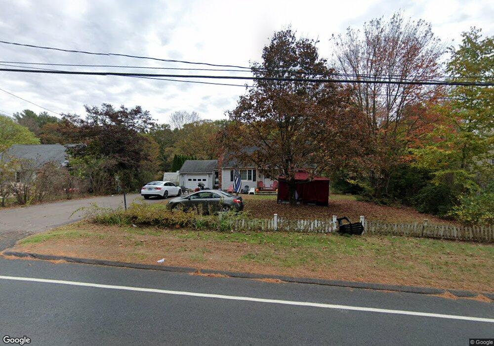
64 Charter Rd Stafford Springs, CT 06076
Estimated Value: $290,000 - $337,508
4
Beds
2
Baths
1,276
Sq Ft
$252/Sq Ft
Est. Value
About This Home
This home is located at 64 Charter Rd, Stafford Springs, CT 06076 and is currently estimated at $321,127, approximately $251 per square foot. 64 Charter Rd is a home located in Tolland County with nearby schools including Stafford Elementary School, Stafford Middle School, and Stafford High School.
Ownership History
Date
Name
Owned For
Owner Type
Purchase Details
Closed on
Nov 22, 2005
Sold by
Armelin Raymond and Armelin Dawn
Bought by
Caron Karolina and Caron David
Current Estimated Value
Home Financials for this Owner
Home Financials are based on the most recent Mortgage that was taken out on this home.
Original Mortgage
$185,000
Outstanding Balance
$101,551
Interest Rate
6.07%
Estimated Equity
$219,576
Create a Home Valuation Report for This Property
The Home Valuation Report is an in-depth analysis detailing your home's value as well as a comparison with similar homes in the area
Home Values in the Area
Average Home Value in this Area
Purchase History
| Date | Buyer | Sale Price | Title Company |
|---|---|---|---|
| Caron Karolina | $195,000 | -- |
Source: Public Records
Mortgage History
| Date | Status | Borrower | Loan Amount |
|---|---|---|---|
| Open | Caron Karolina | $185,000 |
Source: Public Records
Tax History Compared to Growth
Tax History
| Year | Tax Paid | Tax Assessment Tax Assessment Total Assessment is a certain percentage of the fair market value that is determined by local assessors to be the total taxable value of land and additions on the property. | Land | Improvement |
|---|---|---|---|---|
| 2025 | $6,807 | $114,730 | $31,570 | $83,160 |
| 2024 | $4,427 | $114,730 | $31,570 | $83,160 |
| 2023 | $4,217 | $114,730 | $31,570 | $83,160 |
| 2022 | $4,105 | $114,730 | $31,570 | $83,160 |
| 2021 | $4,008 | $114,730 | $31,570 | $83,160 |
| 2020 | $4,181 | $119,700 | $36,960 | $82,740 |
| 2019 | $4,181 | $119,700 | $36,960 | $82,740 |
| 2018 | $4,101 | $119,700 | $36,960 | $82,740 |
| 2017 | $4,061 | $119,700 | $36,960 | $82,740 |
| 2016 | $4,011 | $119,700 | $36,960 | $82,740 |
| 2015 | $3,859 | $115,640 | $36,960 | $78,680 |
| 2014 | $3,820 | $115,640 | $36,960 | $78,680 |
Source: Public Records
Map
Nearby Homes
- 0 Tolland Turnpike
- 73 Cooper Ln
- 44 Tolland Ave Unit 37
- 44 Tolland Ave Unit 46
- 44 Tolland Ave Unit 64
- 127 Sandy Beach Rd
- 644 Buff Cap Rd
- 42 Ladd Rd
- 745 Old Stafford Rd
- 71 W Main St
- 116 Conklin Rd
- 115 Conklin Rd
- 52 High St
- 8 Neff Hill Rd
- 80 W Stafford Rd
- 15 Usher Ridge
- 68 Usher Ridge
- 36 Usher Ridge
- 110 Neff Hill Rd
- 130 Neff Hill Rd
- 62 Charter Rd
- 0 Sandy Beach Rd Unit G485299
- 0 Sandy Beach Rd Unit G508814
- 0 Sandy Beach Rd Unit G574055
- 0 Sandy Beach Rd Unit G581260
- 0 Sandy Beach Rd Unit G624481
- 0 Sandy Beach Rd Unit G638876
- 0 Sandy Beach Rd Unit G654119
- 0 Sandy Beach Rd Unit G678943
- 0 Sandy Beach Rd Unit G10061583
- 00 Sandy Beach Rd
- 0 Sandy Beach Rd Unit 170603954
- 0 Sandy Beach Rd Unit G558245
- 0 Sandy Beach Rd Unit G568265
- 0 Sandy Beach Rd Unit 170208688
- 66 Charter Rd
- 0 Aborn Rd - Sandy Beach Rd Unit G493832
- 03 Sandy Beach Rd
- 3 Sandy Beach Rd
- 48 Charter Rd