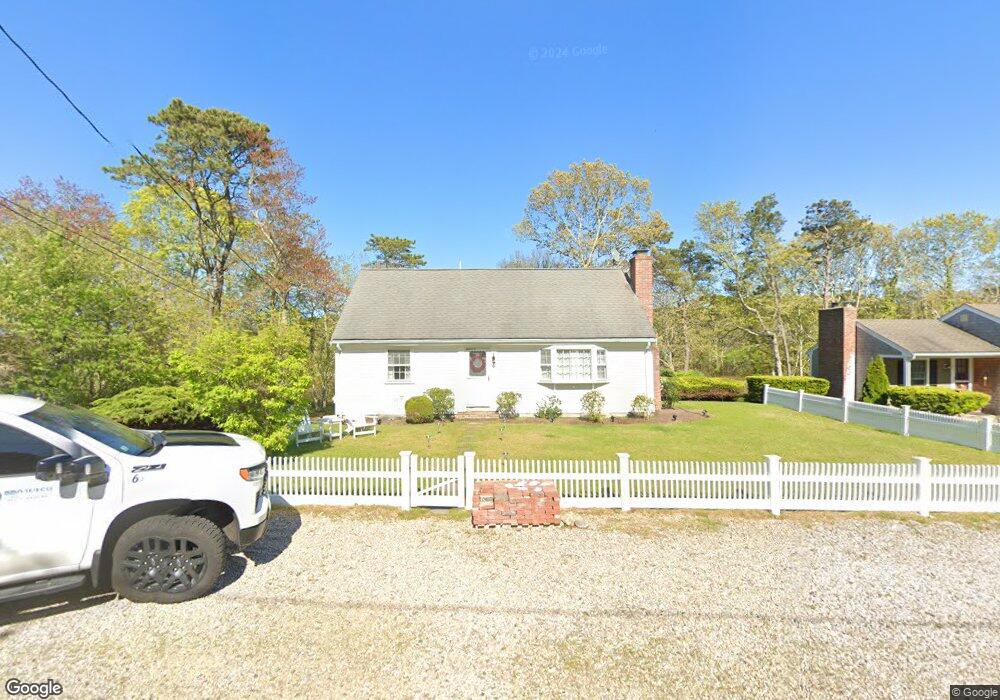
64 Freeman Rd Yarmouth Port, MA 02675
Yarmouth Port NeighborhoodEstimated Value: $571,789 - $642,000
4
Beds
3
Baths
1,296
Sq Ft
$462/Sq Ft
Est. Value
About This Home
This home is located at 64 Freeman Rd, Yarmouth Port, MA 02675 and is currently estimated at $598,947, approximately $462 per square foot. 64 Freeman Rd is a home located in Barnstable County with nearby schools including Dennis-Yarmouth Regional High School, St. Pius X. School, and Trinity Christian Academy of Cape Cod.
Create a Home Valuation Report for This Property
The Home Valuation Report is an in-depth analysis detailing your home's value as well as a comparison with similar homes in the area
Home Values in the Area
Average Home Value in this Area
Tax History Compared to Growth
Tax History
| Year | Tax Paid | Tax Assessment Tax Assessment Total Assessment is a certain percentage of the fair market value that is determined by local assessors to be the total taxable value of land and additions on the property. | Land | Improvement |
|---|---|---|---|---|
| 2025 | $3,424 | $483,600 | $189,700 | $293,900 |
| 2024 | $3,037 | $411,500 | $147,800 | $263,700 |
| 2023 | $3,004 | $370,400 | $130,400 | $240,000 |
| 2022 | $2,991 | $325,800 | $118,600 | $207,200 |
| 2021 | $3,005 | $314,300 | $124,500 | $189,800 |
| 2020 | $2,988 | $298,800 | $131,800 | $167,000 |
| 2019 | $2,814 | $278,600 | $131,800 | $146,800 |
| 2018 | $2,640 | $256,600 | $109,800 | $146,800 |
| 2017 | $2,571 | $256,600 | $109,800 | $146,800 |
| 2016 | $2,473 | $247,800 | $101,000 | $146,800 |
| 2015 | $2,260 | $225,100 | $90,500 | $134,600 |
Source: Public Records
Map
Nearby Homes
- 209 Union St
- 32 Deveau Ln
- 50 Cottonwood St
- 882 W Yarmouth Rd
- 10 Balsam Way
- 933-935 W Yarmouth Rd
- 17 Trowbridge Path
- 607 W Yarmouth Rd
- 8 Rowley Ln
- 16 Warren Rd Unit 16
- 16 Warren Rd
- 560 W Yarmouth Rd
- 24 Minnetuxet Way
- 72 Quartermaster Row
- 0 Forsyth Ave
- 371 Route 6a
- 1 Barnacle Rd
- 33 Sparrow Way
- 23 Dauphine Dr
- 105 Old Hyannis Rd