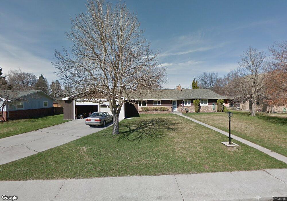
640 Beverly Ave Missoula, MT 59801
University District NeighborhoodEstimated Value: $982,000 - $1,241,000
4
Beds
3
Baths
1,986
Sq Ft
$577/Sq Ft
Est. Value
About This Home
This home is located at 640 Beverly Ave, Missoula, MT 59801 and is currently estimated at $1,145,300, approximately $576 per square foot. 640 Beverly Ave is a home located in Missoula County with nearby schools including Paxson School, Washington Middle School, and Hellgate High School.
Ownership History
Date
Name
Owned For
Owner Type
Purchase Details
Closed on
Jul 28, 2010
Sold by
Thornton Margaret M and Margaret M Thornton Revocable
Bought by
Lynch Teresa K and Lynch Jeremiah C
Current Estimated Value
Home Financials for this Owner
Home Financials are based on the most recent Mortgage that was taken out on this home.
Original Mortgage
$256,000
Interest Rate
4.71%
Mortgage Type
New Conventional
Purchase Details
Closed on
Jun 27, 2005
Sold by
Thornton Margaret M
Bought by
Thornton Margaret M and Margaret M Thornton Revocable Trust
Create a Home Valuation Report for This Property
The Home Valuation Report is an in-depth analysis detailing your home's value as well as a comparison with similar homes in the area
Home Values in the Area
Average Home Value in this Area
Purchase History
| Date | Buyer | Sale Price | Title Company |
|---|---|---|---|
| Lynch Teresa K | -- | First American Title Company | |
| Thornton Margaret M | -- | -- |
Source: Public Records
Mortgage History
| Date | Status | Borrower | Loan Amount |
|---|---|---|---|
| Closed | Lynch Teresa K | $256,000 |
Source: Public Records
Tax History Compared to Growth
Tax History
| Year | Tax Paid | Tax Assessment Tax Assessment Total Assessment is a certain percentage of the fair market value that is determined by local assessors to be the total taxable value of land and additions on the property. | Land | Improvement |
|---|---|---|---|---|
| 2025 | $10,992 | $1,070,410 | $543,660 | $526,750 |
| 2024 | $10,551 | $867,000 | $345,150 | $521,850 |
| 2023 | $10,163 | $867,000 | $345,150 | $521,850 |
| 2022 | $8,619 | $637,900 | $0 | $0 |
| 2021 | $7,748 | $637,900 | $0 | $0 |
| 2020 | $6,544 | $500,260 | $0 | $0 |
| 2019 | $6,523 | $500,260 | $0 | $0 |
| 2018 | $6,115 | $456,100 | $0 | $0 |
| 2017 | $5,466 | $456,100 | $0 | $0 |
| 2016 | $5,490 | $435,070 | $0 | $0 |
| 2015 | $5,078 | $435,070 | $0 | $0 |
| 2014 | $4,535 | $218,806 | $0 | $0 |
Source: Public Records
Map
Nearby Homes
- 1700 Arthur Ave
- 546 Woodworth Ave
- 839 Evans Ave
- 831 Hastings Ave
- 401 Woodworth Ave
- 340 Evans Ave
- 322 Evans Ave
- 921 E Beckwith Ave
- 1617 Ronald Ave
- 1325 Gerald Ave
- 109 E Central Ave
- 101 E Central Ave
- 116 South Ave E
- 540 Ford St
- Lot 26a South Ave W
- 300 Connell Ave
- 542 Eddy Ave
- 951 Ronald Ave Unit 304
- 225 Eddy Ave
- 516 S 5th St E
- 620 Beverly Ave
- 631 Hastings Ave
- 645 Hastings Ave
- 660 Beverly Ave
- 600 Beverly Ave
- 615 Hastings Ave
- 629 Beverly Ave
- 665 Hastings Ave
- 645 Beverly Ave
- 619 Beverly Ave
- 1703 Maurice Ave
- 655 Beverly Ave
- 1701 Maurice Ave
- 601 Beverly Ave
- 1801 Maurice Ave
- 636 Hastings Ave
- 540 Beverly Ave
- 634 Hastings Ave
- 640 Woodworth Ave
- 640 Hastings Ave