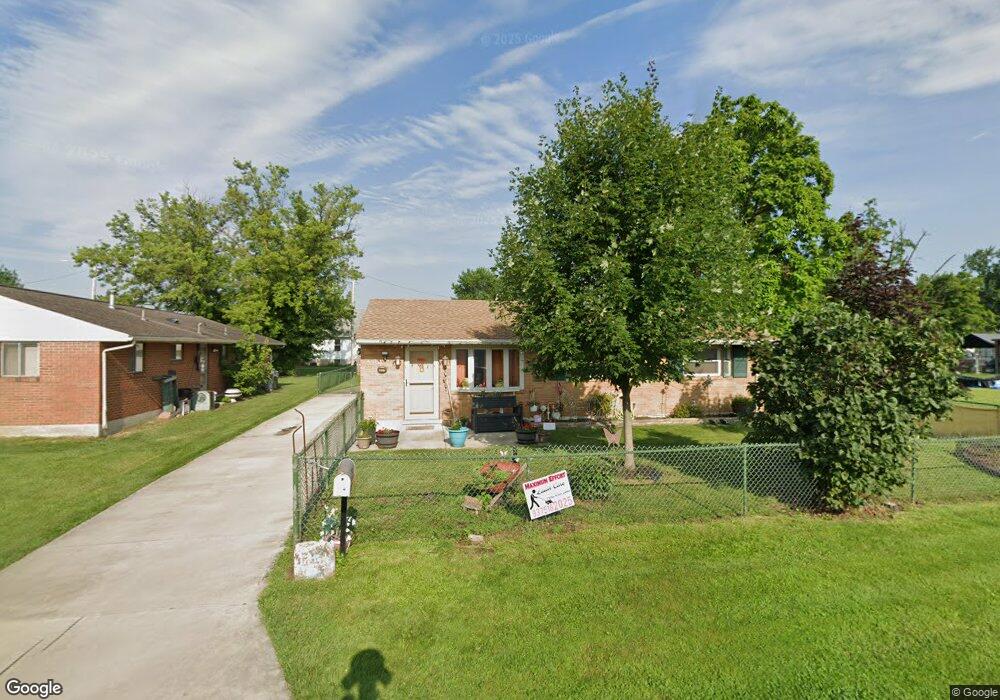
6401 Keats Dr Dayton, OH 45414
Northridge NeighborhoodEstimated Value: $109,708 - $129,000
3
Beds
1
Bath
1,000
Sq Ft
$117/Sq Ft
Est. Value
About This Home
This home is located at 6401 Keats Dr, Dayton, OH 45414 and is currently estimated at $116,677, approximately $116 per square foot. 6401 Keats Dr is a home located in Montgomery County with nearby schools including Northridge High School, Horizon Science Academy-Dayton Elementary School, and Horizon Science Academy Dayton High School.
Ownership History
Date
Name
Owned For
Owner Type
Purchase Details
Closed on
May 16, 2013
Sold by
Heiligenberg Theodore
Bought by
Wells Fargo Bank Na
Current Estimated Value
Purchase Details
Closed on
Jul 24, 2002
Sold by
Ballard David W and Ballard Carmella W
Bought by
Heiligenberg Theodore
Home Financials for this Owner
Home Financials are based on the most recent Mortgage that was taken out on this home.
Original Mortgage
$80,733
Interest Rate
6.63%
Mortgage Type
FHA
Purchase Details
Closed on
Sep 22, 1998
Sold by
Evans Eddie R and Evans Kathleen R
Bought by
Ballard David W and Dershem Carmella W
Home Financials for this Owner
Home Financials are based on the most recent Mortgage that was taken out on this home.
Original Mortgage
$71,650
Interest Rate
6.99%
Create a Home Valuation Report for This Property
The Home Valuation Report is an in-depth analysis detailing your home's value as well as a comparison with similar homes in the area
Home Values in the Area
Average Home Value in this Area
Purchase History
| Date | Buyer | Sale Price | Title Company |
|---|---|---|---|
| Wells Fargo Bank Na | $30,000 | None Available | |
| Heiligenberg Theodore | $82,000 | -- | |
| Ballard David W | $73,900 | -- |
Source: Public Records
Mortgage History
| Date | Status | Borrower | Loan Amount |
|---|---|---|---|
| Previous Owner | Heiligenberg Theodore | $80,733 | |
| Previous Owner | Ballard David W | $71,650 |
Source: Public Records
Tax History Compared to Growth
Tax History
| Year | Tax Paid | Tax Assessment Tax Assessment Total Assessment is a certain percentage of the fair market value that is determined by local assessors to be the total taxable value of land and additions on the property. | Land | Improvement |
|---|---|---|---|---|
| 2024 | $1,200 | $23,820 | $4,600 | $19,220 |
| 2023 | $1,200 | $23,820 | $4,600 | $19,220 |
| 2022 | $892 | $17,010 | $3,280 | $13,730 |
| 2021 | $880 | $17,010 | $3,280 | $13,730 |
| 2020 | $894 | $17,010 | $3,280 | $13,730 |
| 2019 | $1,795 | $14,570 | $3,280 | $11,290 |
| 2018 | $1,966 | $14,570 | $3,280 | $11,290 |
| 2017 | $1,959 | $14,570 | $3,280 | $11,290 |
| 2016 | $1,869 | $13,750 | $3,280 | $10,470 |
| 2015 | $1,441 | $13,750 | $3,280 | $10,470 |
| 2014 | $1,441 | $13,750 | $3,280 | $10,470 |
| 2012 | -- | $18,220 | $4,420 | $13,800 |
Source: Public Records
Map
Nearby Homes
- 5586 Wadsworth Rd
- 2160 Martin Ave
- 2203 Arthur Ave
- 2304 Homesite Dr
- 2021 Gipsy Dr
- 2024 Kildare Ave
- 2010 Gipsy Dr
- 2100 Harding Ave
- 6020 Volkman Dr
- 6114 Miller Ln
- 2127 Marker Ave
- 2110 Needmore Rd
- 2315 Rector Ave
- 2216 Rector Ave
- 1657 Scenic Dr
- 2006 High Knoll Dr
- 5802 Sparkhill Dr
- 3320 Benchwood Rd
- 3280 Benchwood Rd
- 2625 Secretariat Ct
- 6411 Keats Dr
- 2381 Martin Ave
- 2364 Cadie Ave
- 2358 Cadie Ave
- 2333 Martin Ave
- 2327 Martin Ave
- 2348 Cadie Ave
- 2342 Martin Ave
- 2325 Martin Ave
- 2365 Cadie Ave
- 2338 Martin Ave
- 2323 Martin Ave
- 2342 Cadie Ave
- 6311 Keats Dr
- 2357 Cadie Ave
- 2315 Martin Ave
- 2353 Cadie Ave
- 2330 Martin Ave
- 2349 Cadie Ave
- 2324 Martin Ave