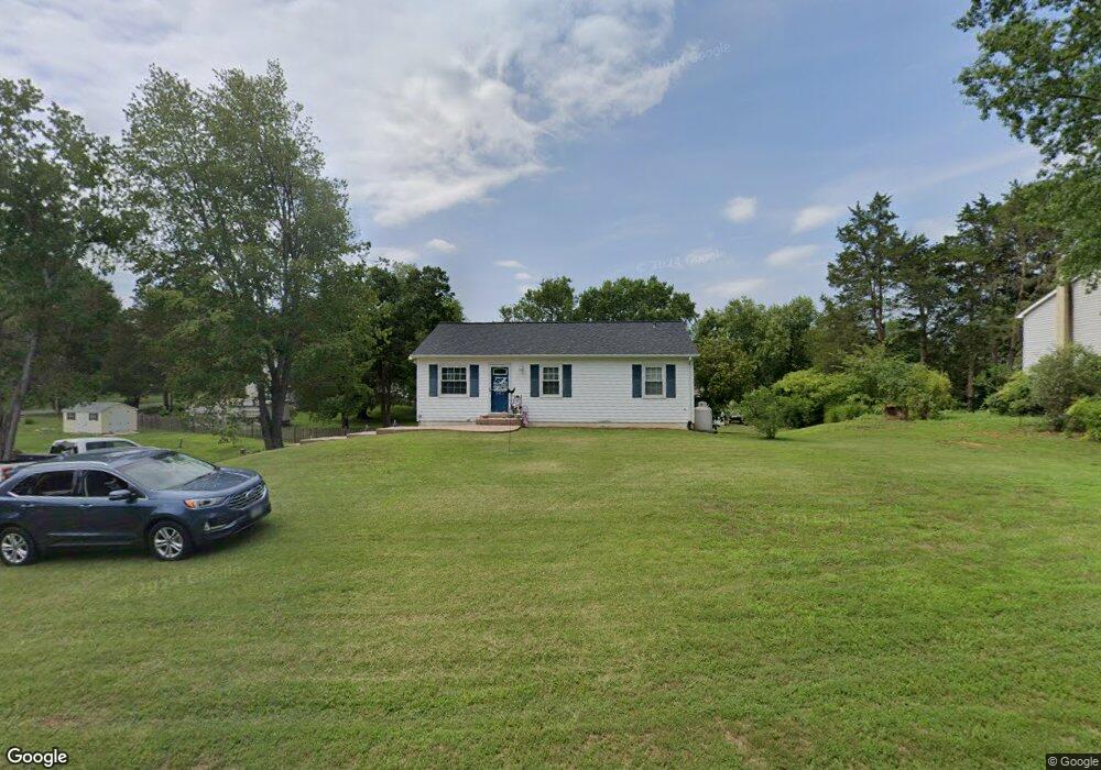
6405 Lancaster Dr Warrenton, VA 20187
Estimated Value: $481,000 - $521,000
3
Beds
2
Baths
962
Sq Ft
$513/Sq Ft
Est. Value
About This Home
This home is located at 6405 Lancaster Dr, Warrenton, VA 20187 and is currently estimated at $493,264, approximately $512 per square foot. 6405 Lancaster Dr is a home located in Fauquier County with nearby schools including P.B. Smith Elementary School, Marshall Middle School, and Fauquier High School.
Ownership History
Date
Name
Owned For
Owner Type
Purchase Details
Closed on
Feb 25, 2010
Sold by
Joseph Michael
Bought by
Zavalanski Jeffery
Current Estimated Value
Home Financials for this Owner
Home Financials are based on the most recent Mortgage that was taken out on this home.
Original Mortgage
$254,308
Outstanding Balance
$170,808
Interest Rate
5.25%
Mortgage Type
FHA
Estimated Equity
$322,456
Create a Home Valuation Report for This Property
The Home Valuation Report is an in-depth analysis detailing your home's value as well as a comparison with similar homes in the area
Home Values in the Area
Average Home Value in this Area
Purchase History
| Date | Buyer | Sale Price | Title Company |
|---|---|---|---|
| Zavalanski Jeffery | $259,000 | -- |
Source: Public Records
Mortgage History
| Date | Status | Borrower | Loan Amount |
|---|---|---|---|
| Open | Zavalanski Jeffery | $254,308 |
Source: Public Records
Tax History Compared to Growth
Tax History
| Year | Tax Paid | Tax Assessment Tax Assessment Total Assessment is a certain percentage of the fair market value that is determined by local assessors to be the total taxable value of land and additions on the property. | Land | Improvement |
|---|---|---|---|---|
| 2025 | $3,242 | $335,300 | $135,000 | $200,300 |
| 2024 | $3,176 | $335,300 | $135,000 | $200,300 |
| 2023 | $3,041 | $335,300 | $135,000 | $200,300 |
| 2022 | $3,041 | $335,300 | $135,000 | $200,300 |
| 2021 | $2,655 | $265,700 | $120,000 | $145,700 |
| 2020 | $2,655 | $265,700 | $120,000 | $145,700 |
| 2019 | $2,655 | $265,700 | $120,000 | $145,700 |
| 2018 | $2,623 | $265,700 | $120,000 | $145,700 |
| 2016 | $2,263 | $216,500 | $110,000 | $106,500 |
| 2015 | -- | $216,500 | $110,000 | $106,500 |
| 2014 | -- | $216,500 | $110,000 | $106,500 |
Source: Public Records
Map
Nearby Homes
- 7213 Princess Anne Ct
- 6397 Tazewell St
- 6416 Airlie Rd
- 7333 Hazelwood Ct
- 0 Hwy Unit VAFQ2018052
- 0 Airlie Road Lee Hwy Unit VAFQ2018058
- 7241 Blackwell Rd
- 7038 Beaconsfield Ln
- 7245 Blackwell Rd
- 7253 Blackwell Rd
- 7323 Bayfield Ln
- 7631 Movern Ln
- 541 Highland Towne Ln
- LOT 1 Blackwell Rd
- 7176 Homestead Ct
- 7040 Hi Rock Ridge Rd
- 315 Winterset Ln
- 6288 Redwinged Blackbird Dr
- 535 Winchester St
- 2 Millfield Dr
- 6411 Lancaster Dr
- 7343 Westmoreland Dr
- 7333 Westmoreland Dr
- 7329 Westmoreland Dr
- 6417 Lancaster Dr
- 6406 Lancaster Dr
- 7173 Spotsylvania St
- 6412 Lancaster Dr
- 6400 Lancaster Dr
- 6416 Lancaster Dr
- 7323 Westmoreland Dr
- 6396 Lancaster Dr
- 7169 Spotsylvania St
- 6423 Lancaster Dr
- 6389 Lancaster Dr
- 7336 Westmoreland Dr
- 6420 Lancaster Dr
- 6388 Lancaster Dr
- 7332 Westmoreland Dr
- 7326 Westmoreland Dr