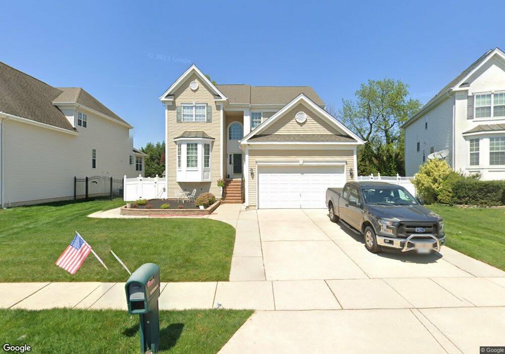
641 Worcester Dr West Deptford, NJ 08086
West Deptford Township NeighborhoodEstimated Value: $520,039 - $608,000
--
Bed
--
Bath
2,542
Sq Ft
$223/Sq Ft
Est. Value
About This Home
This home is located at 641 Worcester Dr, West Deptford, NJ 08086 and is currently estimated at $567,010, approximately $223 per square foot. 641 Worcester Dr is a home located in Gloucester County with nearby schools including Green-Fields Elementary School, Red Bank Elementary School, and Oakview Elementary School.
Ownership History
Date
Name
Owned For
Owner Type
Purchase Details
Closed on
Sep 21, 2005
Sold by
D R Horton Inc
Bought by
Galanti Raymond and Galanti Chatherine A
Current Estimated Value
Home Financials for this Owner
Home Financials are based on the most recent Mortgage that was taken out on this home.
Original Mortgage
$125,000
Interest Rate
5.81%
Mortgage Type
Fannie Mae Freddie Mac
Create a Home Valuation Report for This Property
The Home Valuation Report is an in-depth analysis detailing your home's value as well as a comparison with similar homes in the area
Home Values in the Area
Average Home Value in this Area
Purchase History
| Date | Buyer | Sale Price | Title Company |
|---|---|---|---|
| Galanti Raymond | $290,620 | Trident Land Transfer |
Source: Public Records
Mortgage History
| Date | Status | Borrower | Loan Amount |
|---|---|---|---|
| Previous Owner | Galanti Raymond | $125,000 |
Source: Public Records
Tax History Compared to Growth
Tax History
| Year | Tax Paid | Tax Assessment Tax Assessment Total Assessment is a certain percentage of the fair market value that is determined by local assessors to be the total taxable value of land and additions on the property. | Land | Improvement |
|---|---|---|---|---|
| 2025 | $10,570 | $302,700 | $64,700 | $238,000 |
| 2024 | $10,434 | $302,700 | $64,700 | $238,000 |
| 2023 | $10,434 | $302,700 | $64,700 | $238,000 |
| 2022 | $10,386 | $302,700 | $64,700 | $238,000 |
| 2021 | $9,382 | $302,700 | $64,700 | $238,000 |
| 2020 | $10,325 | $302,700 | $64,700 | $238,000 |
| 2019 | $10,038 | $302,700 | $64,700 | $238,000 |
| 2018 | $9,765 | $302,700 | $64,700 | $238,000 |
| 2017 | $9,538 | $302,700 | $64,700 | $238,000 |
| 2016 | $9,022 | $302,700 | $64,700 | $238,000 |
| 2015 | $8,983 | $316,400 | $64,700 | $251,700 |
| 2014 | $8,524 | $316,400 | $64,700 | $251,700 |
Source: Public Records
Map
Nearby Homes
- 640 Worcester Dr
- 863 Doncaster Dr
- 740 Carter Hill Dr
- 87 Woodway Dr Unit 87
- 1091 Buckingham Dr Unit 45
- 12 Highbridge Ln Unit I2
- 125 Lionheart Ln Unit C125
- 1220 Royal Ln
- 1102 Barnesdale Rd
- 1012 Moore Rd Unit 6
- 1066 Buckingham Dr
- 1311 Barnesdale Rd
- 4 Saint Emilion Ct
- 1810 Fernwood Dr
- 97 Church St
- 64 Tilden Rd
- 247 Crown Point Rd
- 433 Crown Point Rd
- 94 Aviary Rd
- 1054 Kings Hwy
- 639 Worcester Dr
- 643 Worcester Dr
- 637 Worcester Dr
- 642 Worcester Dr
- 645 Worcester Dr
- 635 Worcester Dr
- 638 Worcester Dr
- 636 Worcester Dr
- 647 Worcester Dr
- 633 Worcester Dr
- 634 Worcester Dr
- 656 Worcester Dr
- 658 Worcester Dr
- 649 Worcester Dr
- 660 Worcester Dr
- 631 Worcester Dr
- 662 Worcester Dr
- 1262 Ollerton Rd
- 632 Worcester Dr
- 1266 Ollerton Rd