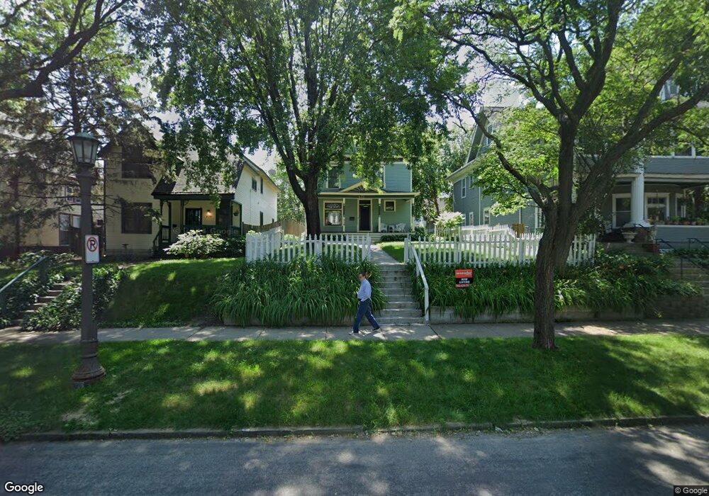
642 642 Ashland Ave St. Paul, MN 55104
Summit-University NeighborhoodEstimated Value: $404,000 - $461,000
2
Beds
3
Baths
1,588
Sq Ft
$274/Sq Ft
Est. Value
About This Home
This home is located at 642 642 Ashland Ave, St. Paul, MN 55104 and is currently estimated at $435,323, approximately $274 per square foot. 642 642 Ashland Ave is a home located in Ramsey County with nearby schools including Maxfield Magnet Elementary School, Hidden River Middle School, and Central Senior High School.
Ownership History
Date
Name
Owned For
Owner Type
Purchase Details
Closed on
Aug 28, 2024
Sold by
Wambach Todd M and Ryan Erin N
Bought by
Hartley Nicholas
Current Estimated Value
Home Financials for this Owner
Home Financials are based on the most recent Mortgage that was taken out on this home.
Original Mortgage
$385,310
Outstanding Balance
$381,219
Interest Rate
6.77%
Mortgage Type
New Conventional
Estimated Equity
$54,104
Purchase Details
Closed on
Jul 24, 2009
Sold by
Cross William W and Cross Nicole E
Bought by
Wambach Todd M and Ryan Erin N
Purchase Details
Closed on
Jun 24, 2004
Sold by
King Timothy A and King Laura K
Bought by
Cross William W and Cross Nicole E
Purchase Details
Closed on
Oct 12, 2000
Sold by
Dziobkowski David and York Mary Ellen
Bought by
King Timothy A and King Laura K
Create a Home Valuation Report for This Property
The Home Valuation Report is an in-depth analysis detailing your home's value as well as a comparison with similar homes in the area
Home Values in the Area
Average Home Value in this Area
Purchase History
| Date | Buyer | Sale Price | Title Company |
|---|---|---|---|
| Hartley Nicholas | $435,308 | Title Group | |
| Wambach Todd M | $296,040 | -- | |
| Cross William W | $297,600 | -- | |
| King Timothy A | $177,900 | -- |
Source: Public Records
Mortgage History
| Date | Status | Borrower | Loan Amount |
|---|---|---|---|
| Open | Hartley Nicholas | $385,310 |
Source: Public Records
Tax History Compared to Growth
Tax History
| Year | Tax Paid | Tax Assessment Tax Assessment Total Assessment is a certain percentage of the fair market value that is determined by local assessors to be the total taxable value of land and additions on the property. | Land | Improvement |
|---|---|---|---|---|
| 2025 | $7,994 | $437,100 | $130,000 | $307,100 |
| 2024 | $7,994 | $470,500 | $130,000 | $340,500 |
| 2023 | $7,994 | $467,900 | $130,000 | $337,900 |
| 2022 | $6,966 | $436,800 | $130,000 | $306,800 |
| 2021 | $6,780 | $387,900 | $130,000 | $257,900 |
| 2020 | $6,920 | $388,800 | $130,000 | $258,800 |
| 2019 | $6,652 | $369,600 | $130,000 | $239,600 |
| 2018 | $6,418 | $349,100 | $130,000 | $219,100 |
| 2017 | $6,378 | $344,000 | $143,000 | $201,000 |
| 2016 | $6,154 | $0 | $0 | $0 |
| 2015 | $6,258 | $325,600 | $132,000 | $193,600 |
| 2014 | $5,466 | $0 | $0 | $0 |
Source: Public Records
Map
Nearby Homes
- 676 Ashland Ave Unit 6
- 704 Holly Ave
- 565 Holly Ave
- 28 Saint Albans St N Unit 4N
- 652 Dayton Ave
- 545 Holly Ave
- 579 Summit Ave Unit 105
- 742 Hague Ave
- 742 Holly Ave
- 681 Dayton Ave
- 518 Laurel Ave
- 542 Portland Ave
- 582 Summit Ave
- 28 Dale St S Unit A
- 505 Holly Ave
- 635 Grand Ave Unit 4
- 496 Holly Ave Unit 1
- 505 Selby Ave Unit 1
- 614 Grand Ave Unit C
- 614 Grand Ave Unit 3EE
- 642 Ashland Ave
- 638 Ashland Ave
- 644 Ashland Ave
- 634 Ashland Ave Unit 1
- 634 Ashland Ave
- 630 Ashland Ave
- 639 Holly Ave
- 647 Holly Ave
- 656 Ashland Ave Unit 3
- 656 Ashland Ave Unit 9
- 656 Ashland Ave Unit 7
- 656 Ashland Ave Unit 6
- 656 Ashland Ave Unit 10
- 656 Ashland Ave Unit 2
- 656 Ashland Ave Unit 8
- 656 Ashland Ave Unit 5
- 656 Ashland Ave Unit 4
- 656 Ashland Ave Unit 1
- 649 Holly Ave
- 633 Holly Ave