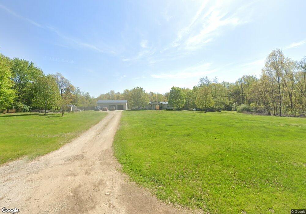
64211 Fair Rd Sturgis, MI 49091
Estimated Value: $216,336 - $247,000
--
Bed
--
Bath
1,680
Sq Ft
$138/Sq Ft
Est. Value
About This Home
This home is located at 64211 Fair Rd, Sturgis, MI 49091 and is currently estimated at $232,445, approximately $138 per square foot. 64211 Fair Rd is a home located in St. Joseph County with nearby schools including Centreville Elementary School and Centreville Junior/Senior High School.
Ownership History
Date
Name
Owned For
Owner Type
Purchase Details
Closed on
Oct 17, 2024
Sold by
Jones David Allen
Bought by
Jones Sherrie Lynne
Current Estimated Value
Purchase Details
Closed on
Mar 20, 2018
Sold by
Jones David
Bought by
Jones Justina and Anding John
Purchase Details
Closed on
Jan 1, 1901
Create a Home Valuation Report for This Property
The Home Valuation Report is an in-depth analysis detailing your home's value as well as a comparison with similar homes in the area
Home Values in the Area
Average Home Value in this Area
Purchase History
| Date | Buyer | Sale Price | Title Company |
|---|---|---|---|
| Jones Sherrie Lynne | -- | None Listed On Document | |
| Jones Justina | -- | None Available | |
| -- | -- | -- |
Source: Public Records
Mortgage History
| Date | Status | Borrower | Loan Amount |
|---|---|---|---|
| Closed | Jones Justina | $0 |
Source: Public Records
Tax History Compared to Growth
Tax History
| Year | Tax Paid | Tax Assessment Tax Assessment Total Assessment is a certain percentage of the fair market value that is determined by local assessors to be the total taxable value of land and additions on the property. | Land | Improvement |
|---|---|---|---|---|
| 2025 | $1,840 | $99,600 | $19,400 | $80,200 |
| 2024 | $666 | $99,800 | $16,800 | $83,000 |
| 2023 | $634 | $73,500 | $12,100 | $61,400 |
| 2022 | $0 | $64,200 | $9,800 | $54,400 |
| 2021 | $989 | $60,700 | $9,200 | $51,500 |
| 2020 | $578 | $61,500 | $8,400 | $53,100 |
| 2019 | $567 | $53,800 | $8,400 | $45,400 |
| 2018 | $1,169 | $49,100 | $8,400 | $40,700 |
| 2017 | $1,894 | $49,400 | $49,400 | $0 |
| 2016 | -- | $44,800 | $44,800 | $0 |
| 2015 | -- | $41,700 | $0 | $0 |
| 2014 | -- | $43,400 | $43,400 | $0 |
| 2012 | -- | $42,300 | $42,300 | $0 |
Source: Public Records
Map
Nearby Homes
- V/L Banker St
- 65890 Burg Rd
- 119 V/L Island Hills Dr
- 61984 Bayshore Dr
- 61570 Raintree Blvd
- V/L Raintree Blvd
- 23974 Findley Rd
- 61704 Crystal Beach Dr
- 23772 Wilson Rd
- 61436 Crystal Beach Dr
- 66109 Hideaway Ln
- 0 Rainbow Dr
- 67696 Thunderbird Dr
- 0 V L M66- 102+ - Unit 24045986
- 27304 Oak Dr
- VL1 Ottokee Dr
- VL2 Ottokee Dr
- 0 Vl Seneca Ct
- 27810 Maystead Rd
- V/L White Pine Dr
- 64253 Fair Rd
- 64159 Fair Rd
- 64275 Fair Rd
- 64343 Fair Rd
- 64159 Fair Rd
- 63738 Fair Rd
- 0 Fair Rd
- 64305 Fair Rd
- 64097 Fair Rd
- 24108 Banker St
- 24108 Banker St
- 24112 Banker St
- 24112 Banker St
- 24015 Banker Street Rd
- 24100 Banker St
- 24100 Banker St
- 24103 Banker St
- 24103 Banker St
- 23888 Banker St
- 24022 Banker St