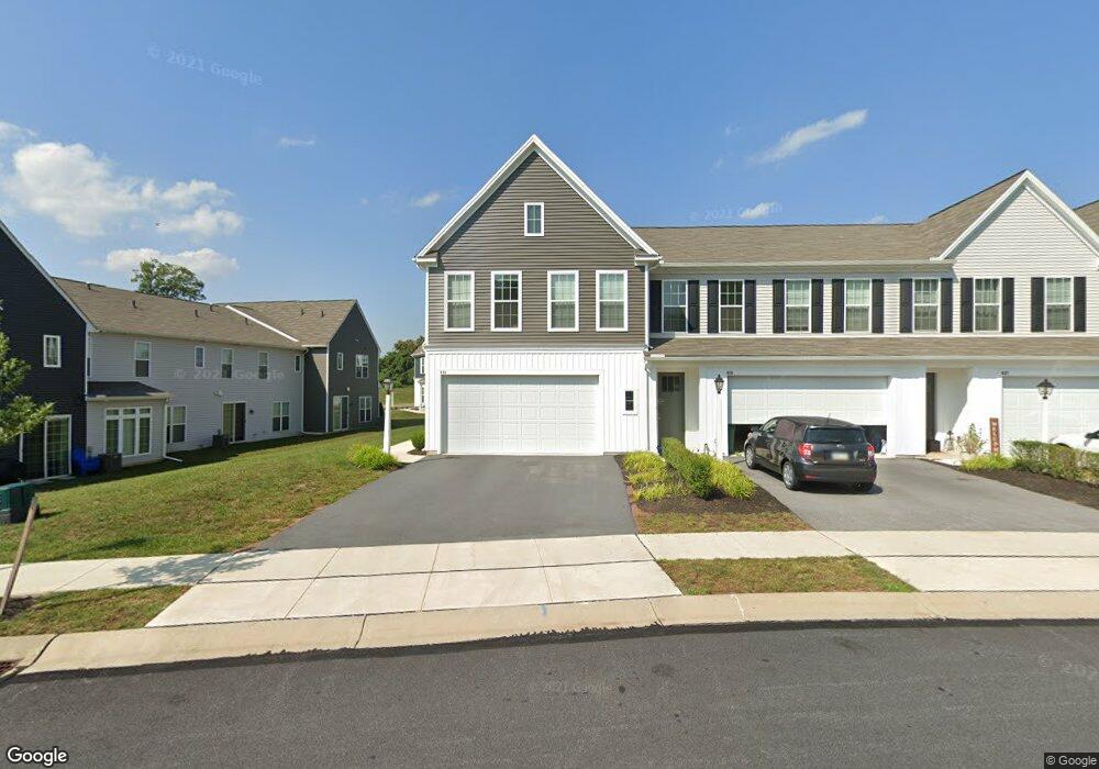
643 Stoverdale Rd Hummelstown, PA 17036
Estimated Value: $367,813 - $392,000
3
Beds
3
Baths
1,765
Sq Ft
$215/Sq Ft
Est. Value
About This Home
This home is located at 643 Stoverdale Rd, Hummelstown, PA 17036 and is currently estimated at $379,453, approximately $214 per square foot. 643 Stoverdale Rd is a home located in Dauphin County with nearby schools including Hershey Elementary School, Hershey Primary Elementary School, and Hershey Middle School.
Ownership History
Date
Name
Owned For
Owner Type
Purchase Details
Closed on
Aug 7, 2019
Sold by
Charter Homes At The Point Inc
Bought by
Banjade Rashmi
Current Estimated Value
Home Financials for this Owner
Home Financials are based on the most recent Mortgage that was taken out on this home.
Original Mortgage
$216,504
Outstanding Balance
$189,617
Interest Rate
3.7%
Mortgage Type
New Conventional
Estimated Equity
$189,836
Purchase Details
Closed on
Apr 22, 2019
Sold by
Dsg Development Corporation
Bought by
Charter Homes At The Point Inc
Home Financials for this Owner
Home Financials are based on the most recent Mortgage that was taken out on this home.
Original Mortgage
$764,234
Interest Rate
4.3%
Mortgage Type
Construction
Create a Home Valuation Report for This Property
The Home Valuation Report is an in-depth analysis detailing your home's value as well as a comparison with similar homes in the area
Home Values in the Area
Average Home Value in this Area
Purchase History
| Date | Buyer | Sale Price | Title Company |
|---|---|---|---|
| Banjade Rashmi | $268,990 | Regent Settlements Lp | |
| Charter Homes At The Point Inc | $260,000 | Regent Settlements Lp |
Source: Public Records
Mortgage History
| Date | Status | Borrower | Loan Amount |
|---|---|---|---|
| Open | Banjade Rashmi | $216,504 | |
| Previous Owner | Charter Homes At The Point Inc | $764,234 |
Source: Public Records
Tax History Compared to Growth
Tax History
| Year | Tax Paid | Tax Assessment Tax Assessment Total Assessment is a certain percentage of the fair market value that is determined by local assessors to be the total taxable value of land and additions on the property. | Land | Improvement |
|---|---|---|---|---|
| 2025 | $4,866 | $155,700 | $27,300 | $128,400 |
| 2024 | $4,573 | $155,700 | $27,300 | $128,400 |
| 2023 | $4,492 | $155,700 | $27,300 | $128,400 |
| 2022 | $4,392 | $155,700 | $27,300 | $128,400 |
| 2021 | $4,392 | $155,700 | $27,300 | $128,400 |
| 2020 | $4,392 | $155,700 | $27,300 | $128,400 |
Source: Public Records
Map
Nearby Homes
- 1959 Deer Run Dr
- 1919 Limestone Dr
- 2017B Raleigh Rd
- 2039H Raleigh Rd
- 497 Middletown Rd
- 2042 Locust Ln
- 285 Dogwood Dr
- 1168 Cord Dr
- 177 Middletown Rd
- 265 Redwood St
- 994 Clifton Heights Rd
- 791 Gregs Dr
- 30 N Walnut St
- 721 S 82nd St Unit L111
- 228 W Main St
- 112 Park Ave
- 227 Pleasant View Rd
- 715 Gregs Dr
- 235 W 2nd St
- 258 W 2nd St
- 645 Stoverdale Rd
- 647 Stoverdale Rd
- 599 Stoverdale Rd
- 649 Stoverdale Rd
- 2246 Stoverdale Rd
- 2244 Red Fox Dr
- 2246 Red Fox Dr
- 2250 Red Fox Dr
- 657 Stoverdale Rd
- 531 Stoverdale Rd
- 2226 Red Fox Dr
- 2224 Red Fox Dr
- 661 Stoverdale Rd
- 663 Stoverdale Rd
- 646 Stoverdale Rd
- 2222 Red Fox Dr
- 467 Stoverdale Rd
- 549 Stoverdale Rd
- 595 Stoverdale Rd
- 2249 Red Fox Dr