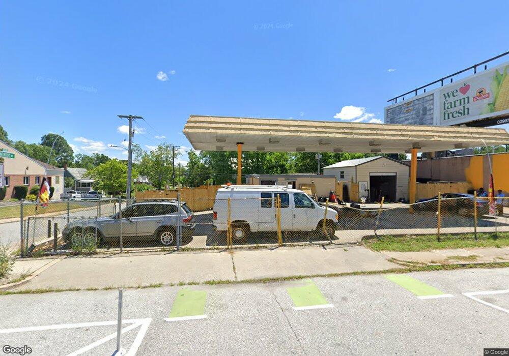
6437 Harford Rd Baltimore, MD 21214
Westfield NeighborhoodEstimated Value: $106,453
--
Bed
--
Bath
280
Sq Ft
$380/Sq Ft
Est. Value
About This Home
This home is located at 6437 Harford Rd, Baltimore, MD 21214 and is currently estimated at $106,453, approximately $380 per square foot. 6437 Harford Rd is a home located in Baltimore City with nearby schools including Hamilton Elementary Middle School, Booker T. Washington Middle School, and Paul Laurence Dunbar High School.
Ownership History
Date
Name
Owned For
Owner Type
Purchase Details
Closed on
May 16, 2015
Sold by
Asfour Hanadi
Bought by
Hammoude Tahani and Hammoude Soha
Current Estimated Value
Purchase Details
Closed on
Sep 3, 2011
Sold by
Hammoude Majdi
Bought by
Asfour Hanadi
Purchase Details
Closed on
Aug 19, 2004
Sold by
Steuart Petroleum Company
Bought by
Hammoude Majdi and Asfour Hanadi
Purchase Details
Closed on
Jun 23, 2004
Sold by
Steuart Petroleum Company
Bought by
Hammoude Majdi and Asfour Hanadi
Create a Home Valuation Report for This Property
The Home Valuation Report is an in-depth analysis detailing your home's value as well as a comparison with similar homes in the area
Home Values in the Area
Average Home Value in this Area
Purchase History
| Date | Buyer | Sale Price | Title Company |
|---|---|---|---|
| Hammoude Tahani | -- | None Available | |
| Asfour Hanadi | $45,000 | -- | |
| Asfour Hanadi | $45,000 | -- | |
| Hammoude Majdi | $45,000 | -- | |
| Hammoude Majdi | $45,000 | -- |
Source: Public Records
Tax History Compared to Growth
Tax History
| Year | Tax Paid | Tax Assessment Tax Assessment Total Assessment is a certain percentage of the fair market value that is determined by local assessors to be the total taxable value of land and additions on the property. | Land | Improvement |
|---|---|---|---|---|
| 2025 | $2,170 | $100,900 | -- | -- |
| 2024 | $2,170 | $92,400 | $60,000 | $32,400 |
| 2023 | $2,181 | $92,400 | $60,000 | $32,400 |
| 2022 | $2,181 | $92,400 | $60,000 | $32,400 |
| 2021 | $2,259 | $95,700 | $60,000 | $35,700 |
| 2020 | $2,259 | $95,700 | $60,000 | $35,700 |
| 2019 | $2,248 | $95,700 | $60,000 | $35,700 |
| 2018 | $2,282 | $96,700 | $60,000 | $36,700 |
| 2017 | $2,134 | $90,433 | $0 | $0 |
| 2016 | $2,308 | $84,167 | $0 | $0 |
| 2015 | $2,308 | $77,900 | $0 | $0 |
| 2014 | $2,308 | $77,900 | $0 | $0 |
Source: Public Records
Map
Nearby Homes
- 3013 Westfield Ave
- 2924 Fleetwood Ave
- 3027 Fleetwood Ave
- 2905 Westfield Ave
- 2926 Christopher Ave
- 3010 Northway Dr
- 6405 Sefton Ave
- 2809 E Northern Pkwy
- 6814 Harford Rd
- 2803 Fleetwood Ave
- 2808 E Northern Pkwy
- 6113 Sefton Ave
- 6110 Old Harford Rd
- 2803 Berwick Ave
- 6015 Sefton Ave
- 2821 Hemlock Ave
- 3126 Woodring Ave
- 2909 Inglewood Ave
- 2911 Inglewood Ave
- 6402 Moyer Ave
- 6427 Harford Rd
- 6425 Harford Rd
- 6423 Harford Rd
- 6421 Harford Rd
- 6419 Harford Rd
- 6420 Milton Ln
- 6500 Harford Rd
- 6500 Harford Rd Unit A
- 6417 Harford Rd
- 6501 Harford Rd
- 3003 Pinewood Ave
- 6502 Harford Rd
- 6413 Harford Rd
- 6510 Harford Rd
- 6507 Harford Rd
- 6409 Harford Rd
- 3005 Pinewood Ave
- 6418 Harford Rd
- 6509 Harford Rd
- 3004 Pinewood Ave