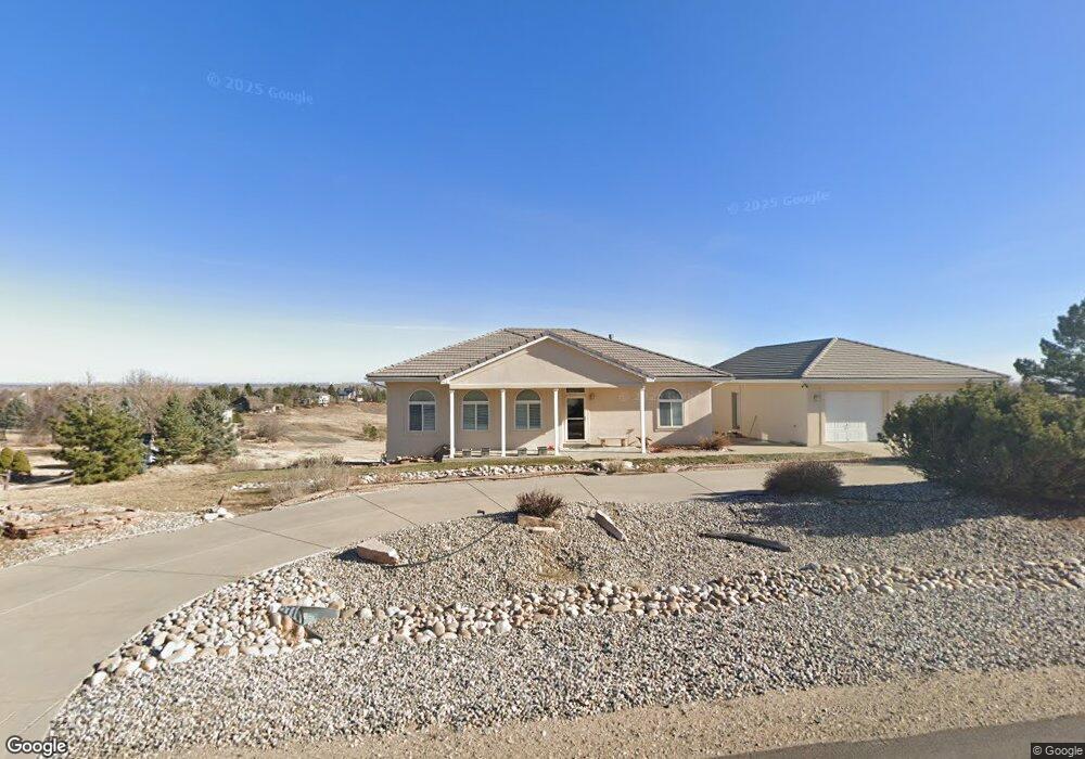
6444 Jordan Dr Loveland, CO 80537
Estimated Value: $796,280 - $1,081,000
4
Beds
4
Baths
1,759
Sq Ft
$564/Sq Ft
Est. Value
About This Home
This home is located at 6444 Jordan Dr, Loveland, CO 80537 and is currently estimated at $991,570, approximately $563 per square foot. 6444 Jordan Dr is a home located in Larimer County with nearby schools including Carrie Martin Elementary School, Walt Clark Middle School, and Thompson Valley High School.
Ownership History
Date
Name
Owned For
Owner Type
Purchase Details
Closed on
Jun 25, 2021
Sold by
Huff Robert E and Robbins Janet A
Bought by
Huff Robert Eugene and Robins Janet Ann
Current Estimated Value
Purchase Details
Closed on
Mar 1, 2002
Sold by
Warnecke Calvin G and Warnecke Janet A
Bought by
Huff Robert E and Robbins Janet A
Home Financials for this Owner
Home Financials are based on the most recent Mortgage that was taken out on this home.
Original Mortgage
$181,800
Outstanding Balance
$75,248
Interest Rate
6.93%
Mortgage Type
Credit Line Revolving
Estimated Equity
$916,322
Create a Home Valuation Report for This Property
The Home Valuation Report is an in-depth analysis detailing your home's value as well as a comparison with similar homes in the area
Home Values in the Area
Average Home Value in this Area
Purchase History
| Date | Buyer | Sale Price | Title Company |
|---|---|---|---|
| Huff Robert Eugene | -- | None Available | |
| Huff Robert E | $383,500 | -- |
Source: Public Records
Mortgage History
| Date | Status | Borrower | Loan Amount |
|---|---|---|---|
| Open | Huff Robert E | $181,800 | |
| Closed | Huff Robert E | $125,000 |
Source: Public Records
Tax History Compared to Growth
Tax History
| Year | Tax Paid | Tax Assessment Tax Assessment Total Assessment is a certain percentage of the fair market value that is determined by local assessors to be the total taxable value of land and additions on the property. | Land | Improvement |
|---|---|---|---|---|
| 2025 | $4,544 | $59,985 | $11,055 | $48,930 |
| 2024 | $4,572 | $59,985 | $11,055 | $48,930 |
| 2022 | $3,473 | $44,529 | $11,468 | $33,061 |
| 2021 | $3,488 | $45,811 | $11,798 | $34,013 |
| 2020 | $2,524 | $35,121 | $11,798 | $23,323 |
| 2019 | $2,486 | $35,121 | $11,798 | $23,323 |
| 2018 | $2,606 | $35,208 | $11,880 | $23,328 |
| 2017 | $2,288 | $35,208 | $11,880 | $23,328 |
| 2016 | $2,167 | $33,727 | $13,134 | $20,593 |
| 2015 | $2,202 | $33,720 | $13,130 | $20,590 |
| 2014 | $2,178 | $32,730 | $7,160 | $25,570 |
Source: Public Records
Map
Nearby Homes
- 2909 Pronghorn Ct
- 3020 Blue Mountain Ct
- 5714 Bluff Ln
- 2272 Golden Valley Rd
- 2712 S County Road 29
- 4260 S County Road 23
- 6950 W County Road 18
- 6819 W County Road 18
- 4400 Sedona Hills Dr
- 1016 Meadowridge Ct
- 5644 Kiva Ridge Dr
- 1350 S County Road 29
- 8701 Rock Hill Rd
- 4707 Lonetree Dr
- 4012 Lakefront Dr
- 4616 Lonetree Dr
- 940 S County Road 29
- 5794 Jackdaw Dr
- 9209 Four Wheel Dr
- 613 Cove Dr