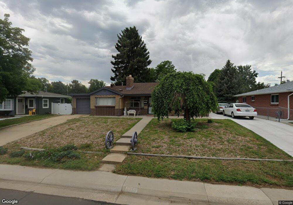
6450 W 47th Ave Wheat Ridge, CO 80033
Barths NeighborhoodEstimated Value: $539,199 - $561,000
3
Beds
1
Bath
1,184
Sq Ft
$466/Sq Ft
Est. Value
About This Home
This home is located at 6450 W 47th Ave, Wheat Ridge, CO 80033 and is currently estimated at $551,300, approximately $465 per square foot. 6450 W 47th Ave is a home located in Jefferson County with nearby schools including Stevens Elementary School, Everitt Middle School, and Wheat Ridge High School.
Ownership History
Date
Name
Owned For
Owner Type
Purchase Details
Closed on
Aug 1, 2019
Sold by
Bristol Christina Marie and Estate Of Elizabeth Ann Bristo
Bought by
Bristo Christina Marie
Current Estimated Value
Purchase Details
Closed on
Jan 30, 2009
Sold by
Bristol Elizabeth Ann
Bought by
Bristol Elizabeth Ann and Bristol Stanley Eugene
Purchase Details
Closed on
Jan 7, 2009
Sold by
Ribovich John Joseph
Bought by
Bristol Elizabeth Ann
Purchase Details
Closed on
Aug 13, 2003
Sold by
Foster Ralph Clarence
Bought by
Foster Ralph Clarence
Create a Home Valuation Report for This Property
The Home Valuation Report is an in-depth analysis detailing your home's value as well as a comparison with similar homes in the area
Home Values in the Area
Average Home Value in this Area
Purchase History
| Date | Buyer | Sale Price | Title Company |
|---|---|---|---|
| Bristo Christina Marie | -- | None Available | |
| Bristol Elizabeth Ann | -- | None Available | |
| Bristol Elizabeth Ann | $82,850 | None Available | |
| Foster Ralph Clarence | -- | -- |
Source: Public Records
Tax History Compared to Growth
Tax History
| Year | Tax Paid | Tax Assessment Tax Assessment Total Assessment is a certain percentage of the fair market value that is determined by local assessors to be the total taxable value of land and additions on the property. | Land | Improvement |
|---|---|---|---|---|
| 2024 | $2,840 | $32,476 | $15,948 | $16,528 |
| 2023 | $2,840 | $32,476 | $15,948 | $16,528 |
| 2022 | $2,437 | $27,371 | $16,069 | $11,302 |
| 2021 | $2,471 | $28,159 | $16,531 | $11,628 |
| 2020 | $2,246 | $25,726 | $15,150 | $10,576 |
| 2019 | $2,216 | $25,726 | $15,150 | $10,576 |
| 2018 | $1,954 | $21,931 | $9,310 | $12,621 |
| 2017 | $1,765 | $21,931 | $9,310 | $12,621 |
| 2016 | $1,531 | $17,806 | $6,280 | $11,526 |
| 2015 | $1,304 | $17,806 | $6,280 | $11,526 |
| 2014 | $1,304 | $14,224 | $5,731 | $8,493 |
Source: Public Records
Map
Nearby Homes
- 4730 Otis St
- 4730 Pierce St
- 6920 W 48th Ave Unit 6920
- 4835 Harlan St Unit 14-17
- 6920 W 47th Place
- 6105 W 49th Place
- 4963 Harlan St
- 4541 Reed St
- 4635 Teller St
- 7221 W 48th Ave
- 7010 W 44th Ave
- 4860 Depew St
- 4420 Teller St
- 4295 Harlan St
- 4877 Chase St
- 4125 Pierce St
- 6801 W 52nd Ave
- 4095 Quay St
- 6247 W 53rd Ave
- 4711 Wadsworth Blvd
- 6500 W 47th Ave
- 6510 W 47th Ave
- 4700 Marshall St
- 6410 W 47th Ave
- 6495 W 46th Place
- 6550 W 47th Ave
- 6465 W 46th Place
- 4701 Marshall St
- 6525 W 46th Place
- 4701 Lamar St
- 4710 Marshall St
- 6400 W 47th Ave
- 6425 W 46th Place
- 4711 Marshall St
- 6575 W 46th Place
- 4711 Lamar St
- 6580 W 47th Ave
- 6405 W 46th Place
- 4720 Marshall St
- 4670 Newland St