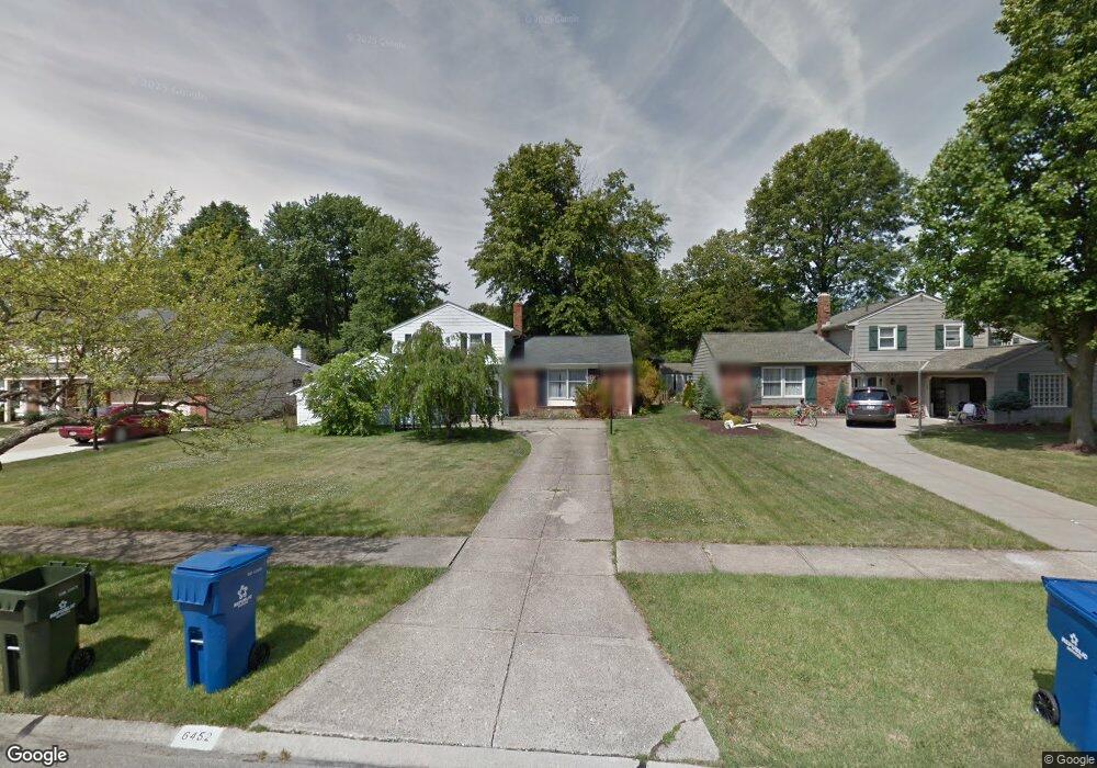
6452 Surrey Dr North Olmsted, OH 44070
Estimated Value: $290,665 - $350,000
3
Beds
2
Baths
1,834
Sq Ft
$170/Sq Ft
Est. Value
About This Home
This home is located at 6452 Surrey Dr, North Olmsted, OH 44070 and is currently estimated at $312,166, approximately $170 per square foot. 6452 Surrey Dr is a home located in Cuyahoga County with nearby schools including Chestnut Intermediate Elementary School, Pine Intermediate School, and North Olmsted Middle School.
Ownership History
Date
Name
Owned For
Owner Type
Purchase Details
Closed on
May 26, 1994
Sold by
Kelemen Marc P
Bought by
Hetman John R
Current Estimated Value
Purchase Details
Closed on
Oct 10, 1984
Sold by
Mahoney Donald R
Bought by
Kelemen Marc P
Purchase Details
Closed on
Oct 6, 1976
Sold by
Mahoney Donald R and Mahoney Therese V
Bought by
Mahoney Donald R
Purchase Details
Closed on
Oct 24, 1975
Sold by
Kendall Richard W
Bought by
Mahoney Donald R and Mahoney Therese
Purchase Details
Closed on
Jan 1, 1975
Bought by
Kendall Richard W
Create a Home Valuation Report for This Property
The Home Valuation Report is an in-depth analysis detailing your home's value as well as a comparison with similar homes in the area
Home Values in the Area
Average Home Value in this Area
Purchase History
| Date | Buyer | Sale Price | Title Company |
|---|---|---|---|
| Hetman John R | $126,500 | -- | |
| Kelemen Marc P | $71,000 | -- | |
| Mahoney Donald R | -- | -- | |
| Mahoney Donald R | $53,500 | -- | |
| Kendall Richard W | -- | -- |
Source: Public Records
Tax History Compared to Growth
Tax History
| Year | Tax Paid | Tax Assessment Tax Assessment Total Assessment is a certain percentage of the fair market value that is determined by local assessors to be the total taxable value of land and additions on the property. | Land | Improvement |
|---|---|---|---|---|
| 2024 | $5,959 | $86,940 | $18,025 | $68,915 |
| 2023 | $5,314 | $65,070 | $14,180 | $50,890 |
| 2022 | $5,286 | $65,070 | $14,180 | $50,890 |
| 2021 | $4,784 | $65,070 | $14,180 | $50,890 |
| 2020 | $4,617 | $55,620 | $12,110 | $43,510 |
| 2019 | $4,493 | $158,900 | $34,600 | $124,300 |
| 2018 | $4,484 | $55,620 | $12,110 | $43,510 |
| 2017 | $4,486 | $50,410 | $10,540 | $39,870 |
| 2016 | $4,447 | $50,410 | $10,540 | $39,870 |
| 2015 | $4,412 | $50,410 | $10,540 | $39,870 |
| 2014 | $4,341 | $48,930 | $10,220 | $38,710 |
Source: Public Records
Map
Nearby Homes
- 6321 Brighton Dr
- 6305 Christman Dr
- 6617 Sutton Dr
- 6281 Christman Dr
- 6723 Warrington Dr
- 30247 Lorain Rd
- 6580 Barton Rd
- 0 Stearns Rd
- 29861 Wellington Dr
- 30630 Lorain Rd
- 29408 Stewart Dr
- 28628 Aspen Dr
- 28625 Elder Dr
- 7100 Barton Rd
- 5833 Stearns Rd
- 31134 Lorain Rd
- 5920 Sherwood Dr
- 30241 Sugar Sand Ln Unit 14B
- 6427 Mackenzie Rd
- 28130 Angela Dr
- 6464 Surrey Dr
- 6440 Surrey Dr
- 6476 Surrey Dr
- 6428 Surrey Dr
- 6457 Brighton Dr
- 6445 Brighton Dr
- 6433 Brighton Dr
- 6418 Surrey Dr
- 6488 Surrey Dr
- 6451 Surrey Dr
- 6463 Surrey Dr
- 6439 Surrey Dr
- 6481 Brighton Dr
- 6421 Brighton Dr
- 6475 Surrey Dr
- 6427 Surrey Dr
- 6500 Surrey Dr
- 6404 Surrey Dr
- 6493 Brighton Dr
- 6407 Brighton Dr