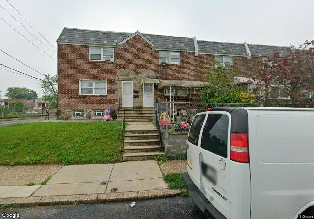
6453 Akron St Philadelphia, PA 19149
Castor Gardens NeighborhoodEstimated Value: $212,093 - $250,000
3
Beds
1
Bath
1,170
Sq Ft
$197/Sq Ft
Est. Value
About This Home
This home is located at 6453 Akron St, Philadelphia, PA 19149 and is currently estimated at $230,773, approximately $197 per square foot. 6453 Akron St is a home located in Philadelphia County with nearby schools including Gilbert Spruance School, Northeast High School, and St Martin Of Tours Catholic School.
Ownership History
Date
Name
Owned For
Owner Type
Purchase Details
Closed on
Oct 29, 2018
Sold by
Yuan Hua Hui
Bought by
Yuan Vanesa
Current Estimated Value
Purchase Details
Closed on
Oct 8, 2003
Sold by
Danese Ramon
Bought by
Yaun Hua Hui
Home Financials for this Owner
Home Financials are based on the most recent Mortgage that was taken out on this home.
Original Mortgage
$45,900
Outstanding Balance
$21,742
Interest Rate
6.43%
Mortgage Type
Stand Alone First
Estimated Equity
$209,031
Create a Home Valuation Report for This Property
The Home Valuation Report is an in-depth analysis detailing your home's value as well as a comparison with similar homes in the area
Home Values in the Area
Average Home Value in this Area
Purchase History
| Date | Buyer | Sale Price | Title Company |
|---|---|---|---|
| Yuan Vanesa | -- | None Available | |
| Yaun Hua Hui | $65,400 | -- |
Source: Public Records
Mortgage History
| Date | Status | Borrower | Loan Amount |
|---|---|---|---|
| Open | Yaun Hua Hui | $45,900 |
Source: Public Records
Tax History Compared to Growth
Tax History
| Year | Tax Paid | Tax Assessment Tax Assessment Total Assessment is a certain percentage of the fair market value that is determined by local assessors to be the total taxable value of land and additions on the property. | Land | Improvement |
|---|---|---|---|---|
| 2025 | $2,427 | $203,600 | $40,720 | $162,880 |
| 2024 | $2,427 | $203,600 | $40,720 | $162,880 |
| 2023 | $2,427 | $173,400 | $34,680 | $138,720 |
| 2022 | $1,193 | $128,400 | $34,680 | $93,720 |
| 2021 | $1,823 | $0 | $0 | $0 |
| 2020 | $1,823 | $0 | $0 | $0 |
| 2019 | $1,748 | $0 | $0 | $0 |
| 2018 | $1,194 | $0 | $0 | $0 |
| 2017 | $1,614 | $0 | $0 | $0 |
| 2016 | $1,194 | $0 | $0 | $0 |
| 2015 | $1,143 | $0 | $0 | $0 |
| 2014 | -- | $115,300 | $18,837 | $96,463 |
| 2012 | -- | $14,592 | $978 | $13,614 |
Source: Public Records
Map
Nearby Homes
- 6627 Oakland St
- 1535 Hellerman St
- 6621 Sylvester St
- 6300 Eastwood St
- 6306 Leonard St
- 6340 Calvert St
- 1500 Hellerman St
- 6725 Eastwood St
- 2687 Levick St
- 6640 Souder St
- 2003 Devereaux Ave
- 2001R Mckinley St
- 2112 Robbins Ave
- 2019 Devereaux Ave
- 2133 Mckinley St
- 2052 Devereaux Ave
- 6626 Lynford St
- 2169 Knorr St
- 1531 Stevens St
- 1440 Robbins Ave