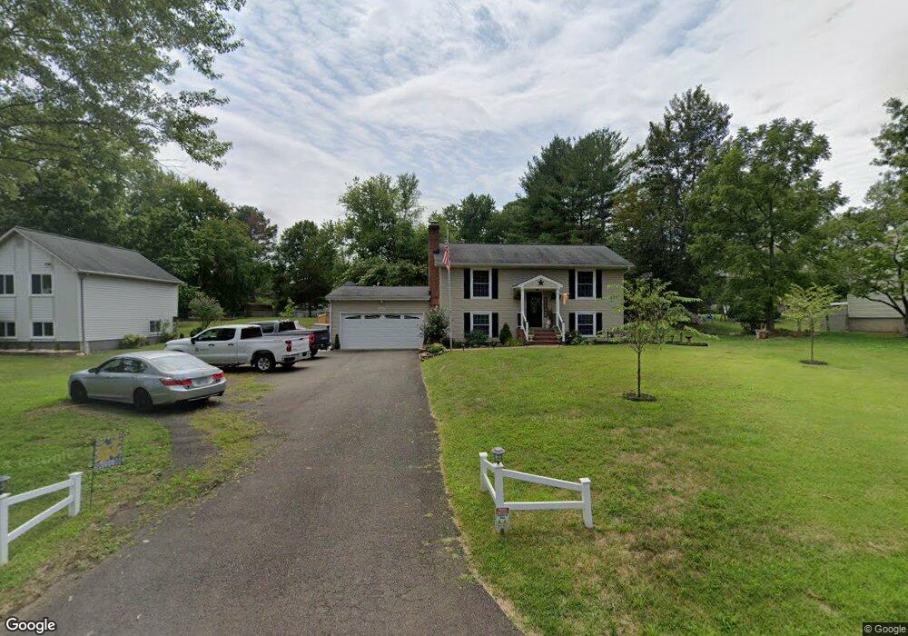
6465 Lancaster Dr Warrenton, VA 20187
Estimated Value: $550,000 - $602,970
4
Beds
2
Baths
1,659
Sq Ft
$352/Sq Ft
Est. Value
About This Home
This home is located at 6465 Lancaster Dr, Warrenton, VA 20187 and is currently estimated at $583,993, approximately $352 per square foot. 6465 Lancaster Dr is a home located in Fauquier County with nearby schools including P.B. Smith Elementary School, Marshall Middle School, and Fauquier High School.
Ownership History
Date
Name
Owned For
Owner Type
Purchase Details
Closed on
Nov 14, 2001
Sold by
Abramo Adam D
Bought by
Smith Adam M
Current Estimated Value
Home Financials for this Owner
Home Financials are based on the most recent Mortgage that was taken out on this home.
Original Mortgage
$186,000
Outstanding Balance
$72,591
Interest Rate
6.7%
Estimated Equity
$511,402
Purchase Details
Closed on
May 1, 1997
Sold by
Mcfarlane William H and Mcfarlane Shirley P
Bought by
Beaulieu Pamela J
Home Financials for this Owner
Home Financials are based on the most recent Mortgage that was taken out on this home.
Original Mortgage
$124,900
Interest Rate
7.85%
Mortgage Type
New Conventional
Create a Home Valuation Report for This Property
The Home Valuation Report is an in-depth analysis detailing your home's value as well as a comparison with similar homes in the area
Home Values in the Area
Average Home Value in this Area
Purchase History
| Date | Buyer | Sale Price | Title Company |
|---|---|---|---|
| Smith Adam M | $216,000 | -- | |
| Beaulieu Pamela J | $124,900 | -- |
Source: Public Records
Mortgage History
| Date | Status | Borrower | Loan Amount |
|---|---|---|---|
| Open | Smith Adam M | $186,000 | |
| Previous Owner | Beaulieu Pamela J | $124,900 |
Source: Public Records
Tax History Compared to Growth
Tax History
| Year | Tax Paid | Tax Assessment Tax Assessment Total Assessment is a certain percentage of the fair market value that is determined by local assessors to be the total taxable value of land and additions on the property. | Land | Improvement |
|---|---|---|---|---|
| 2025 | $5,048 | $522,000 | $135,000 | $387,000 |
| 2024 | $4,936 | $522,000 | $135,000 | $387,000 |
| 2023 | $4,727 | $522,000 | $135,000 | $387,000 |
| 2022 | $4,727 | $522,000 | $135,000 | $387,000 |
| 2021 | $3,895 | $390,500 | $120,000 | $270,500 |
| 2020 | $3,895 | $390,500 | $120,000 | $270,500 |
| 2019 | $3,895 | $390,500 | $120,000 | $270,500 |
| 2018 | $3,848 | $390,500 | $120,000 | $270,500 |
| 2016 | $3,156 | $302,400 | $110,000 | $192,400 |
| 2015 | -- | $302,400 | $110,000 | $192,400 |
| 2014 | -- | $302,400 | $110,000 | $192,400 |
Source: Public Records
Map
Nearby Homes
- 6416 Airlie Rd
- 7213 Princess Anne Ct
- 6397 Tazewell St
- 0 Hwy Unit VAFQ2018052
- 0 Airlie Road Lee Hwy Unit VAFQ2018058
- 7333 Hazelwood Ct
- 7038 Beaconsfield Ln
- 7241 Blackwell Rd
- 7245 Blackwell Rd
- 7253 Blackwell Rd
- 7323 Bayfield Ln
- 7631 Movern Ln
- 541 Highland Towne Ln
- 7040 Hi Rock Ridge Rd
- LOT 1 Blackwell Rd
- 7176 Homestead Ct
- 6704 Holly Farm Ln Unit 109
- 6696 Club House Ln Unit 104
- 315 Winterset Ln
- 916 Broadview Ave
- 6461 Lancaster Dr
- 6451 Lancaster Dr
- 6475 Lancaster Dr
- 6464 Lancaster Dr
- 6470 Lancaster Dr
- 7151 Spotsylvania St
- 7155 Spotsylvania St
- 6460 Lancaster Dr
- 6445 Lancaster Dr
- 6476 Lancaster Dr
- 6481 Lancaster Dr
- 7147 Spotsylvania St
- 6456 Lancaster Dr
- 6439 Lancaster Dr
- 7159 Spotsylvania St
- 6480 Lancaster Dr
- 6448 Lancaster Dr
- 6452 Lancaster Dr
- 6487 Lancaster Dr
- 6433 Lancaster Dr