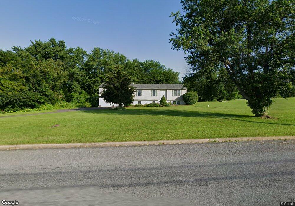
6477 Palm Rd Zionsville, PA 18092
Lower Milford NeighborhoodEstimated Value: $476,000 - $612,000
3
Beds
1
Bath
2,958
Sq Ft
$186/Sq Ft
Est. Value
About This Home
This home is located at 6477 Palm Rd, Zionsville, PA 18092 and is currently estimated at $549,652, approximately $185 per square foot. 6477 Palm Rd is a home located in Lehigh County with nearby schools including Southern Lehigh High School and Chapel Mennonite School.
Ownership History
Date
Name
Owned For
Owner Type
Purchase Details
Closed on
Apr 16, 2004
Sold by
Juliano Anthony H
Bought by
Dorazio Michael A
Current Estimated Value
Purchase Details
Closed on
Oct 1, 2003
Sold by
Wentz Larry J
Bought by
Juliano Anthony H
Home Financials for this Owner
Home Financials are based on the most recent Mortgage that was taken out on this home.
Original Mortgage
$116,910
Interest Rate
6.25%
Mortgage Type
Stand Alone Second
Purchase Details
Closed on
Jan 5, 1996
Sold by
Wentz John S and Wentz Verna M
Bought by
Wentz Larry J
Create a Home Valuation Report for This Property
The Home Valuation Report is an in-depth analysis detailing your home's value as well as a comparison with similar homes in the area
Home Values in the Area
Average Home Value in this Area
Purchase History
| Date | Buyer | Sale Price | Title Company |
|---|---|---|---|
| Dorazio Michael A | $215,000 | -- | |
| Juliano Anthony H | $129,900 | -- | |
| Wentz Larry J | -- | -- |
Source: Public Records
Mortgage History
| Date | Status | Borrower | Loan Amount |
|---|---|---|---|
| Previous Owner | Juliano Anthony H | $116,910 |
Source: Public Records
Tax History Compared to Growth
Tax History
| Year | Tax Paid | Tax Assessment Tax Assessment Total Assessment is a certain percentage of the fair market value that is determined by local assessors to be the total taxable value of land and additions on the property. | Land | Improvement |
|---|---|---|---|---|
| 2025 | $5,898 | $267,400 | $74,500 | $192,900 |
| 2024 | $5,898 | $267,400 | $74,500 | $192,900 |
| 2023 | $5,898 | $267,400 | $74,500 | $192,900 |
| 2022 | $5,809 | $267,400 | $192,900 | $74,500 |
| 2021 | $5,678 | $267,400 | $74,500 | $192,900 |
| 2020 | $5,566 | $267,400 | $74,500 | $192,900 |
| 2019 | $5,475 | $267,400 | $74,500 | $192,900 |
| 2018 | $5,475 | $267,400 | $74,500 | $192,900 |
| 2017 | $5,422 | $267,400 | $74,500 | $192,900 |
| 2016 | -- | $267,400 | $74,500 | $192,900 |
| 2015 | -- | $267,400 | $74,500 | $192,900 |
| 2014 | -- | $267,400 | $74,500 | $192,900 |
Source: Public Records
Map
Nearby Homes
- 7921 Corning Rd
- 0 Chestnut St
- 770 Gravel Pike
- 117 Concord Dr
- 62 Ashford Ln
- 328 Ashford Ln
- 317 Ashford Ln
- 6335 Sweetbriar Ln
- 1962 Tollgate Rd
- 4675 E Mill Hill Rd
- 2563 Wasser Rd
- 5722 Kings Hwy S
- 1137 Church Rd
- 548 Blaker Dr
- 434 Jefferson St
- 2071 Baus Rd
- 5061 Wendi Dr W
- 333 Blaker Dr
- 317 State St
- 238 Main St
- 8031 Corning Rd
- 8009 Corning Rd
- 6526 Palm Rd
- 7981 Corning Rd
- 6423 Palm Rd
- 7963 Corning Rd
- 6419 Palm Rd
- 6550 Palm Rd
- 6345 Palm Rd
- 7901 Corning Rd
- 7911 Corning Rd
- 8043 Yeakels Rd
- 7831 Corning Rd
- 6339 Palm Rd
- 2044 Corning Rd
- 7825 Corning Rd
- 7821 Corning Rd
- 7822 Corning Rd
- 7815 Corning Rd
- 2038 Corning Rd