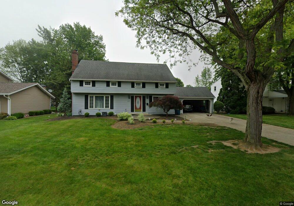
649 N Woodhill Dr Amherst, OH 44001
Estimated Value: $287,050 - $337,000
4
Beds
3
Baths
2,436
Sq Ft
$132/Sq Ft
Est. Value
About This Home
This home is located at 649 N Woodhill Dr, Amherst, OH 44001 and is currently estimated at $321,263, approximately $131 per square foot. 649 N Woodhill Dr is a home located in Lorain County with nearby schools including Powers Elementary School, Walter G. Nord Middle School, and Amherst Junior High School.
Ownership History
Date
Name
Owned For
Owner Type
Purchase Details
Closed on
Jan 11, 2023
Sold by
Davis Charles R
Bought by
C & V Davis Family Irrevocable Trost
Current Estimated Value
Purchase Details
Closed on
Sep 21, 2000
Sold by
Judith Benson
Bought by
Davis Charles R and Davis Vicki R
Home Financials for this Owner
Home Financials are based on the most recent Mortgage that was taken out on this home.
Original Mortgage
$144,000
Interest Rate
8.05%
Purchase Details
Closed on
Apr 12, 1999
Sold by
Benson Robert J
Bought by
Benson Judith
Home Financials for this Owner
Home Financials are based on the most recent Mortgage that was taken out on this home.
Original Mortgage
$140,000
Interest Rate
7.62%
Create a Home Valuation Report for This Property
The Home Valuation Report is an in-depth analysis detailing your home's value as well as a comparison with similar homes in the area
Home Values in the Area
Average Home Value in this Area
Purchase History
| Date | Buyer | Sale Price | Title Company |
|---|---|---|---|
| C & V Davis Family Irrevocable Trost | -- | -- | |
| Davis Charles R | $180,000 | Americas Choice Title Agency | |
| Benson Judith | -- | -- |
Source: Public Records
Mortgage History
| Date | Status | Borrower | Loan Amount |
|---|---|---|---|
| Previous Owner | Davis Charles R | $144,000 | |
| Previous Owner | Benson Judith | $140,000 | |
| Closed | Davis Charles R | $39,660 |
Source: Public Records
Tax History Compared to Growth
Tax History
| Year | Tax Paid | Tax Assessment Tax Assessment Total Assessment is a certain percentage of the fair market value that is determined by local assessors to be the total taxable value of land and additions on the property. | Land | Improvement |
|---|---|---|---|---|
| 2024 | $3,430 | $82,922 | $13,909 | $69,013 |
| 2023 | $3,175 | $66,255 | $13,468 | $52,787 |
| 2022 | $3,043 | $66,255 | $13,468 | $52,787 |
| 2021 | $3,051 | $66,255 | $13,468 | $52,787 |
| 2020 | $2,817 | $54,310 | $11,040 | $43,270 |
| 2019 | $2,761 | $54,310 | $11,040 | $43,270 |
| 2018 | $2,795 | $54,310 | $11,040 | $43,270 |
| 2017 | $2,815 | $51,730 | $7,740 | $43,990 |
| 2016 | $2,837 | $51,730 | $7,740 | $43,990 |
| 2015 | $2,821 | $51,730 | $7,740 | $43,990 |
| 2014 | $2,913 | $53,160 | $7,950 | $45,210 |
| 2013 | $2,922 | $53,160 | $7,950 | $45,210 |
Source: Public Records
Map
Nearby Homes
- 707 Greenlawn Dr
- 726 Sunrise Dr
- 922 Sharondale Dr
- 105 N Woodhill Dr
- 117 Fall Lake Ln
- 825 Cleveland Ave
- 1273 Spruce Tree Ln
- 135 Ridgeland Dr
- 0 Cooper Foster Park Rd Unit 5129838
- Pine w/ Full Basement Plan at Quarry Creek
- Poplar Plan at Quarry Creek
- 60 Flamingo Ave
- 8 Riviera Ave
- 41 Flamingo Ave
- 1011 N Main St
- 127 Tropicana Ave
- 117 Caesars Cir
- 351 Rockridge Dr
- 168 Orchard Hill Dr
- 1140 Woodside Dr
- 637 N Woodhill Dr
- 651 N Woodhill Dr
- 632 Cherry Valley Dr
- 642 Cherry Valley Dr
- 653 N Woodhill Dr
- 625 N Woodhill Dr
- 622 Cherry Valley Dr
- 650 N Woodhill Dr
- 652 Cherry Valley Dr
- 652 N Woodhill Dr
- 636 N Woodhill Dr
- 655 N Woodhill Dr
- 654 N Woodhill Dr
- 901 Shadylawn Dr
- 626 N Woodhill Dr
- 612 Cherry Valley Dr
- 662 Cherry Valley Dr
- 656 N Woodhill Dr
- 657 N Woodhill Dr
- 815 Shadylawn Dr