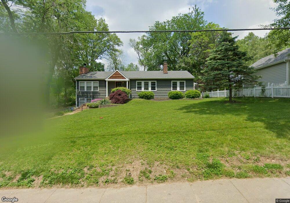
649 Newport Ave Saint Louis, MO 63119
Estimated Value: $574,813 - $629,000
3
Beds
2
Baths
2,094
Sq Ft
$286/Sq Ft
Est. Value
About This Home
This home is located at 649 Newport Ave, Saint Louis, MO 63119 and is currently estimated at $598,203, approximately $285 per square foot. 649 Newport Ave is a home located in St. Louis County with nearby schools including Avery Elementary School, Hixson Middle School, and Webster Groves High School.
Ownership History
Date
Name
Owned For
Owner Type
Purchase Details
Closed on
Apr 24, 2018
Sold by
Abdallah Nancy N and Abdallah Revocable Liv Nancy N
Bought by
Brunk Gabriel J and Brunk Sarah J
Current Estimated Value
Home Financials for this Owner
Home Financials are based on the most recent Mortgage that was taken out on this home.
Original Mortgage
$358,625
Outstanding Balance
$308,411
Interest Rate
4.44%
Mortgage Type
New Conventional
Estimated Equity
$289,792
Purchase Details
Closed on
Aug 3, 2010
Sold by
Abdallah Nancy N
Bought by
Abdallah Nancy N
Purchase Details
Closed on
Feb 29, 2000
Sold by
Ryan Sarah J and Ryan Kevin D
Bought by
Abdallah Nancy N
Home Financials for this Owner
Home Financials are based on the most recent Mortgage that was taken out on this home.
Original Mortgage
$193,000
Interest Rate
3.95%
Create a Home Valuation Report for This Property
The Home Valuation Report is an in-depth analysis detailing your home's value as well as a comparison with similar homes in the area
Home Values in the Area
Average Home Value in this Area
Purchase History
| Date | Buyer | Sale Price | Title Company |
|---|---|---|---|
| Brunk Gabriel J | -- | Investors Title Company Clay | |
| Abdallah Nancy N | -- | None Available | |
| Abdallah Nancy N | $241,250 | -- |
Source: Public Records
Mortgage History
| Date | Status | Borrower | Loan Amount |
|---|---|---|---|
| Open | Brunk Gabriel J | $358,625 | |
| Previous Owner | Abdallah Nancy N | $193,000 |
Source: Public Records
Tax History Compared to Growth
Tax History
| Year | Tax Paid | Tax Assessment Tax Assessment Total Assessment is a certain percentage of the fair market value that is determined by local assessors to be the total taxable value of land and additions on the property. | Land | Improvement |
|---|---|---|---|---|
| 2025 | $5,528 | $80,580 | $52,970 | $27,610 |
| 2024 | $5,528 | $79,470 | $38,510 | $40,960 |
| 2023 | $5,501 | $79,470 | $38,510 | $40,960 |
| 2022 | $5,395 | $72,370 | $38,510 | $33,860 |
| 2021 | $5,376 | $72,370 | $38,510 | $33,860 |
| 2020 | $5,719 | $71,760 | $38,190 | $33,570 |
| 2019 | $5,678 | $71,760 | $38,190 | $33,570 |
| 2018 | $5,437 | $61,010 | $26,750 | $34,260 |
| 2017 | $5,401 | $61,010 | $26,750 | $34,260 |
| 2016 | $5,148 | $55,650 | $22,950 | $32,700 |
| 2015 | $5,173 | $55,650 | $22,950 | $32,700 |
| 2014 | $5,341 | $55,920 | $18,240 | $37,680 |
Source: Public Records
Map
Nearby Homes
- 610 Cornelia Ave
- 619 N Bompart Ave
- 400 Marion Ave
- 441 Park Rd
- 544 Summit Ave
- 716 Clark Ave
- 808 Greeley Ave
- 840 Marshall Ave
- 946 Newport Ave
- 450 E Lockwood Ave Unit 303
- 112 Oakwood Ave
- 546 Holland Ave
- 940 Brookside Ave
- 946 Marshall Ave Unit D
- 835 N Forest Ave
- 554 N Laclede Station Rd
- 570 N Laclede Station Rd
- 814 Holland Ave
- 7723 Suffolk Ave
- 7826 Grove Ave
- 643 Newport Ave
- 511 N Bompart Ave
- 503 N Bompart Ave
- 639 Newport Ave
- 515 N Bompart Ave
- 635 Newport Ave
- 519 N Bompart Ave
- 631 Newport Ave
- 477 Hawthorne Ave
- 471 Hawthorne Ave
- 502 N Bompart Ave
- 512 N Bompart Ave
- 422 N Bompart Ave
- 625 Newport Ave
- 648 Fairview Ave
- 654 Fairview Ave
- 485 Hawthorne Ave
- 644 Fairview Ave
- 461 Hawthorne Ave
- 491 Hawthorne Ave