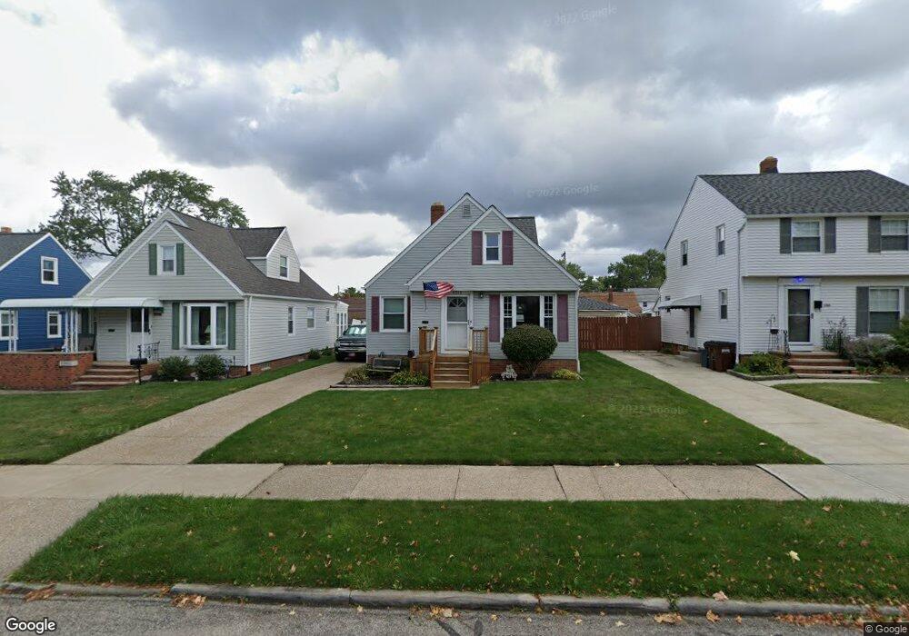
6510 Thornton Dr Cleveland, OH 44129
Estimated Value: $177,498 - $219,000
2
Beds
1
Bath
882
Sq Ft
$227/Sq Ft
Est. Value
About This Home
This home is located at 6510 Thornton Dr, Cleveland, OH 44129 and is currently estimated at $199,875, approximately $226 per square foot. 6510 Thornton Dr is a home located in Cuyahoga County with nearby schools including Renwood Elementary School, Thoreau Park Elementary School, and Shiloh Middle School.
Ownership History
Date
Name
Owned For
Owner Type
Purchase Details
Closed on
Nov 6, 1998
Sold by
Mcguire Helene M
Bought by
Dawson Ritchie L
Current Estimated Value
Home Financials for this Owner
Home Financials are based on the most recent Mortgage that was taken out on this home.
Original Mortgage
$89,919
Interest Rate
6.72%
Purchase Details
Closed on
Dec 28, 1983
Sold by
Mcguire Edward W and Mcguire Helene M
Bought by
Mcguire Helene M
Purchase Details
Closed on
Jan 1, 1975
Bought by
Mcguire Edward W and Mcguire Helene M
Create a Home Valuation Report for This Property
The Home Valuation Report is an in-depth analysis detailing your home's value as well as a comparison with similar homes in the area
Home Values in the Area
Average Home Value in this Area
Purchase History
| Date | Buyer | Sale Price | Title Company |
|---|---|---|---|
| Dawson Ritchie L | $97,000 | Midland Title Security Inc | |
| Mcguire Helene M | -- | -- | |
| Mcguire Edward W | -- | -- |
Source: Public Records
Mortgage History
| Date | Status | Borrower | Loan Amount |
|---|---|---|---|
| Open | Dawson Richie L | $97,100 | |
| Closed | Dawson Ritchie L | $96,866 | |
| Closed | Dawson Ritchie L | $67,650 | |
| Closed | Dawson Ritchie L | $36,870 | |
| Closed | Dawson Ritchie L | $25,000 | |
| Closed | Dawson Ritchie L | $20,250 | |
| Closed | Dawson Ritchie L | $10,103 | |
| Closed | Dawson Ritchie L | $89,919 |
Source: Public Records
Tax History Compared to Growth
Tax History
| Year | Tax Paid | Tax Assessment Tax Assessment Total Assessment is a certain percentage of the fair market value that is determined by local assessors to be the total taxable value of land and additions on the property. | Land | Improvement |
|---|---|---|---|---|
| 2024 | $3,342 | $54,635 | $10,850 | $43,785 |
| 2023 | $2,983 | $41,860 | $9,590 | $32,270 |
| 2022 | $2,954 | $41,860 | $9,590 | $32,270 |
| 2021 | $3,038 | $41,860 | $9,590 | $32,270 |
| 2020 | $2,662 | $32,200 | $7,390 | $24,820 |
| 2019 | $2,548 | $92,000 | $21,100 | $70,900 |
| 2018 | $2,437 | $32,200 | $7,390 | $24,820 |
| 2017 | $2,473 | $28,990 | $5,710 | $23,280 |
| 2016 | $2,458 | $28,990 | $5,710 | $23,280 |
| 2015 | $2,347 | $28,990 | $5,710 | $23,280 |
| 2014 | $2,347 | $29,580 | $5,810 | $23,770 |
Source: Public Records
Map
Nearby Homes
- 6708 Thornton Dr
- 6610 Renwood Dr
- 6096 Wareham Dr
- 7014 Thornton Dr
- 6111 Manchester Rd
- 6818 Hampstead Ave
- 7115 Hampstead Ave
- 6704 Charles Ave
- 6406 Sunderland Dr
- 6168 Manchester Rd
- 6136 Ridge Rd
- 5603 Allanwood Dr
- 5815 Wilber Ave
- 6903 Alber Ave
- 6227 Ridge Rd
- 6234 N Canterbury Rd
- 6706 Alber Ave
- 7514 Spring Garden Rd
- 5415 Pelham Dr
- 6510 Belmere Dr
- 6506 Thornton Dr
- 6514 Thornton Dr
- 6602 Thornton Dr
- 6502 Thornton Dr
- 6606 Thornton Dr
- 6418 Thornton Dr
- 6415 Dartworth Dr
- 6419 Dartworth Dr
- 6411 Dartworth Dr
- 6503 Dartworth Dr
- 6407 Dartworth Dr
- 6507 Dartworth Dr
- 6610 Thornton Dr
- 6414 Thornton Dr
- 6515 Thornton Dr
- 6519 Thornton Dr
- 6511 Thornton Dr
- 6403 Dartworth Dr
- 6511 Dartworth Dr
- 6603 Thornton Dr