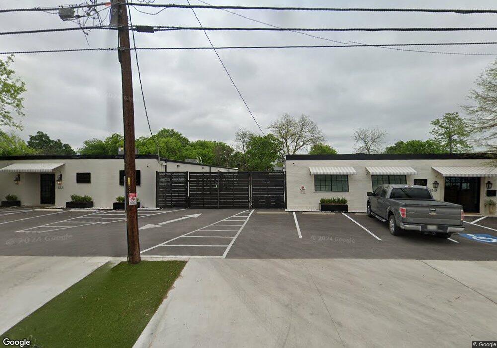
6519 Burnet Ln Austin, TX 78757
Brentwood Neighborhood
--
Bed
--
Bath
960
Sq Ft
10,454
Sq Ft Lot
About This Home
This home is located at 6519 Burnet Ln, Austin, TX 78757. 6519 Burnet Ln is a home located in Travis County with nearby schools including Brentwood Elementary School, Lamar Middle School, and McCallum High School.
Ownership History
Date
Name
Owned For
Owner Type
Purchase Details
Closed on
Aug 19, 2022
Sold by
Town & Country Rentals Llc
Bought by
Burnet Lane Design Collective Llc
Home Financials for this Owner
Home Financials are based on the most recent Mortgage that was taken out on this home.
Original Mortgage
$1,800,000
Outstanding Balance
$1,717,978
Interest Rate
5.3%
Mortgage Type
New Conventional
Purchase Details
Closed on
Mar 9, 2017
Sold by
Stringfellow Steven and Stringfellow Melanie
Bought by
Stringfellow Rentals Llc
Purchase Details
Closed on
Feb 28, 2013
Sold by
Rislov George and Archer Stephanie
Bought by
Stringfellow Steven W and Springfellow Melanie E
Purchase Details
Closed on
Aug 5, 2010
Sold by
Engelbrecht Margaret Thomas
Bought by
Town & Country Rentals Llc
Purchase Details
Closed on
Dec 30, 2009
Sold by
Town & Country Investment Co and Engelbrecht Margaret Ann Thomas
Bought by
Engelbrecht Margaret Thomas
Purchase Details
Closed on
Aug 8, 2007
Sold by
Pyle Melva M
Bought by
Ashton Leslie P
Create a Home Valuation Report for This Property
The Home Valuation Report is an in-depth analysis detailing your home's value as well as a comparison with similar homes in the area
Home Values in the Area
Average Home Value in this Area
Purchase History
| Date | Buyer | Sale Price | Title Company |
|---|---|---|---|
| Burnet Lane Design Collective Llc | -- | None Listed On Document | |
| Stringfellow Rentals Llc | -- | None Available | |
| Stringfellow Steven W | -- | Heritage Title | |
| Town & Country Rentals Llc | -- | None Available | |
| Engelbrecht Margaret Thomas | -- | None Available | |
| Ashton Leslie P | -- | None Available |
Source: Public Records
Mortgage History
| Date | Status | Borrower | Loan Amount |
|---|---|---|---|
| Open | Burnet Lane Design Collective Llc | $1,800,000 |
Source: Public Records
Tax History Compared to Growth
Tax History
| Year | Tax Paid | Tax Assessment Tax Assessment Total Assessment is a certain percentage of the fair market value that is determined by local assessors to be the total taxable value of land and additions on the property. | Land | Improvement |
|---|---|---|---|---|
| 2025 | $13,873 | $642,104 | $534,600 | $107,504 |
| 2023 | $12,123 | $670,084 | $534,600 | $135,484 |
| 2022 | $13,099 | $663,262 | $534,600 | $128,662 |
| 2021 | $12,483 | $573,507 | $534,600 | $38,907 |
| 2020 | $13,373 | $623,485 | $534,600 | $88,885 |
| 2018 | $9,280 | $419,150 | $374,220 | $44,930 |
| 2017 | $9,348 | $419,150 | $374,220 | $44,930 |
| 2016 | $7,830 | $351,114 | $320,760 | $30,354 |
| 2015 | $7,139 | $284,702 | $213,840 | $70,862 |
| 2014 | $7,139 | $351,679 | $213,840 | $137,839 |
Source: Public Records
Map
Nearby Homes
- 6602 Laird Dr
- 2019 Brentwood St
- 6444 Burnet Rd Unit 204
- 6444 Burnet Rd Unit 305
- 2009 Payne Ave Unit 2
- 1900 Burbank St
- 2004 Pequeno St
- 1812 Burbank St
- 1907 Payne Ave
- 2601 Park View Dr
- 6403 Nasco Dr
- 2603 Park View Dr
- 2604 Addison Ave
- 1912 Romeria Dr Unit B
- 1711 Brentwood St
- 1915 Cullen Ave
- 2608 Twin Oaks Dr
- 6905 Daugherty St
- 1708 Payne Ave
- 2012 Cullen Ave
- 6513 Burnet Ln
- 6521 Burnet Ln Unit 100
- 6511 Burnet Ln
- 6516 Laird Dr
- 6518 Laird Dr
- 6520 Laird Dr
- 6514 Laird Dr
- 6522 Laird Dr
- 6512 Laird Dr
- 6600 Laird Dr
- 2007 Burbank St
- 2009 Burbank St
- 6510 Laird Dr
- 6509 Laird Dr
- 6701 Burnet Rd
- 6701 Burnet Rd
- 6517 Laird Dr
- 2016 Karen Ave
- 2005 Burbank St
- 6508 Laird Dr