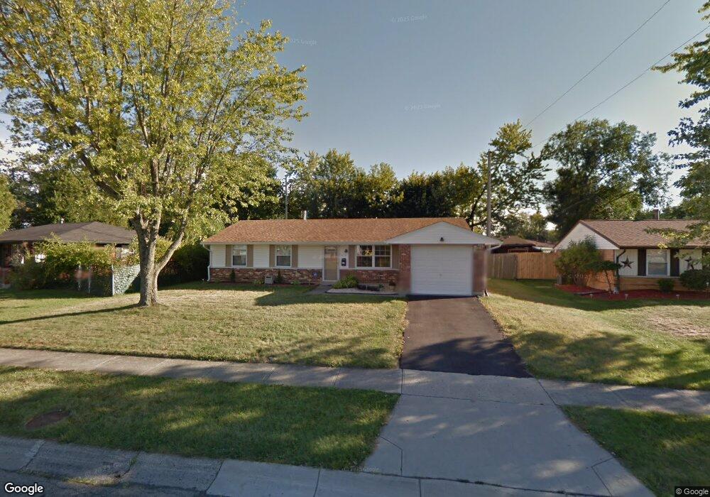
6520 Stonehurst Dr Dayton, OH 45424
Estimated Value: $181,894 - $196,000
3
Beds
2
Baths
1,170
Sq Ft
$162/Sq Ft
Est. Value
About This Home
This home is located at 6520 Stonehurst Dr, Dayton, OH 45424 and is currently estimated at $189,724, approximately $162 per square foot. 6520 Stonehurst Dr is a home located in Montgomery County with nearby schools including Wayne High School and Huber Heights Christian Academy.
Ownership History
Date
Name
Owned For
Owner Type
Purchase Details
Closed on
Jun 20, 2007
Sold by
Rihm Heather J
Bought by
Maurer Michael J
Current Estimated Value
Home Financials for this Owner
Home Financials are based on the most recent Mortgage that was taken out on this home.
Original Mortgage
$91,300
Outstanding Balance
$56,408
Interest Rate
6.37%
Mortgage Type
Purchase Money Mortgage
Estimated Equity
$133,316
Purchase Details
Closed on
Jun 27, 2003
Sold by
Becker Norman C and Becker Patricia G
Bought by
Rihm Heather J
Home Financials for this Owner
Home Financials are based on the most recent Mortgage that was taken out on this home.
Original Mortgage
$71,920
Interest Rate
5.3%
Mortgage Type
Purchase Money Mortgage
Purchase Details
Closed on
Mar 21, 2000
Sold by
Norman Becker
Bought by
Becker Norman C and Becker Patricia G
Create a Home Valuation Report for This Property
The Home Valuation Report is an in-depth analysis detailing your home's value as well as a comparison with similar homes in the area
Home Values in the Area
Average Home Value in this Area
Purchase History
| Date | Buyer | Sale Price | Title Company |
|---|---|---|---|
| Maurer Michael J | $91,300 | Attorney | |
| Rihm Heather J | $89,900 | -- | |
| Becker Norman C | -- | -- |
Source: Public Records
Mortgage History
| Date | Status | Borrower | Loan Amount |
|---|---|---|---|
| Open | Maurer Michael J | $91,300 | |
| Previous Owner | Rihm Heather J | $71,920 |
Source: Public Records
Tax History Compared to Growth
Tax History
| Year | Tax Paid | Tax Assessment Tax Assessment Total Assessment is a certain percentage of the fair market value that is determined by local assessors to be the total taxable value of land and additions on the property. | Land | Improvement |
|---|---|---|---|---|
| 2024 | $2,339 | $45,210 | $10,150 | $35,060 |
| 2023 | $2,339 | $45,210 | $10,150 | $35,060 |
| 2022 | $2,040 | $31,140 | $7,000 | $24,140 |
| 2021 | $2,075 | $31,140 | $7,000 | $24,140 |
| 2020 | $2,077 | $31,140 | $7,000 | $24,140 |
| 2019 | $2,043 | $27,090 | $7,000 | $20,090 |
| 2018 | $2,050 | $27,090 | $7,000 | $20,090 |
| 2017 | $2,036 | $27,090 | $7,000 | $20,090 |
| 2016 | $1,939 | $25,120 | $7,000 | $18,120 |
| 2015 | $1,914 | $25,120 | $7,000 | $18,120 |
| 2014 | $1,914 | $25,120 | $7,000 | $18,120 |
| 2012 | -- | $26,500 | $8,750 | $17,750 |
Source: Public Records
Map
Nearby Homes
- 6681 Spokane Dr
- 6701 Springport Way
- 7866 Harshmanville Rd
- 7854 Harshmanville Rd
- 7741 Shalamar Dr
- 7833 Harshmanville Rd
- 6605 Highbury Rd
- 8282 Briar Ridge Ct
- 7371 Damascus Dr
- 7660 Stonecrest Dr
- 6447 Highbury Rd
- 7611 Shepherdess Dr
- 7211 Stonehurst Dr
- 7011 Safari Dr
- 6601 Grovehill Dr
- 6960 Serene Place
- 6811 Highbury Rd
- 7221 Serpentine Dr
- 6150 Taylorsville Rd
- 6652 Loblolly Dr
- 6510 Stonehurst Dr
- 6530 Stonehurst Dr
- 7761 Rothfield Dr
- 7771 Rothfield Dr
- 7780 Remmick Ln
- 7751 Rothfield Dr
- 6531 Stonehurst Dr
- 7770 Remmick Ln
- 6501 Stonehurst Dr
- 6541 Stonehurst Dr
- 6600 Stonehurst Dr
- 6467 Stonehurst Dr
- 7760 Remmick Ln
- 7770 Stonesboro Dr
- 7741 Rothfield Dr
- 7750 Rothfield Dr
- 7760 Stonesboro Dr
- 6611 Stonehurst Dr
- 7770 Rothfield Dr
- 6460 Stonehurst Dr