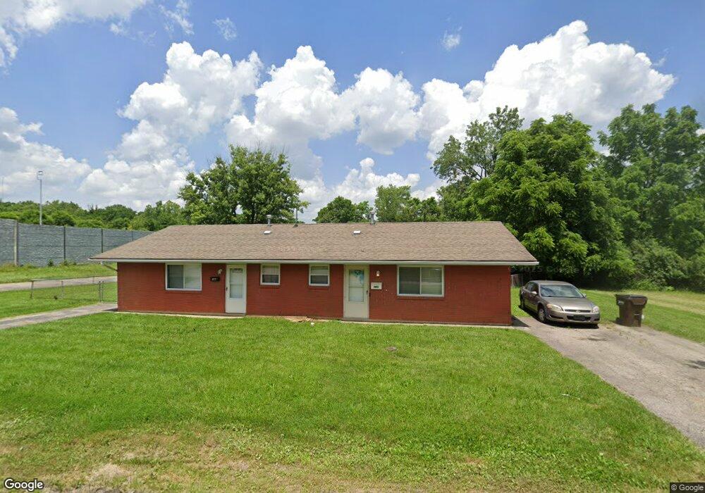
6521 Nathaniel St Dayton, OH 45417
Estimated Value: $69,000 - $120,000
4
Beds
2
Baths
1,566
Sq Ft
$61/Sq Ft
Est. Value
About This Home
This home is located at 6521 Nathaniel St, Dayton, OH 45417 and is currently estimated at $95,739, approximately $61 per square foot. 6521 Nathaniel St is a home located in Montgomery County with nearby schools including International School at Residence Park, Westwood Elementary, and Louise Troy Elementary.
Ownership History
Date
Name
Owned For
Owner Type
Purchase Details
Closed on
Jan 8, 2018
Sold by
Sweet Elizabeth and Pidcock David
Bought by
Starlion Llc
Current Estimated Value
Purchase Details
Closed on
Jun 4, 2015
Sold by
Bolden Morrell
Bought by
Yolo Construction & Property Investment
Purchase Details
Closed on
May 27, 2015
Sold by
Dennison Barbara
Bought by
Bolden Morrell
Purchase Details
Closed on
Apr 3, 2015
Sold by
Dennison Lori and Dennison John
Bought by
Dennison Barbara
Purchase Details
Closed on
May 30, 2007
Sold by
Bowen Dovie L and Powers Dovie L
Bought by
Hughes Charles E and Hughes Rosella Y
Create a Home Valuation Report for This Property
The Home Valuation Report is an in-depth analysis detailing your home's value as well as a comparison with similar homes in the area
Home Values in the Area
Average Home Value in this Area
Purchase History
| Date | Buyer | Sale Price | Title Company |
|---|---|---|---|
| Starlion Llc | -- | None Available | |
| Yolo Construction & Property Investment | -- | Partners Land Title Agency | |
| Bolden Morrell | $26,500 | Partners Land Title Agency | |
| Dennison Barbara | -- | None Available | |
| Hughes Charles E | $21,000 | Attorney |
Source: Public Records
Tax History Compared to Growth
Tax History
| Year | Tax Paid | Tax Assessment Tax Assessment Total Assessment is a certain percentage of the fair market value that is determined by local assessors to be the total taxable value of land and additions on the property. | Land | Improvement |
|---|---|---|---|---|
| 2024 | $508 | $14,760 | $2,420 | $12,340 |
| 2023 | $508 | $14,760 | $2,420 | $12,340 |
| 2022 | $1,579 | $13,990 | $2,290 | $11,700 |
| 2021 | $1,231 | $13,990 | $2,290 | $11,700 |
| 2020 | $1,229 | $13,990 | $2,290 | $11,700 |
| 2019 | $1,103 | $11,180 | $2,060 | $9,120 |
| 2018 | $1,104 | $11,180 | $2,060 | $9,120 |
| 2017 | $1,386 | $11,180 | $2,060 | $9,120 |
| 2016 | $1,111 | $11,320 | $2,290 | $9,030 |
| 2015 | $1,066 | $11,320 | $2,290 | $9,030 |
| 2014 | $1,066 | $11,320 | $2,290 | $9,030 |
| 2012 | -- | $11,330 | $2,290 | $9,040 |
Source: Public Records
Map
Nearby Homes
- 175 N Northampton Ave
- 51 N Northampton Ave
- 764 Miller Ave
- 6236 Carmin Ave
- 71 Elkins Ave
- 6925 W Third St
- 0 Meeker Woods Unit 884863
- 201 Parsons Ave
- 217 Parsons Ave
- 72 Patton Ave
- 5328 Whaley Dr
- 773 Goodlow Ave
- 775 Goodlow Ave
- 5116 Rucks Rd
- 5357 Dushore Dr
- 5396 Dushore Dr
- 720 Mia Ave
- 1303 Graystone Dr
- 4643 Laurel Dr
- 4615 Dayview Ave
- 280 Norfolk Ave
- 320 Norfolk Ave
- 283 Lensdale Ave
- 264 Norfolk Ave
- 269 Lensdale Ave
- 246 Norfolk Ave
- 300 Lensdale Ave
- 284 Lensdale Ave
- 332 Norfolk Ave
- 229 Lensdale Ave
- 270 Lensdale Ave
- 246 Devonshire Ave
- 214 Norfolk Ave
- 240 Lensdale Ave
- 6460 Howie St
- 334 Norfolk Ave
- 6639 Nathaniel St
- 238 Lensdale Ave
- 222 Devonshire Ave
- 285 Devonshire Ave