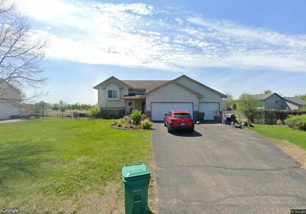
653 Forest Rd Big Lake, MN 55309
Estimated Value: $311,000 - $335,000
1
Bed
1
Bath
1,026
Sq Ft
$314/Sq Ft
Est. Value
About This Home
This home is located at 653 Forest Rd, Big Lake, MN 55309 and is currently estimated at $321,748, approximately $313 per square foot. 653 Forest Rd is a home located in Sherburne County with nearby schools including Liberty Elementary School, Independence Elementary School, and Big Lake Middle School.
Ownership History
Date
Name
Owned For
Owner Type
Purchase Details
Closed on
Apr 15, 2019
Sold by
Saman Susan R
Bought by
Tully Kathy
Current Estimated Value
Home Financials for this Owner
Home Financials are based on the most recent Mortgage that was taken out on this home.
Original Mortgage
$196,377
Outstanding Balance
$174,186
Interest Rate
4.75%
Mortgage Type
FHA
Estimated Equity
$147,562
Purchase Details
Closed on
Feb 27, 2003
Sold by
Bradish Builders Llc
Bought by
Saman Susan R
Purchase Details
Closed on
Oct 23, 2001
Sold by
Heritage Development Of Mn Inc
Bought by
Bradish Builders Llc
Purchase Details
Closed on
Jan 26, 2001
Sold by
Panayotoff Donna and Panayotoff Mark
Bought by
Heritage Development Of Minnesota Inc
Create a Home Valuation Report for This Property
The Home Valuation Report is an in-depth analysis detailing your home's value as well as a comparison with similar homes in the area
Home Values in the Area
Average Home Value in this Area
Purchase History
| Date | Buyer | Sale Price | Title Company |
|---|---|---|---|
| Tully Kathy | $200,000 | None Available | |
| Saman Susan R | $163,300 | -- | |
| Bradish Builders Llc | $395,300 | -- | |
| Heritage Development Of Minnesota Inc | $118,000 | -- | |
| Heritage Development Of Minnesota | $118,000 | -- |
Source: Public Records
Mortgage History
| Date | Status | Borrower | Loan Amount |
|---|---|---|---|
| Open | Tully Kathy | $196,377 |
Source: Public Records
Tax History Compared to Growth
Tax History
| Year | Tax Paid | Tax Assessment Tax Assessment Total Assessment is a certain percentage of the fair market value that is determined by local assessors to be the total taxable value of land and additions on the property. | Land | Improvement |
|---|---|---|---|---|
| 2025 | $3,540 | $302,900 | $82,400 | $220,500 |
| 2024 | $3,606 | $299,900 | $82,400 | $217,500 |
| 2023 | $3,568 | $304,200 | $86,200 | $218,000 |
| 2022 | $3,270 | $291,000 | $73,000 | $218,000 |
| 2020 | $3,154 | $223,300 | $43,400 | $179,900 |
| 2019 | $3,218 | $214,700 | $38,400 | $176,300 |
| 2018 | $3,022 | $199,500 | $35,300 | $164,200 |
| 2017 | $2,928 | $179,100 | $30,900 | $148,200 |
| 2016 | $2,840 | $167,000 | $27,700 | $139,300 |
| 2015 | $2,642 | $162,900 | $27,700 | $135,200 |
| 2014 | $2,266 | $159,000 | $28,100 | $130,900 |
| 2013 | -- | $129,500 | $27,900 | $101,600 |
Source: Public Records
Map
Nearby Homes
- 19400 Karen Ln
- 199 Henry Rd
- 541 William St
- 23xxx 182nd St NW
- 393 Phyllis St
- 19128 Eagle Lake Rd S
- 19024 Engle Wood Dr
- 19101 Gunter Way
- 631 Norwood Ln
- 637 Norwood Ln
- 705 Independence Dr NW
- 722 Independence Dr NW
- 20386 181st Cir NW
- XXX 176th St NW
- 778 Independence Dr NW
- 824 Independence Dr NW
- 591 Glenwood Ave
- 585 Glenwood Ave
- 18585 Arctic Ave
- TBD Highway 10 NW