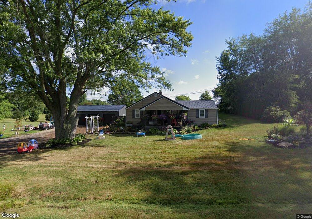
6555 Winter St Louisville, OH 44641
Estimated Value: $151,000 - $226,000
3
Beds
1
Bath
1,184
Sq Ft
$168/Sq Ft
Est. Value
About This Home
This home is located at 6555 Winter St, Louisville, OH 44641 and is currently estimated at $198,368, approximately $167 per square foot. 6555 Winter St is a home located in Stark County with nearby schools including Louisville High School and St. Thomas Aquinas High School & Middle School.
Ownership History
Date
Name
Owned For
Owner Type
Purchase Details
Closed on
May 9, 2012
Sold by
Kosunick Melissa N and Pitts Melissa N
Bought by
Pitts Melissa N and Pitts Todd A
Current Estimated Value
Purchase Details
Closed on
Jun 10, 2006
Sold by
Kosunick Michael J
Bought by
Kosunick Melissa N
Purchase Details
Closed on
Jan 14, 2002
Sold by
Bennett Scott G and Bennett Jacqueline R
Bought by
Kosunick Michael J
Home Financials for this Owner
Home Financials are based on the most recent Mortgage that was taken out on this home.
Original Mortgage
$97,440
Interest Rate
7.07%
Mortgage Type
FHA
Purchase Details
Closed on
Nov 12, 1998
Sold by
Godfrey Lori A
Bought by
Bennett Scott G and Bennett Jacqueline R
Home Financials for this Owner
Home Financials are based on the most recent Mortgage that was taken out on this home.
Original Mortgage
$78,965
Interest Rate
6.68%
Purchase Details
Closed on
Oct 28, 1991
Create a Home Valuation Report for This Property
The Home Valuation Report is an in-depth analysis detailing your home's value as well as a comparison with similar homes in the area
Home Values in the Area
Average Home Value in this Area
Purchase History
| Date | Buyer | Sale Price | Title Company |
|---|---|---|---|
| Pitts Melissa N | $50,000 | None Available | |
| Kosunick Melissa N | -- | None Available | |
| Kosunick Michael J | $100,000 | -- | |
| Bennett Scott G | $92,900 | -- | |
| -- | -- | -- |
Source: Public Records
Mortgage History
| Date | Status | Borrower | Loan Amount |
|---|---|---|---|
| Previous Owner | Kosunick Michael J | $97,440 | |
| Previous Owner | Bennett Scott G | $78,965 |
Source: Public Records
Tax History Compared to Growth
Tax History
| Year | Tax Paid | Tax Assessment Tax Assessment Total Assessment is a certain percentage of the fair market value that is determined by local assessors to be the total taxable value of land and additions on the property. | Land | Improvement |
|---|---|---|---|---|
| 2025 | -- | $52,750 | $14,840 | $37,910 |
| 2024 | -- | $52,750 | $14,840 | $37,910 |
| 2023 | $1,972 | $40,470 | $14,180 | $26,290 |
| 2022 | $1,843 | $37,700 | $14,180 | $23,520 |
| 2021 | $1,848 | $37,700 | $14,180 | $23,520 |
| 2020 | $1,553 | $33,460 | $12,740 | $20,720 |
| 2019 | $1,560 | $33,470 | $12,740 | $20,730 |
| 2018 | $1,555 | $33,470 | $12,740 | $20,730 |
| 2017 | $1,298 | $26,650 | $9,560 | $17,090 |
| 2016 | $1,269 | $26,650 | $9,560 | $17,090 |
| 2015 | $1,273 | $26,650 | $9,560 | $17,090 |
| 2014 | $1,276 | $24,730 | $8,860 | $15,870 |
| 2013 | $642 | $24,730 | $8,860 | $15,870 |
Source: Public Records
Map
Nearby Homes
- 6416 15th St NE
- 6969 Georgetown St NE
- 1639 Horizon Dr
- 1702 View Pointe Ave
- 4060 Hambleton Ave NE
- 2425 Miday Ave NE
- 3894 Tulane Ave
- 2260 Broadway Ave NE
- 4034 Broadway Ave NE
- 201 Indiana Ave
- 908 Sand Lot Cir
- 822 Sand Lot Cir
- 248 Menegay Rd
- 6610 Maplebrook Ave NE
- 510 S Bauman Ct
- 204 E Broad St
- 0 Maplebrook St NE
- 107 E Broad St
- 414 Honeycrisp Dr NE
- 8225 Georgetown St
- 6556 Winter St
- 6566 Winter St
- 6540 Winter St
- 6590 Winter St
- 6610 Winter St
- 6601 Winter St
- 3007 Ravenna Ave
- 3023 Ravenna Ave
- 2977 Ravenna Ave
- 2941 Ravenna Ave
- 2953 Ravenna Ave
- 3073 Ravenna Ave
- 2919 Ravenna Ave
- 3081 Ravenna Ave
- 2970 Ravenna Ave
- 2909 Ravenna Ave
- 2934 Ravenna Ave
- 2916 Ravenna Ave
- 2901 Ravenna Ave
- 2873 Ravenna Ave