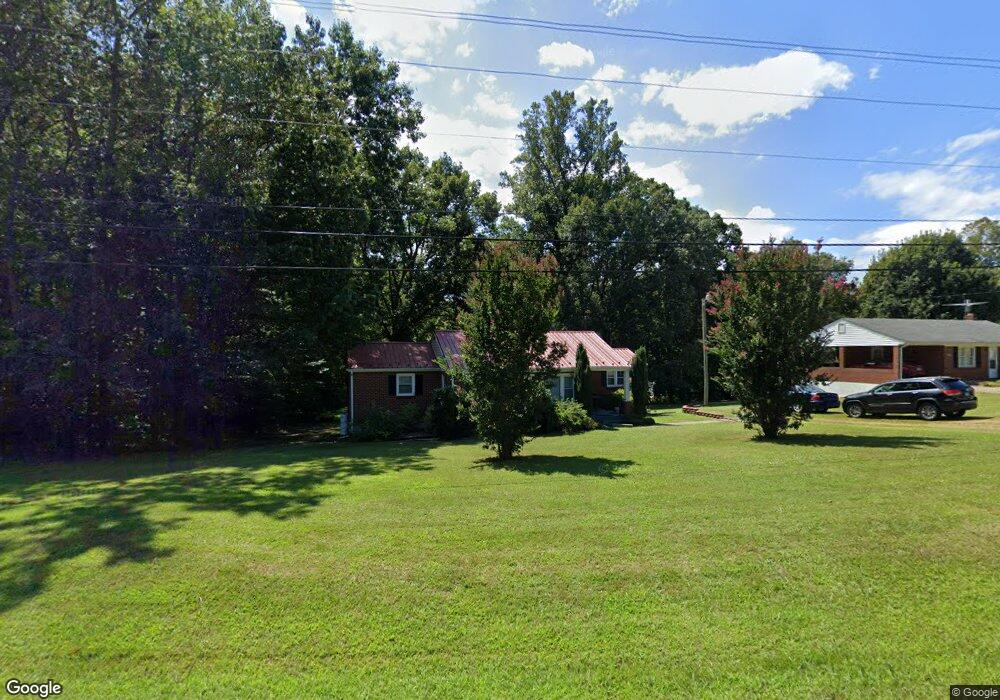
656 Dixie Airport Rd Madison Heights, VA 24572
Estimated Value: $173,000 - $235,000
3
Beds
1
Bath
1,173
Sq Ft
$168/Sq Ft
Est. Value
About This Home
This home is located at 656 Dixie Airport Rd, Madison Heights, VA 24572 and is currently estimated at $197,300, approximately $168 per square foot. 656 Dixie Airport Rd is a home located in Amherst County with nearby schools including Amelon Elementary School, Monelison Middle School, and Amherst County High School.
Ownership History
Date
Name
Owned For
Owner Type
Purchase Details
Closed on
Feb 22, 2023
Sold by
Macheras Theodore G
Bought by
Tomlin Jeffrey David
Current Estimated Value
Purchase Details
Closed on
Sep 14, 2022
Sold by
Jones Robert Byron
Bought by
Macheras Theodore G
Purchase Details
Closed on
Oct 19, 2010
Sold by
Padgett Jason N
Bought by
Jones Robert Byron and Jones Teresa P
Purchase Details
Closed on
Dec 2, 2009
Sold by
Cash James Kevin and Cash Christi M
Bought by
Padgett Jason N
Home Financials for this Owner
Home Financials are based on the most recent Mortgage that was taken out on this home.
Original Mortgage
$112,000
Interest Rate
4.92%
Mortgage Type
New Conventional
Create a Home Valuation Report for This Property
The Home Valuation Report is an in-depth analysis detailing your home's value as well as a comparison with similar homes in the area
Home Values in the Area
Average Home Value in this Area
Purchase History
| Date | Buyer | Sale Price | Title Company |
|---|---|---|---|
| Tomlin Jeffrey David | $145,000 | -- | |
| Macheras Theodore G | $110,000 | -- | |
| Jones Robert Byron | -- | None Available | |
| Padgett Jason N | -- | None Available |
Source: Public Records
Mortgage History
| Date | Status | Borrower | Loan Amount |
|---|---|---|---|
| Previous Owner | Padgett Jason N | $112,000 |
Source: Public Records
Tax History Compared to Growth
Tax History
| Year | Tax Paid | Tax Assessment Tax Assessment Total Assessment is a certain percentage of the fair market value that is determined by local assessors to be the total taxable value of land and additions on the property. | Land | Improvement |
|---|---|---|---|---|
| 2025 | $591 | $96,900 | $17,500 | $79,400 |
| 2024 | $591 | $96,900 | $17,500 | $79,400 |
| 2023 | $591 | $96,900 | $17,500 | $79,400 |
| 2022 | $591 | $96,900 | $17,500 | $79,400 |
| 2021 | $591 | $96,900 | $17,500 | $79,400 |
| 2020 | $591 | $96,900 | $17,500 | $79,400 |
| 2019 | $586 | $96,000 | $23,500 | $72,500 |
| 2018 | $586 | $96,000 | $23,500 | $72,500 |
| 2017 | $586 | $96,000 | $23,500 | $72,500 |
| 2016 | $586 | $96,000 | $23,500 | $72,500 |
| 2015 | $538 | $96,000 | $23,500 | $72,500 |
| 2014 | $538 | $96,000 | $23,500 | $72,500 |
Source: Public Records
Map
Nearby Homes
- 121 Crestwood Dr
- 250 S Wood Duck Dr
- 150 Glenwood Dr
- 327 Dixie Airport Rd
- 272 Dixie Airport Rd
- 505 Royal Gardens Ct
- 0 Commonwealth Dr Unit 361760
- 51 Patrick Ct
- 151 Stratford Place
- TBD Stratford Place Unit 39
- 0 Lot 10 & 11 Stoney Creek Dr Unit 345183
- 164 Glade Rd
- 289 Todd Ln
- 4123 S Amherst Hwy
- 1769 Izaak Walton Rd
- 0 Monticello Ln
- 255 Glade Rd
- 172 Stoney Creek Dr
- 0 Izaak Walton Rd
- 11 Stoney Creek Dr
- 654 Dixie Airport Rd
- 642 Dixie Airport Rd
- 678 Dixie Airport Rd
- 122 Lamont Dr
- 0 Lamont Dr
- 671 Dixie Airport Rd
- 665 Dixie Airport Rd
- 145 Shearingham Dr
- 683 Dixie Airport Rd
- 128 Lamont Dr
- 695 Dixie Airport Rd
- 107 Lamont Dr
- 112 Pine Acres Dr
- 149 Shearingham Dr
- 702 Dixie Airport Rd
- 121 Lamont Dr
- 161 Shearingham Dr
- 127 Lamont Dr
- 610 Dixie Airport Rd
- 701 Dixie Airport Rd