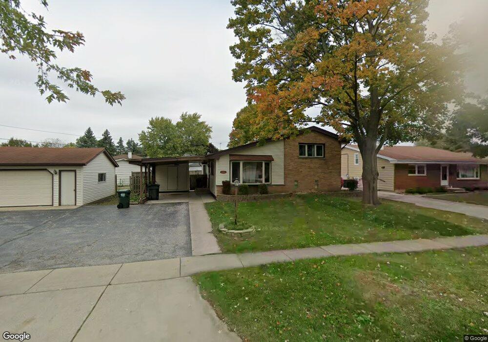
658 Noel Dr Mundelein, IL 60060
Mundelein Station NeighborhoodEstimated Value: $301,000 - $336,000
3
Beds
2
Baths
1,073
Sq Ft
$296/Sq Ft
Est. Value
About This Home
This home is located at 658 Noel Dr, Mundelein, IL 60060 and is currently estimated at $317,246, approximately $295 per square foot. 658 Noel Dr is a home located in Lake County with nearby schools including Diamond Lake Elementary School, West Oak Middle School, and Mundelein Cons High School.
Ownership History
Date
Name
Owned For
Owner Type
Purchase Details
Closed on
Oct 18, 2018
Sold by
Peck Gregory A and Kugler Shayna L
Bought by
Peck Douglas E and Peck Sharon L
Current Estimated Value
Purchase Details
Closed on
May 15, 2010
Sold by
Snyder Ryan P and Snyder Tina M
Bought by
Peck Gregory A
Home Financials for this Owner
Home Financials are based on the most recent Mortgage that was taken out on this home.
Original Mortgage
$138,000
Outstanding Balance
$52,721
Interest Rate
5.12%
Mortgage Type
Purchase Money Mortgage
Estimated Equity
$264,525
Purchase Details
Closed on
Aug 29, 2006
Sold by
Maravelias Stanley P and Maravelias Donna M
Bought by
Synder Ryan P and Synder Tina M
Home Financials for this Owner
Home Financials are based on the most recent Mortgage that was taken out on this home.
Original Mortgage
$196,000
Interest Rate
6.59%
Mortgage Type
Purchase Money Mortgage
Create a Home Valuation Report for This Property
The Home Valuation Report is an in-depth analysis detailing your home's value as well as a comparison with similar homes in the area
Home Values in the Area
Average Home Value in this Area
Purchase History
| Date | Buyer | Sale Price | Title Company |
|---|---|---|---|
| Peck Douglas E | -- | None Available | |
| Peck Gregory A | $140,000 | First American Title Ins Co | |
| Synder Ryan P | $245,000 | Attorneys Title Guaranty Fun |
Source: Public Records
Mortgage History
| Date | Status | Borrower | Loan Amount |
|---|---|---|---|
| Open | Peck Gregory A | $138,000 | |
| Previous Owner | Synder Ryan P | $196,000 |
Source: Public Records
Tax History Compared to Growth
Tax History
| Year | Tax Paid | Tax Assessment Tax Assessment Total Assessment is a certain percentage of the fair market value that is determined by local assessors to be the total taxable value of land and additions on the property. | Land | Improvement |
|---|---|---|---|---|
| 2024 | $8,281 | $84,161 | $18,741 | $65,420 |
| 2023 | $6,675 | $77,625 | $17,286 | $60,339 |
| 2022 | $6,675 | $68,122 | $16,614 | $51,508 |
| 2021 | $6,426 | $66,655 | $16,256 | $50,399 |
| 2020 | $6,003 | $62,414 | $15,222 | $47,192 |
| 2019 | $5,917 | $61,820 | $15,077 | $46,743 |
| 2018 | $5,299 | $56,327 | $15,235 | $41,092 |
| 2017 | $5,221 | $54,549 | $14,754 | $39,795 |
| 2016 | $5,065 | $51,720 | $13,989 | $37,731 |
| 2015 | $4,893 | $48,341 | $13,075 | $35,266 |
| 2014 | $4,660 | $47,693 | $12,900 | $34,793 |
| 2012 | $4,318 | $48,425 | $14,787 | $33,638 |
Source: Public Records
Map
Nearby Homes
- 701 Thomas Ct
- 49 N Shaddle Ave
- 215 Brice Ave
- 510 S Hickory St
- 841 Wilcox St
- 31 Washington Blvd Unit 108
- 328 Brice Ave
- 433 E High St
- 422 James Ave
- 331 Plaza Cir
- 40 S Seymour Ave
- 847 Mckinley Ave
- 1255 Huntington Dr
- 640 Allanson Rd
- 659 E Maple Ave
- 29746 U S 45
- 342 Allanson Rd
- 1202 Ballantrae Place Unit E
- 114 W Hawthorne Blvd
- 288 N Lincoln Ave
- 651 Countryside Hwy Unit A
- 655 Countryside Hwy Unit A
- 662 Noel Dr
- 647 Countryside Hwy Unit A
- 659 Countryside Hwy
- 742 Noel Dr
- 659 Noel Dr
- 663 Noel Dr
- 743 Noel Dr
- 643 Countryside Hwy Unit A
- 663 Countryside Hwy
- 746 Noel Dr
- 747 Noel Dr Unit C
- 743 Countryside Hwy
- 751 Noel Dr
- 750 Noel Dr
- 134 Rouse Ave
- 747 Countryside Hwy
- 801 Noel Dr
- 800 Noel Dr