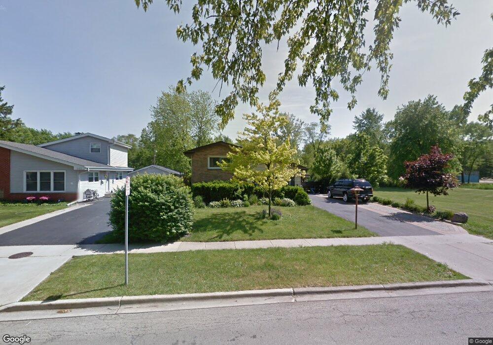
659 Noel Dr Mundelein, IL 60060
Mundelein Station NeighborhoodEstimated Value: $301,359 - $383,000
3
Beds
2
Baths
1,147
Sq Ft
$297/Sq Ft
Est. Value
About This Home
This home is located at 659 Noel Dr, Mundelein, IL 60060 and is currently estimated at $340,340, approximately $296 per square foot. 659 Noel Dr is a home located in Lake County with nearby schools including Diamond Lake Elementary School, West Oak Middle School, and Mundelein Cons High School.
Ownership History
Date
Name
Owned For
Owner Type
Purchase Details
Closed on
May 11, 2005
Sold by
Kipp Kathryn A and Kathryn A Kipp Living Trust
Bought by
Solis Federico and Gomez Reyna
Current Estimated Value
Home Financials for this Owner
Home Financials are based on the most recent Mortgage that was taken out on this home.
Original Mortgage
$198,432
Outstanding Balance
$104,988
Interest Rate
6.07%
Mortgage Type
Fannie Mae Freddie Mac
Estimated Equity
$235,352
Purchase Details
Closed on
Jul 12, 2001
Sold by
Kipp Kathryn A
Bought by
Kipp Kathryn A and Kathryn A Kipp Living Trust
Purchase Details
Closed on
Nov 15, 2000
Sold by
Kipp Edward
Bought by
Kipp Kathryn
Home Financials for this Owner
Home Financials are based on the most recent Mortgage that was taken out on this home.
Original Mortgage
$117,000
Interest Rate
7.7%
Create a Home Valuation Report for This Property
The Home Valuation Report is an in-depth analysis detailing your home's value as well as a comparison with similar homes in the area
Home Values in the Area
Average Home Value in this Area
Purchase History
| Date | Buyer | Sale Price | Title Company |
|---|---|---|---|
| Solis Federico | $230,000 | St | |
| Kipp Kathryn A | -- | -- | |
| Kipp Kathryn | -- | Oconnor Title Guaranty Inc |
Source: Public Records
Mortgage History
| Date | Status | Borrower | Loan Amount |
|---|---|---|---|
| Open | Solis Federico | $198,432 | |
| Previous Owner | Kipp Kathryn | $117,000 |
Source: Public Records
Tax History Compared to Growth
Tax History
| Year | Tax Paid | Tax Assessment Tax Assessment Total Assessment is a certain percentage of the fair market value that is determined by local assessors to be the total taxable value of land and additions on the property. | Land | Improvement |
|---|---|---|---|---|
| 2024 | $7,543 | $85,331 | $18,741 | $66,590 |
| 2023 | $6,780 | $78,705 | $17,286 | $61,419 |
| 2022 | $6,780 | $69,100 | $16,614 | $52,486 |
| 2021 | $6,528 | $67,612 | $16,256 | $51,356 |
| 2020 | $6,098 | $63,311 | $15,222 | $48,089 |
| 2019 | $6,011 | $62,709 | $15,077 | $47,632 |
| 2018 | $5,276 | $56,107 | $15,235 | $40,872 |
| 2017 | $5,198 | $54,336 | $14,754 | $39,582 |
| 2016 | $5,043 | $51,518 | $13,989 | $37,529 |
| 2015 | $4,871 | $48,152 | $13,075 | $35,077 |
| 2014 | $5,321 | $47,506 | $12,900 | $34,606 |
| 2012 | $5,223 | $54,452 | $14,787 | $39,665 |
Source: Public Records
Map
Nearby Homes
- 701 Thomas Ct
- 49 N Shaddle Ave
- 510 S Hickory St
- 215 Brice Ave
- 841 Wilcox St
- 433 E High St
- 328 Brice Ave
- 31 Washington Blvd Unit 108
- 422 James Ave
- 331 Plaza Cir
- 40 S Seymour Ave
- 29746 U S 45
- 847 Mckinley Ave
- 640 Allanson Rd
- 1255 Huntington Dr
- 659 E Maple Ave
- 342 Allanson Rd
- 114 W Hawthorne Blvd
- 288 N Lincoln Ave
- 1202 Ballantrae Place Unit E
- 663 Noel Dr
- 743 Noel Dr
- 658 Noel Dr
- 747 Noel Dr Unit C
- 647 Countryside Hwy Unit A
- 651 Countryside Hwy Unit A
- 643 Countryside Hwy Unit A
- 662 Noel Dr
- 751 Noel Dr
- 655 Countryside Hwy Unit A
- 742 Noel Dr
- 801 Noel Dr
- 659 Countryside Hwy
- 746 Noel Dr
- 702 Thomas Ct
- 805 Noel Dr
- 750 Noel Dr
- 663 Countryside Hwy
- 706 Thomas Ct Unit 1
- 743 Countryside Hwy