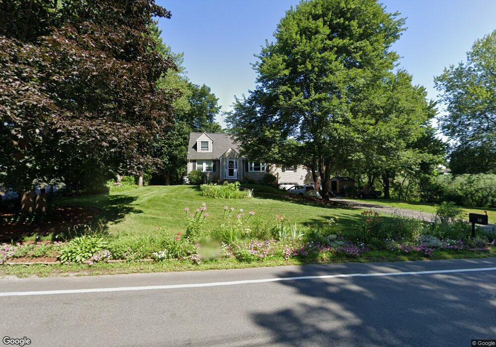
66 Park St Wilmington, MA 01887
Estimated Value: $796,000 - $848,000
4
Beds
3
Baths
2,028
Sq Ft
$406/Sq Ft
Est. Value
About This Home
This home is located at 66 Park St, Wilmington, MA 01887 and is currently estimated at $823,708, approximately $406 per square foot. 66 Park St is a home located in Middlesex County with nearby schools including Wilmington Middle School, Wilmington High School, and N Reading Knowledge Beginnings.
Ownership History
Date
Name
Owned For
Owner Type
Purchase Details
Closed on
Nov 5, 2012
Sold by
Rowe Alan R and Rowe Ruth S
Bought by
Alan R&R S Rowe Irt and Rowe Alan R
Current Estimated Value
Purchase Details
Closed on
Jul 28, 1978
Bought by
Alan R & R S Rowe Irt
Create a Home Valuation Report for This Property
The Home Valuation Report is an in-depth analysis detailing your home's value as well as a comparison with similar homes in the area
Home Values in the Area
Average Home Value in this Area
Purchase History
| Date | Buyer | Sale Price | Title Company |
|---|---|---|---|
| Alan R&R S Rowe Irt | -- | -- | |
| Alan R & R S Rowe Irt | $43,500 | -- |
Source: Public Records
Mortgage History
| Date | Status | Borrower | Loan Amount |
|---|---|---|---|
| Previous Owner | Alan R & R S Rowe Irt | $50,000 |
Source: Public Records
Tax History Compared to Growth
Tax History
| Year | Tax Paid | Tax Assessment Tax Assessment Total Assessment is a certain percentage of the fair market value that is determined by local assessors to be the total taxable value of land and additions on the property. | Land | Improvement |
|---|---|---|---|---|
| 2025 | $7,754 | $677,200 | $325,200 | $352,000 |
| 2024 | $7,418 | $649,000 | $325,200 | $323,800 |
| 2023 | $7,341 | $614,800 | $295,700 | $319,100 |
| 2022 | $7,104 | $545,200 | $246,500 | $298,700 |
| 2021 | $6,970 | $503,600 | $224,300 | $279,300 |
| 2020 | $6,840 | $503,700 | $224,300 | $279,400 |
| 2019 | $6,791 | $493,900 | $213,500 | $280,400 |
| 2018 | $6,192 | $446,800 | $203,300 | $243,500 |
| 2017 | $6,192 | $428,500 | $203,300 | $225,200 |
| 2016 | $5,811 | $397,200 | $193,700 | $203,500 |
| 2015 | $5,428 | $377,700 | $193,700 | $184,000 |
| 2014 | $5,114 | $359,100 | $184,700 | $174,400 |
Source: Public Records
Map
Nearby Homes
- 3 Gordon Rd
- 220 Martins Landing Unit 309
- 260 Martins Landing Unit 508
- 260 Martins Landing Unit 103
- 200 Martins Landing Unit 102
- 300 Martins Landing Unit 107
- 320 Martins Landing Unit 311
- 320 Martins Landing Unit 108
- 320 Martins Landing Unit 109
- 320 Martins Landing Unit 110
- 320 Martins Landing Unit 303
- 320 Martins Landing Unit 102
- 320 Martins Landing Unit 103
- 320 Martins Landing Unit 2410
- 320 Martins Landing Unit 403
- 320 Martins Landing Unit 107
- 320 Martins Landing Unit 210
- 320 Martins Landing Unit 2201
- 320 Martins Landing Unit 112
- 320 Martins Landing Unit 206