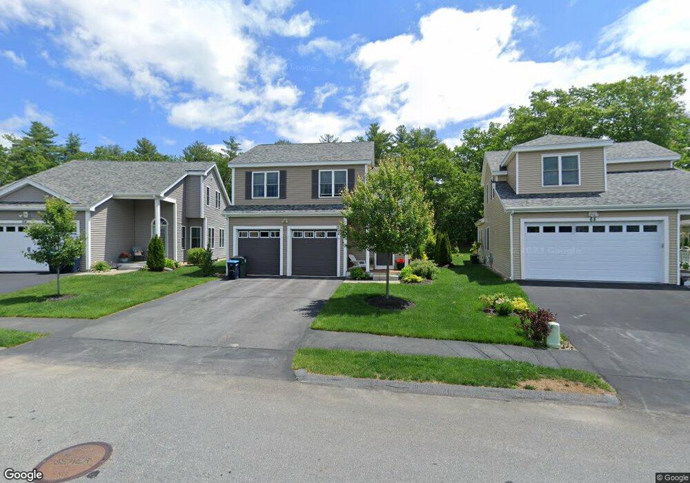
66 Tea Party Cir Holden, MA 01520
Estimated Value: $545,000 - $617,000
3
Beds
2
Baths
1,727
Sq Ft
$334/Sq Ft
Est. Value
About This Home
This home is located at 66 Tea Party Cir, Holden, MA 01520 and is currently estimated at $576,979, approximately $334 per square foot. 66 Tea Party Cir is a home located in Worcester County with nearby schools including Wachusett Regional High School, Bancroft School, and Notre Dame Academy.
Ownership History
Date
Name
Owned For
Owner Type
Purchase Details
Closed on
Jul 17, 2025
Sold by
Lowe Ft and Lowe
Bought by
Han Myoung O
Current Estimated Value
Purchase Details
Closed on
May 15, 2020
Sold by
Lowe Jeffrey S and Lowe Renee F
Bought by
Lowe Ft 2020 and Lowe
Purchase Details
Closed on
Feb 14, 2019
Sold by
Chaffin Pond Development
Bought by
Lowe Jeffrey S and Lowe Renee F
Purchase Details
Closed on
Jan 24, 2019
Sold by
Newell Road Realty Llc
Bought by
Chaffin Pond Dev Llc
Create a Home Valuation Report for This Property
The Home Valuation Report is an in-depth analysis detailing your home's value as well as a comparison with similar homes in the area
Home Values in the Area
Average Home Value in this Area
Purchase History
| Date | Buyer | Sale Price | Title Company |
|---|---|---|---|
| Han Myoung O | $600,000 | -- | |
| Han Myoung O | $600,000 | -- | |
| Lowe Ft 2020 | -- | None Available | |
| Lowe Ft 2020 | -- | None Available | |
| Lowe Jeffrey S | $403,540 | -- | |
| Lowe Jeffrey S | $403,540 | -- | |
| Chaffin Pond Dev Llc | -- | -- | |
| Chaffin Pond Dev Llc | -- | -- |
Source: Public Records
Tax History Compared to Growth
Tax History
| Year | Tax Paid | Tax Assessment Tax Assessment Total Assessment is a certain percentage of the fair market value that is determined by local assessors to be the total taxable value of land and additions on the property. | Land | Improvement |
|---|---|---|---|---|
| 2025 | $6,722 | $485,000 | $0 | $485,000 |
| 2024 | $6,532 | $461,600 | $0 | $461,600 |
| 2023 | $6,063 | $404,500 | $0 | $404,500 |
| 2022 | $6,818 | $411,700 | $0 | $411,700 |
| 2021 | $6,609 | $379,800 | $0 | $379,800 |
| 2020 | $6,394 | $376,100 | $0 | $376,100 |
| 2019 | $0 | $0 | $0 | $0 |
| 2018 | $0 | $0 | $0 | $0 |
| 2017 | $0 | $0 | $0 | $0 |
| 2016 | -- | $0 | $0 | $0 |
| 2015 | -- | $0 | $0 | $0 |
| 2014 | -- | $0 | $0 | $0 |
Source: Public Records
Map
Nearby Homes
- 27 Tea Party Cir Unit 27
- 2 Explorers Way Unit 2
- 314 Main St
- 23 Gail Dr
- 27 Mayflower Cir
- 189 Holden St
- 156 Newell Rd
- 308 Holden St
- 48 Lexington Cir
- 9 Emily St
- 160 Shrewsbury St
- 9 Birchwood Dr
- 527 Salisbury St
- 250 Shrewsbury St
- 47 Banbury Ln
- 10 Sumac Cir
- 68 Fisher Rd
- 168 Twinbrooke Dr
- 12 Tattan Farm Rd
- 303 Greenwich Ct Unit 303
- 66 Tea Party Cir Unit 527
- 66 Tea Party Cir Unit Lot 526
- 64 Tea Party Cir
- 68 Tea Party Cir
- 58 Tea Party Cir
- 58 Tea Party Cir Unit 524
- 4 King Philip Trail Unit 601
- 84 Tea Party Cir
- 86 Tea Party Cir
- 9 Settlers Ln Unit 583
- 1 Settlers Ln Unit 587
- 92 Tea Party Cir Unit 537
- 92 Tea Party Cir
- 92 Tea Party Cir Unit 536
- 235 Main St
- 243 Main St
- 243/A Main St
- 225 Main St
- 253 Main St
- 623 Explorers Way Unit 623