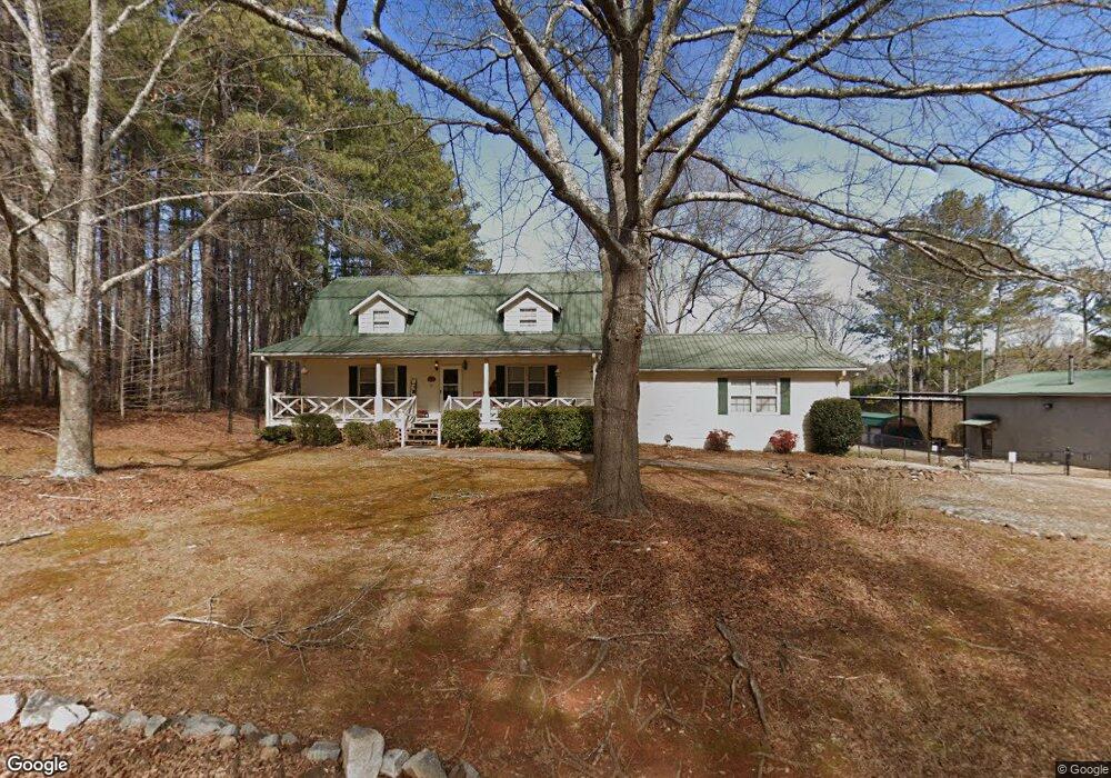
660 Monroe Cole Rd Dallas, GA 30157
Estimated Value: $350,000 - $384,000
3
Beds
2
Baths
2,684
Sq Ft
$136/Sq Ft
Est. Value
About This Home
This home is located at 660 Monroe Cole Rd, Dallas, GA 30157 and is currently estimated at $365,063, approximately $136 per square foot. 660 Monroe Cole Rd is a home located in Paulding County with nearby schools including Lillian C. Poole Elementary School, South Paulding Middle School, and Paulding County High School.
Ownership History
Date
Name
Owned For
Owner Type
Purchase Details
Closed on
Mar 14, 2001
Sold by
Davis Jimmy L and Davis Jennifer B
Bought by
Couch Calvin H and Couch Lora P
Current Estimated Value
Home Financials for this Owner
Home Financials are based on the most recent Mortgage that was taken out on this home.
Original Mortgage
$123,500
Outstanding Balance
$45,273
Interest Rate
7.11%
Mortgage Type
New Conventional
Estimated Equity
$319,790
Create a Home Valuation Report for This Property
The Home Valuation Report is an in-depth analysis detailing your home's value as well as a comparison with similar homes in the area
Home Values in the Area
Average Home Value in this Area
Purchase History
| Date | Buyer | Sale Price | Title Company |
|---|---|---|---|
| Couch Calvin H | $130,000 | -- |
Source: Public Records
Mortgage History
| Date | Status | Borrower | Loan Amount |
|---|---|---|---|
| Open | Couch Calvin H | $123,500 |
Source: Public Records
Tax History Compared to Growth
Tax History
| Year | Tax Paid | Tax Assessment Tax Assessment Total Assessment is a certain percentage of the fair market value that is determined by local assessors to be the total taxable value of land and additions on the property. | Land | Improvement |
|---|---|---|---|---|
| 2024 | $3,384 | $139,284 | $11,480 | $127,804 |
| 2023 | $3,377 | $132,044 | $11,080 | $120,964 |
| 2022 | $2,914 | $113,652 | $9,560 | $104,092 |
| 2021 | $2,511 | $88,276 | $7,800 | $80,476 |
| 2020 | $2,317 | $79,876 | $8,080 | $71,796 |
| 2019 | $2,221 | $75,576 | $8,320 | $67,256 |
| 2018 | $1,877 | $64,176 | $8,360 | $55,816 |
| 2017 | $1,885 | $63,576 | $8,360 | $55,216 |
| 2016 | $105 | $48,424 | $7,920 | $40,504 |
| 2015 | $1,353 | $45,824 | $7,080 | $38,744 |
| 2014 | $1,258 | $41,704 | $6,760 | $34,944 |
| 2013 | -- | $37,440 | $7,480 | $29,960 |
Source: Public Records
Map
Nearby Homes
- 216 McMichen Rd
- 1136 Cole Lake Rd
- 140 Cyrilla Walk
- 128 Cyrilla Walk
- 47 Whitley Ct
- 000 Villa Rica Hwy
- 196 Pope Place
- 380 Buchanan Hwy
- 2240 Buchanan Hwy
- 298 Buchanan Hwy
- 60 Westside Cir
- 155 Tuscany Trail
- +/-1.0 Cole Lake Rd
- 105 Arbor Creek Trail
- 107 Arbor Creek Trail
- 233 E Skyline View
- 205 Arbor Creek Dr
- 00 Rock Springs Pass
- 634 Monroe Cole Rd
- 651 Monroe Cole Rd
- 615 Monroe Cole Rd
- 544 McMichen Rd
- 544 McMichen Rd
- 416 Cannon Trail
- 10 Monroe Cole Rd Unit Right
- 10 Monroe Cole Rd
- 420 Cannon Trail
- 350 McMichen Rd
- 352 Cannon Trail
- 419 Cannon Trail
- 1248 Cole Lake Rd
- 330 Cannon Trail
- 310 Cannon Trail
- 387 Cannon Trail
- 405 Cannon Trail
- 297 Monroe Cole Rd
- 365 Cannon Trail
- 290 Cannon Trail