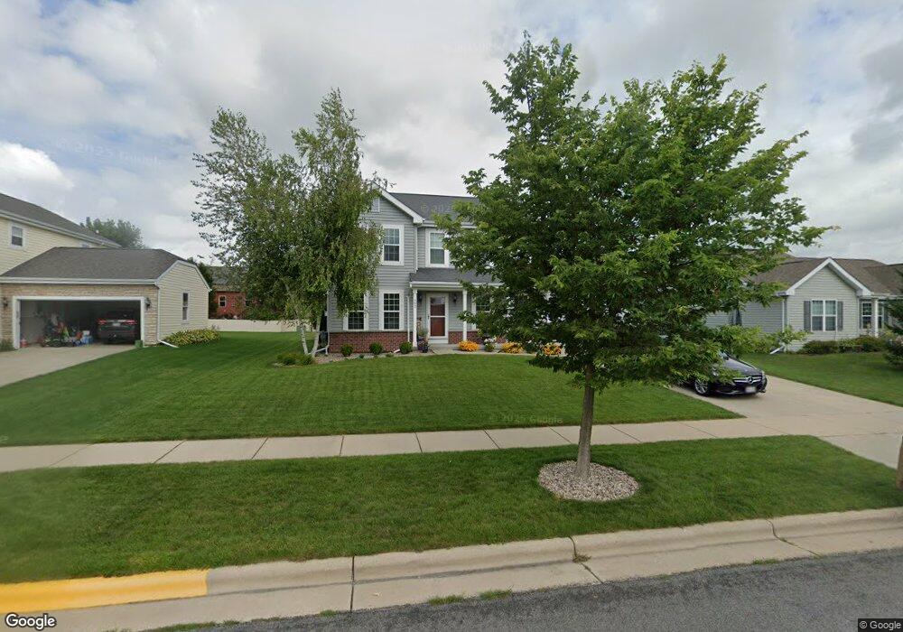
662 Hawthorn Dr Sun Prairie, WI 53590
Meadow Crossing NeighborhoodEstimated Value: $542,000 - $624,000
3
Beds
3
Baths
2,105
Sq Ft
$272/Sq Ft
Est. Value
About This Home
This home is located at 662 Hawthorn Dr, Sun Prairie, WI 53590 and is currently estimated at $572,354, approximately $271 per square foot. 662 Hawthorn Dr is a home located in Dane County with nearby schools including Northside Elementary School, Sun Prairie East High School, and Central Heights Middle School.
Ownership History
Date
Name
Owned For
Owner Type
Purchase Details
Closed on
May 31, 2011
Sold by
Brookstone Homes Inc
Bought by
Meece Calvin E and Meece Dianne K
Current Estimated Value
Home Financials for this Owner
Home Financials are based on the most recent Mortgage that was taken out on this home.
Original Mortgage
$21,600
Outstanding Balance
$15,016
Interest Rate
4.81%
Mortgage Type
Stand Alone Second
Estimated Equity
$557,338
Purchase Details
Closed on
May 21, 2010
Sold by
Sanibel Llc
Bought by
Brookstone Homes Inc
Home Financials for this Owner
Home Financials are based on the most recent Mortgage that was taken out on this home.
Original Mortgage
$44,000,000
Interest Rate
5.12%
Mortgage Type
Construction
Create a Home Valuation Report for This Property
The Home Valuation Report is an in-depth analysis detailing your home's value as well as a comparison with similar homes in the area
Home Values in the Area
Average Home Value in this Area
Purchase History
| Date | Buyer | Sale Price | Title Company |
|---|---|---|---|
| Meece Calvin E | $216,000 | Frontier Title & Closing Ser | |
| Brookstone Homes Inc | $150,000 | None Available |
Source: Public Records
Mortgage History
| Date | Status | Borrower | Loan Amount |
|---|---|---|---|
| Open | Meece Calvin E | $21,600 | |
| Open | Meece Calvin E | $172,800 | |
| Previous Owner | Brookstone Homes Inc | $44,000,000 |
Source: Public Records
Tax History Compared to Growth
Tax History
| Year | Tax Paid | Tax Assessment Tax Assessment Total Assessment is a certain percentage of the fair market value that is determined by local assessors to be the total taxable value of land and additions on the property. | Land | Improvement |
|---|---|---|---|---|
| 2024 | $9,890 | $520,500 | $82,600 | $437,900 |
| 2023 | $8,995 | $520,500 | $82,600 | $437,900 |
| 2021 | $7,133 | $340,100 | $67,500 | $272,600 |
| 2020 | $7,295 | $340,100 | $67,500 | $272,600 |
| 2019 | $7,355 | $304,200 | $58,600 | $245,600 |
| 2018 | $6,803 | $304,200 | $58,600 | $245,600 |
| 2017 | $6,524 | $304,200 | $58,600 | $245,600 |
| 2016 | $5,897 | $249,500 | $51,900 | $197,600 |
| 2015 | $5,729 | $249,500 | $51,900 | $197,600 |
| 2014 | $5,223 | $226,300 | $43,700 | $182,600 |
| 2013 | $5,439 | $226,300 | $43,700 | $182,600 |
Source: Public Records
Map
Nearby Homes
- 626 Sanibel Ln
- 111 White Tail Dr
- 223 Larkspur Ct
- 201 E Lane St Unit 202
- 311 Spoke Cir
- 2543 Water Lily Cir
- 2560 Water Lily Cir
- 2535 Water Lily Cir
- 2522 Water Lily Cir
- 5801 Town Hall Dr
- 1077 Gas Light Dr
- 600 Linnerud Dr
- 566 Gerald Ave
- 709 Linnerud Dr
- 147 Flint St
- 530 W Main St
- 227 Windsor St
- 1171 Carriage Dr
- 116 Gary Ct
- Phase 2 Lots Town Hall Dr
- 680 Hawthorn Dr
- 648 Hawthorn Dr
- 659 Pelican Ln
- 653 Pelican Ln
- 679 Pelican Ln
- 640 Hawthorn Dr
- 698 Hawthorn Dr
- 671 Hawthorn Dr
- 645 Pelican Ln
- 679 Hawthorn Dr
- 695 Pelican Ln
- 663 Hawthorn Dr
- 691 Hawthorn Dr
- 745 Whitetail Dr
- 761 Whitetail Dr
- 711 Whitetail Dr
- 709 Whitetail Dr
- 630 Hawthorn Dr
- Lot 97 Whitetail Dr
- 649 Hawthorn Dr