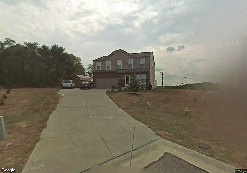
663 Colton Ct Independence, KY 41051
Estimated Value: $296,000 - $332,952
3
Beds
3
Baths
1,853
Sq Ft
$168/Sq Ft
Est. Value
About This Home
This home is located at 663 Colton Ct, Independence, KY 41051 and is currently estimated at $311,238, approximately $167 per square foot. 663 Colton Ct is a home located in Kenton County with nearby schools including Beechgrove Elementary School, Twenhofel Middle School, and Simon Kenton High School.
Ownership History
Date
Name
Owned For
Owner Type
Purchase Details
Closed on
Jul 8, 2004
Sold by
Maple Street Homes Llc
Bought by
Averbeck Matthew A and Averbeck Robbin L
Current Estimated Value
Home Financials for this Owner
Home Financials are based on the most recent Mortgage that was taken out on this home.
Original Mortgage
$124,100
Interest Rate
6.24%
Mortgage Type
Purchase Money Mortgage
Purchase Details
Closed on
Apr 22, 2004
Sold by
Glenhurst Development Llc
Bought by
Maple Street Homes Llc
Create a Home Valuation Report for This Property
The Home Valuation Report is an in-depth analysis detailing your home's value as well as a comparison with similar homes in the area
Home Values in the Area
Average Home Value in this Area
Purchase History
| Date | Buyer | Sale Price | Title Company |
|---|---|---|---|
| Averbeck Matthew A | $155,200 | Homestead Title Agency Ltd | |
| Maple Street Homes Llc | $30,000 | -- |
Source: Public Records
Mortgage History
| Date | Status | Borrower | Loan Amount |
|---|---|---|---|
| Previous Owner | Averbeck Matthew A | $124,100 |
Source: Public Records
Tax History Compared to Growth
Tax History
| Year | Tax Paid | Tax Assessment Tax Assessment Total Assessment is a certain percentage of the fair market value that is determined by local assessors to be the total taxable value of land and additions on the property. | Land | Improvement |
|---|---|---|---|---|
| 2024 | $2,395 | $195,500 | $30,000 | $165,500 |
| 2023 | $2,467 | $195,500 | $30,000 | $165,500 |
| 2022 | $2,527 | $195,500 | $30,000 | $165,500 |
| 2021 | $2,565 | $195,500 | $30,000 | $165,500 |
| 2020 | $2,222 | $165,000 | $25,000 | $140,000 |
| 2019 | $2,228 | $165,000 | $25,000 | $140,000 |
| 2018 | $2,240 | $165,000 | $25,000 | $140,000 |
| 2017 | $2,179 | $165,000 | $25,000 | $140,000 |
| 2015 | $1,993 | $155,200 | $30,000 | $125,200 |
| 2014 | $1,965 | $155,200 | $30,000 | $125,200 |
Source: Public Records
Map
Nearby Homes
- 558 Tupelo Dr
- 10470 Travis St
- 10720 Hanover Ct
- 611 Berlander Dr
- 660 Ackerly Dr
- 604 Astoria Ct
- 10724 Melbury Ct Unit 287GL
- 586 Cutter Ln
- The Westchester Plan at The Greens of Glenhurst
- The Ella Marie Plan at The Greens of Glenhurst
- The Jefferson Plan at The Greens of Glenhurst
- The Leighann Plan at The Greens of Glenhurst
- The Waterson Plan at The Greens of Glenhurst
- The Lancaster Plan at The Greens of Glenhurst
- The Austin Plan at The Greens of Glenhurst
- The Morgan Plan at The Greens of Glenhurst
- The Marietta Plan at The Greens of Glenhurst
- The Camden Plan at The Greens of Glenhurst
- The Lincoln Plan at The Greens of Glenhurst
- The Bristol Plan at The Greens of Glenhurst
- 659 Colton Ct
- 742 Maher Rd
- 655 Colton Ct
- 662 Colton Ct
- 658 Colton Ct
- 654 Colton Ct
- 654 Colton Ct Unit 6
- 671 Maher Rd
- 719 Maher Rd
- 5 Colton Ct
- 10790 Glenhurst Dr
- 663 Lyonia Dr
- 659 Lyonia Dr
- 655 Lyonia Dr
- 10784 Glenhurst Dr
- 661 Maher Rd
- 10788 Glenhurst Dr
- 10788 Glenhurst Rd
- 10786 Glenhurst Dr
- 647 Lyonia Dr