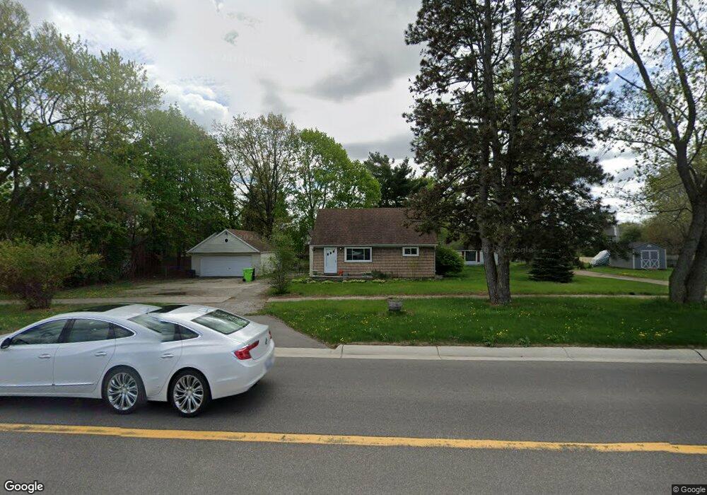
668 E Auburn Rd Rochester Hills, MI 48307
Estimated Value: $237,788 - $430,000
3
Beds
1
Bath
1,160
Sq Ft
$252/Sq Ft
Est. Value
About This Home
This home is located at 668 E Auburn Rd, Rochester Hills, MI 48307 and is currently estimated at $292,197, approximately $251 per square foot. 668 E Auburn Rd is a home located in Oakland County with nearby schools including Brooklands Elementary School, Reuther Middle School, and Rochester High School.
Ownership History
Date
Name
Owned For
Owner Type
Purchase Details
Closed on
Aug 10, 2001
Sold by
Pellar Dennis M
Bought by
Maynard Robert
Current Estimated Value
Home Financials for this Owner
Home Financials are based on the most recent Mortgage that was taken out on this home.
Original Mortgage
$144,200
Interest Rate
6.99%
Purchase Details
Closed on
Apr 7, 1997
Sold by
Yankee Charles
Bought by
Pellar Dennis M
Home Financials for this Owner
Home Financials are based on the most recent Mortgage that was taken out on this home.
Original Mortgage
$99,000
Interest Rate
7.92%
Create a Home Valuation Report for This Property
The Home Valuation Report is an in-depth analysis detailing your home's value as well as a comparison with similar homes in the area
Home Values in the Area
Average Home Value in this Area
Purchase History
| Date | Buyer | Sale Price | Title Company |
|---|---|---|---|
| Maynard Robert | $145,375 | -- | |
| Pellar Dennis M | $102,000 | -- |
Source: Public Records
Mortgage History
| Date | Status | Borrower | Loan Amount |
|---|---|---|---|
| Previous Owner | Maynard Robert | $144,200 | |
| Previous Owner | Pellar Dennis M | $99,000 |
Source: Public Records
Tax History Compared to Growth
Tax History
| Year | Tax Paid | Tax Assessment Tax Assessment Total Assessment is a certain percentage of the fair market value that is determined by local assessors to be the total taxable value of land and additions on the property. | Land | Improvement |
|---|---|---|---|---|
| 2022 | $1,476 | $76,140 | $0 | $0 |
| 2018 | $2,449 | $68,990 | $0 | $0 |
| 2017 | $2,400 | $67,360 | $0 | $0 |
| 2015 | -- | $57,220 | $0 | $0 |
| 2014 | -- | $49,780 | $0 | $0 |
| 2011 | -- | $50,020 | $0 | $0 |
Source: Public Records
Map
Nearby Homes
- 830 Dartmouth Dr
- 2817 Hartwick Dr
- 2653 Helmsdale Cir
- 2605 Helmsdale Cir
- 980 Briston Dr
- 525 Oxford Ct
- 372 Daylily Dr
- 740 Eastbridge Ct
- 733 Hamilton Ct Unit 120
- 653 Glasgow Ct Unit 207
- 1166 Sugar Creek Dr
- 1120 Michelson Rd
- 2574 Culbertson Ave
- 535 Tennyson Unit 48
- 513 Tennyson
- 134 W Auburn Rd
- 2580 Longview Ave
- 2460 Emmons Ave
- 388 E South Blvd
- 1142 E South Blvd
- 660 E Auburn Rd
- 680 E Auburn Rd
- 700 E Auburn Rd
- 650 E Auburn Rd
- 3202 Everett Dr
- 630 E Auburn Rd
- 3214 Everett Dr
- 3190 Everett Dr
- 3226 Everett Dr
- 3178 Everett Dr Unit 117
- 3238 Everett Dr Unit 112
- 3166 Everett Dr
- 600 E Auburn Rd
- 3250 Everett Dr
- 3213 Everett Dr
- 3237 Everett Dr
- 3225 Everett Dr
- 580 E Auburn Rd
- 3249 Everett Dr
- 3262 Everett Dr