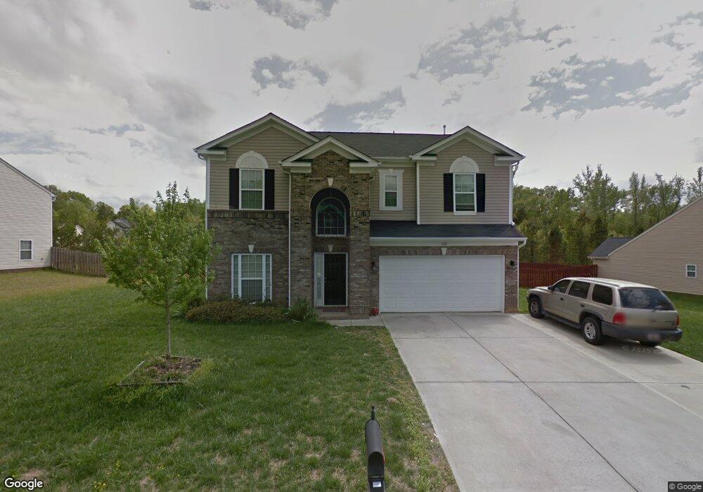
668 Stonehenge Dr Rock Hill, SC 29730
Estimated Value: $437,000 - $460,000
--
Bed
1
Bath
2,637
Sq Ft
$170/Sq Ft
Est. Value
About This Home
This home is located at 668 Stonehenge Dr, Rock Hill, SC 29730 and is currently estimated at $449,178, approximately $170 per square foot. 668 Stonehenge Dr is a home located in York County with nearby schools including Castle Heights Middle School, Rock Hill High School, and St. Anne Catholic School.
Ownership History
Date
Name
Owned For
Owner Type
Purchase Details
Closed on
Jan 2, 2008
Sold by
The Ryland Group Inc
Bought by
Albin Gregory J and Albin Janice D
Current Estimated Value
Home Financials for this Owner
Home Financials are based on the most recent Mortgage that was taken out on this home.
Original Mortgage
$212,481
Outstanding Balance
$132,577
Interest Rate
5.94%
Mortgage Type
New Conventional
Estimated Equity
$316,601
Purchase Details
Closed on
Aug 2, 2007
Sold by
Springdale Properties Inc
Bought by
The Ryland Group Inc
Create a Home Valuation Report for This Property
The Home Valuation Report is an in-depth analysis detailing your home's value as well as a comparison with similar homes in the area
Home Values in the Area
Average Home Value in this Area
Purchase History
| Date | Buyer | Sale Price | Title Company |
|---|---|---|---|
| Albin Gregory J | $223,665 | Attorney | |
| The Ryland Group Inc | $26,000 | None Available |
Source: Public Records
Mortgage History
| Date | Status | Borrower | Loan Amount |
|---|---|---|---|
| Open | Albin Gregory J | $212,481 |
Source: Public Records
Tax History Compared to Growth
Tax History
| Year | Tax Paid | Tax Assessment Tax Assessment Total Assessment is a certain percentage of the fair market value that is determined by local assessors to be the total taxable value of land and additions on the property. | Land | Improvement |
|---|---|---|---|---|
| 2024 | $1,701 | $7,751 | $1,167 | $6,584 |
| 2023 | $1,705 | $7,751 | $1,167 | $6,584 |
| 2022 | $1,717 | $7,751 | $1,167 | $6,584 |
| 2021 | -- | $7,751 | $1,167 | $6,584 |
| 2020 | $1,721 | $7,751 | $0 | $0 |
| 2019 | $1,543 | $6,740 | $0 | $0 |
| 2018 | $1,541 | $6,740 | $0 | $0 |
| 2017 | $1,485 | $6,740 | $0 | $0 |
| 2016 | $1,471 | $6,740 | $0 | $0 |
| 2014 | $1,527 | $6,740 | $1,080 | $5,660 |
| 2013 | $1,527 | $7,340 | $1,080 | $6,260 |
Source: Public Records
Map
Nearby Homes
- 487 Saddlebrook Dr
- 541 Stonehenge Dr
- 1033 Millhouse Dr
- 739 Springdale Rd
- 00 Hopewell Rd
- 1014 Holly Rd
- 286 Liverpool Rd
- 1141 Ardwyck Place
- 1677 Shetland Ln
- 1142 Ardwyck Place Unit 5
- 1730 Townsend Ln
- 1724 Townsend Ln
- 1636 Beacon Hill Ct
- 764 Atherton Way
- 837 Dillard Rd
- 1723 Townsend Ln
- 1527 Meadow Glen Ln
- 2021 Eddie Massey Ln
- 835 Holdcroft Ln
- 709 Atherton Way
- 674 Stonehenge Dr
- 662 Stonehenge Dr
- 771 Campcreek Place
- 678 Stonehenge Dr
- 656 Stonehenge Dr
- 677 Stonehenge Dr
- 663 Stonehenge Dr
- 770 Campcreek Place
- 657 Stonehenge Dr
- 682 Stonehenge Dr
- 650 Stonehenge Dr
- 786 Campcreek Place
- 681 Stonehenge Dr
- 633 Stonehenge Dr
- 687 Stonehenge Dr
- 794 Campcreek Place
- 547 Saddlebrook Dr
- 559 Saddlebrook Dr
- 519 Webster Ct
- 541 Saddlebrook Dr