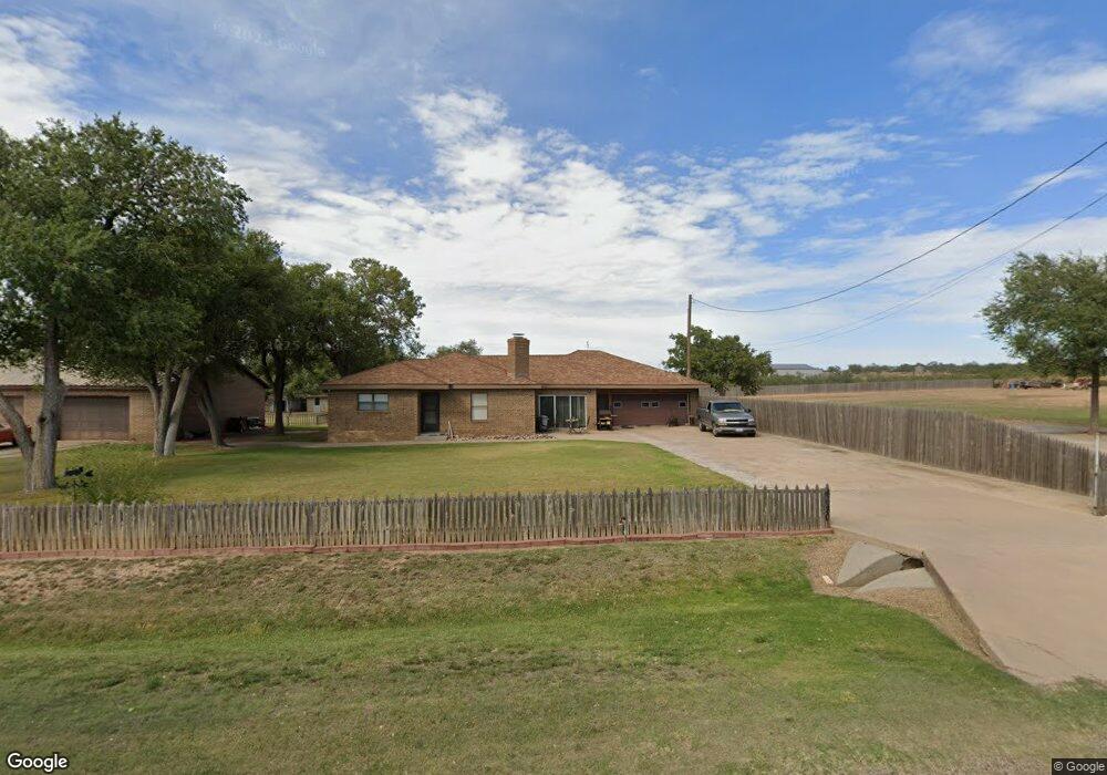
6680 Cliffside Cir Amarillo, TX 79124
Estimated Value: $253,099 - $331,000
3
Beds
2
Baths
5,330
Sq Ft
$55/Sq Ft
Est. Value
About This Home
This home is located at 6680 Cliffside Cir, Amarillo, TX 79124 and is currently estimated at $293,525, approximately $55 per square foot. 6680 Cliffside Cir is a home located in Potter County with nearby schools including Bushland Intermediate School, Bushland Junior High School, and Bushland High School.
Ownership History
Date
Name
Owned For
Owner Type
Purchase Details
Closed on
Dec 20, 2007
Sold by
Azzopardi Charles
Bought by
Williams Wesley E and Williams Dianna G
Current Estimated Value
Home Financials for this Owner
Home Financials are based on the most recent Mortgage that was taken out on this home.
Original Mortgage
$1,000
Interest Rate
6.3%
Mortgage Type
Seller Take Back
Purchase Details
Closed on
Jul 24, 1989
Bought by
Williams Wesley E
Create a Home Valuation Report for This Property
The Home Valuation Report is an in-depth analysis detailing your home's value as well as a comparison with similar homes in the area
Home Values in the Area
Average Home Value in this Area
Purchase History
| Date | Buyer | Sale Price | Title Company |
|---|---|---|---|
| Williams Wesley E | -- | None Available | |
| Azzopardi Charles | $1,500 | None Available | |
| Azzopardi Charles | $1,500 | None Available | |
| Williams Wesley E | -- | -- |
Source: Public Records
Mortgage History
| Date | Status | Borrower | Loan Amount |
|---|---|---|---|
| Closed | Azzopardi Charles | $1,000 |
Source: Public Records
Tax History Compared to Growth
Tax History
| Year | Tax Paid | Tax Assessment Tax Assessment Total Assessment is a certain percentage of the fair market value that is determined by local assessors to be the total taxable value of land and additions on the property. | Land | Improvement |
|---|---|---|---|---|
| 2025 | $808 | $180,672 | -- | -- |
| 2024 | $808 | $164,247 | $9,260 | $178,713 |
| 2023 | $2,857 | $174,792 | $9,260 | $165,532 |
| 2022 | $3,014 | $164,860 | $9,260 | $155,600 |
| 2021 | $1,145 | $123,401 | $9,260 | $114,141 |
| 2020 | $2,758 | $131,176 | $9,260 | $121,916 |
| 2019 | $2,801 | $131,176 | $9,260 | $121,916 |
| 2018 | $2,787 | $131,176 | $9,260 | $121,916 |
| 2017 | $2,935 | $129,662 | $9,260 | $120,402 |
| 2016 | $2,935 | $129,662 | $9,260 | $120,402 |
| 2015 | $73,966 | $129,662 | $9,260 | $120,402 |
| 2014 | $805 | $129,662 | $9,260 | $120,402 |
Source: Public Records
Map
Nearby Homes
- 3502 Golden Chestnut Ln
- 6903 Foxtail Pine Place
- 3401 Golden Chestnut Ln
- 6418 Basswood Ln
- 6502 Willow Oak Place
- 6806 Jersey Elm Place
- 5800 Hester Rd
- 7 Pebble Beach Ct
- 6607 Sumac Place
- 6 Merion Place
- 2705 Sweetgum Ln
- 8541 Cliffside Rd
- 18 Cypress Point
- 410 Creekside Dr
- 27 Carnoustie Ln
- 417 Creekside Dr
- 6501 Acacia Ln
- 121 Quail Blvd
- 13 Prestwick Ln
- 34 Merion Place
- 5250 Cliffside Cir
- 5290 Cliffside Cir
- 6641 Cliffside Cir
- 6681 Cliffside Cir
- 5370 Cliffside Cir
- 5251 Cliffside Cir
- 5330 Cliffside Cir
- 5341 Cliffside Cir
- 6459 Cliffside Cir
- 5596 Cliffside Cir
- 6651 Cliffside Rd
- 6371 Cliffside Rd
- 7007 Cliffside Rd
- 6415 Hester Dr
- 6721 Hester Dr
- 6971 Cliffside Cir
- 6540 Hester Dr
- 6401 Hester Dr
- 0 Rainbow Ave Unit 24-10354
- 6520 Hester Dr