Estimated Value: $590,000 - $711,000
3
Beds
3
Baths
2,029
Sq Ft
$315/Sq Ft
Est. Value
About This Home
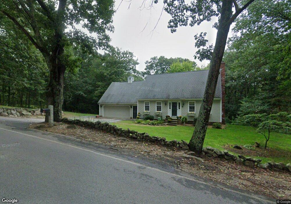
This home is located at 67 Knox Rd, Bow, NH 03304 and is currently estimated at $638,444, approximately $314 per square foot. 67 Knox Rd is a home with nearby schools including Bow Elementary School, Bow Memorial School, and Bow High School.
Ownership History
Date
Name
Owned For
Owner Type
Purchase Details
Closed on
Aug 5, 2024
Sold by
Labrecque Scott N
Bought by
Labreque Marybeth
Current Estimated Value
Purchase Details
Closed on
Mar 26, 2001
Sold by
Masuck Carol M
Bought by
Lebrecque Scott N and Lebrecque Marybeth
Home Financials for this Owner
Home Financials are based on the most recent Mortgage that was taken out on this home.
Original Mortgage
$177,650
Interest Rate
6.93%
Create a Home Valuation Report for This Property
The Home Valuation Report is an in-depth analysis detailing your home's value as well as a comparison with similar homes in the area
Home Values in the Area
Average Home Value in this Area
Purchase History
| Date | Buyer | Sale Price | Title Company |
|---|---|---|---|
| Labreque Marybeth | -- | None Available | |
| Lebrecque Scott N | $187,000 | -- | |
| Lebrecque Scott N | $187,000 | -- |
Source: Public Records
Mortgage History
| Date | Status | Borrower | Loan Amount |
|---|---|---|---|
| Previous Owner | Labrecque Marybeth | $265,000 | |
| Previous Owner | Labrecque Scott N | $144,600 | |
| Previous Owner | Lebrecque Scott N | $177,650 |
Source: Public Records
Tax History Compared to Growth
Tax History
| Year | Tax Paid | Tax Assessment Tax Assessment Total Assessment is a certain percentage of the fair market value that is determined by local assessors to be the total taxable value of land and additions on the property. | Land | Improvement |
|---|---|---|---|---|
| 2024 | $10,472 | $529,400 | $143,800 | $385,600 |
| 2023 | $9,706 | $349,000 | $99,800 | $249,200 |
| 2022 | $9,255 | $349,000 | $99,800 | $249,200 |
| 2021 | $8,896 | $349,000 | $99,800 | $249,200 |
| 2020 | $8,897 | $347,800 | $99,800 | $248,000 |
| 2019 | $9,116 | $347,800 | $99,800 | $248,000 |
| 2018 | $8,498 | $305,900 | $91,500 | $214,400 |
| 2017 | $8,495 | $305,900 | $91,500 | $214,400 |
| 2016 | $8,042 | $305,900 | $91,500 | $214,400 |
| 2015 | $7,700 | $269,800 | $91,500 | $178,300 |
| 2014 | $7,962 | $269,800 | $91,500 | $178,300 |
| 2011 | $6,744 | $248,400 | $91,500 | $156,900 |
Source: Public Records
Map
Nearby Homes
- 49 Robinson Rd
- 29 Westover Ln
- 36 Westover Ln Unit k
- 42 Westover Ln
- 4 Bow Center Rd Unit F2
- 4 Bow Center Rd Unit B2
- 24 Grandview Rd
- 5 Holly Cir
- 91 Whittemore Rd
- 440 Micol Rd
- 77 White Rock Hill Rd
- 0 Garvins Falls Rd Unit 4 5061370
- 107 Garvins Falls Rd
- 53 Heather Ln
- 6 Woodland Cir
- 7 Morgan Dr
- 40 Sawmill Rd
- 455 Carrie Ave
- 203 Brickett Hill Rd
- 214 Pembroke St