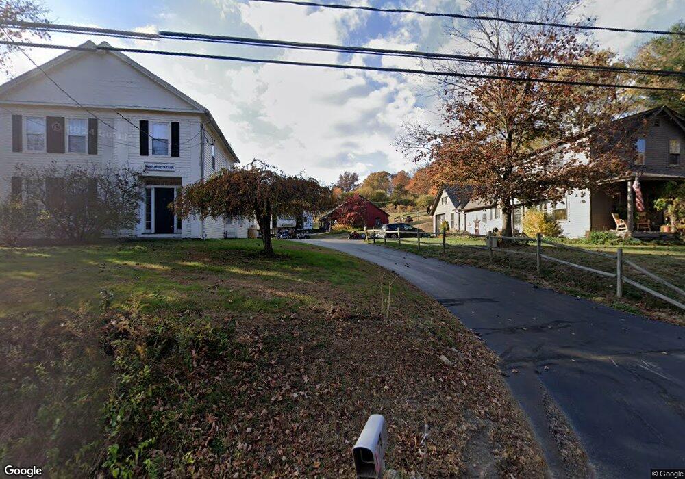
67 Route 197 Woodstock, CT 06281
Estimated Value: $495,894 - $597,000
4
Beds
2
Baths
2,126
Sq Ft
$247/Sq Ft
Est. Value
About This Home
This home is located at 67 Route 197, Woodstock, CT 06281 and is currently estimated at $524,974, approximately $246 per square foot. 67 Route 197 is a home located in Windham County with nearby schools including Woodstock Elementary School and Woodstock Middle School.
Ownership History
Date
Name
Owned For
Owner Type
Purchase Details
Closed on
Jan 28, 2003
Sold by
Demers Cheryl A
Bought by
Horniak Francine and Horniak Paul
Current Estimated Value
Purchase Details
Closed on
Jan 27, 1997
Sold by
Woodstock Properties
Bought by
Demers Cheryl A and Liden Richard H
Create a Home Valuation Report for This Property
The Home Valuation Report is an in-depth analysis detailing your home's value as well as a comparison with similar homes in the area
Home Values in the Area
Average Home Value in this Area
Purchase History
| Date | Buyer | Sale Price | Title Company |
|---|---|---|---|
| Horniak Francine | $288,000 | -- | |
| Demers Cheryl A | $139,900 | -- | |
| Woodstock Properties | $130,000 | -- |
Source: Public Records
Mortgage History
| Date | Status | Borrower | Loan Amount |
|---|---|---|---|
| Open | Woodstock Properties | $206,400 | |
| Closed | Woodstock Properties | $209,305 | |
| Closed | Woodstock Properties | $290,000 |
Source: Public Records
Tax History Compared to Growth
Tax History
| Year | Tax Paid | Tax Assessment Tax Assessment Total Assessment is a certain percentage of the fair market value that is determined by local assessors to be the total taxable value of land and additions on the property. | Land | Improvement |
|---|---|---|---|---|
| 2025 | $5,482 | $224,600 | $39,600 | $185,000 |
| 2024 | $5,175 | $224,600 | $39,600 | $185,000 |
| 2023 | $5,033 | $224,600 | $39,600 | $185,000 |
| 2022 | $4,683 | $224,600 | $39,600 | $185,000 |
| 2021 | $4,274 | $167,600 | $39,600 | $128,000 |
| 2020 | $3,643 | $148,700 | $39,600 | $109,100 |
| 2019 | $3,643 | $148,700 | $39,600 | $109,100 |
| 2018 | $3,643 | $148,700 | $39,600 | $109,100 |
| 2017 | $3,613 | $148,700 | $39,600 | $109,100 |
| 2016 | $3,200 | $133,100 | $50,100 | $83,000 |
| 2015 | $3,109 | $133,100 | $50,100 | $83,000 |
| 2014 | $3,075 | $133,100 | $50,100 | $83,000 |
Source: Public Records
Map
Nearby Homes
- 81 Parkway Dr
- 10 Highland Dr
- 0 Blash Rd Unit 24105055
- 126 Old Southbridge Rd
- 417 Dugg Hill Rd
- 128 Old Southbridge Rd
- 10 Green Acres Ln
- 36 Olde Meadow Rd
- 468 Fabyan Rd
- 433 Fabyan Rd
- 40 Hagstrom Rd
- 1669 Route 169
- 00 Prospect St
- 264 Dresser Hill Rd
- 313 Quinebaug Rd
- 2 W Dudley Rd
- 4 W Dudley Rd
- 11 Lempicki Rd
- 717 Tipton Rock Rd
- 1023 N Woodstock Rd
- 75 Route 197
- 56 Route 197
- 55 Converse Rd
- 55 Converse Rd Unit 2
- 39 Route 197
- 30 Route 197
- 14 Route 197
- 25 Connecticut 197 Unit 5
- 25 Connecticut 197 Unit 11
- 25 Connecticut 197 Unit 41
- 35 Route 197
- 000 Route 197
- 0B Route 197
- 00 Route 197
- 0 Route 197
- Lot 92 Rt 197
- 6 Route 197
- 129 Route 197
- 6 Route 197
- 6 Route 197