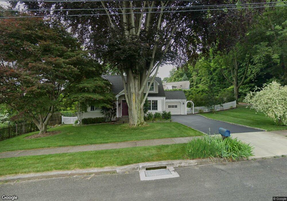
67 Steep Hill Rd Southport, CT 06890
Estimated Value: $870,000 - $991,137
2
Beds
3
Baths
1,641
Sq Ft
$567/Sq Ft
Est. Value
About This Home
This home is located at 67 Steep Hill Rd, Southport, CT 06890 and is currently estimated at $930,284, approximately $566 per square foot. 67 Steep Hill Rd is a home located in Fairfield County with nearby schools including Mill Hill School, Roger Ludlowe Middle School, and Fairfield Ludlowe High School.
Ownership History
Date
Name
Owned For
Owner Type
Purchase Details
Closed on
Jun 1, 1998
Sold by
Thompson Christopher P and Thompson Victoria R
Bought by
Stranaglia John
Current Estimated Value
Home Financials for this Owner
Home Financials are based on the most recent Mortgage that was taken out on this home.
Original Mortgage
$266,400
Interest Rate
7.12%
Mortgage Type
Unknown
Purchase Details
Closed on
Dec 30, 1994
Sold by
Clonts Jeffrey F
Bought by
Thompson Christopher P and Thompson Victoria R
Purchase Details
Closed on
Jul 1, 1993
Sold by
Musante James J
Bought by
Clonts Jeffrey F
Create a Home Valuation Report for This Property
The Home Valuation Report is an in-depth analysis detailing your home's value as well as a comparison with similar homes in the area
Home Values in the Area
Average Home Value in this Area
Purchase History
| Date | Buyer | Sale Price | Title Company |
|---|---|---|---|
| Stranaglia John | $296,000 | -- | |
| Stranaglia John | $296,000 | -- | |
| Thompson Christopher P | $267,500 | -- | |
| Thompson Christopher P | $267,500 | -- | |
| Clonts Jeffrey F | $190,000 | -- | |
| Clonts Jeffrey F | $190,000 | -- |
Source: Public Records
Mortgage History
| Date | Status | Borrower | Loan Amount |
|---|---|---|---|
| Closed | Clonts Jeffrey F | $220,000 | |
| Closed | Clonts Jeffrey F | $266,400 |
Source: Public Records
Tax History Compared to Growth
Tax History
| Year | Tax Paid | Tax Assessment Tax Assessment Total Assessment is a certain percentage of the fair market value that is determined by local assessors to be the total taxable value of land and additions on the property. | Land | Improvement |
|---|---|---|---|---|
| 2025 | $10,781 | $379,750 | $260,750 | $119,000 |
| 2024 | $10,595 | $379,750 | $260,750 | $119,000 |
| 2023 | $10,447 | $379,750 | $260,750 | $119,000 |
| 2022 | $10,344 | $379,750 | $260,750 | $119,000 |
| 2021 | $10,246 | $379,750 | $260,750 | $119,000 |
| 2020 | $10,273 | $383,460 | $258,020 | $125,440 |
| 2019 | $10,273 | $383,460 | $258,020 | $125,440 |
| 2018 | $10,108 | $383,460 | $258,020 | $125,440 |
| 2017 | $9,901 | $383,460 | $258,020 | $125,440 |
| 2016 | $9,759 | $383,460 | $258,020 | $125,440 |
| 2015 | $8,895 | $358,820 | $271,950 | $86,870 |
| 2014 | $8,755 | $358,820 | $271,950 | $86,870 |
Source: Public Records
Map
Nearby Homes
- 53 Hilltop Dr
- 647 Bronson Rd
- 476 Mill Hill Terrace
- 28 Mill Hill Rd Unit 28
- 844 Mill Hill Terrace
- 88 Overhill Rd
- 100 Overhill Rd
- 21 Beaumont St
- 209 S Pine Creek Rd
- 43 Helen St
- 153 Pease Ave
- 57 Beaumont Place
- 1135 Mill Hill Rd
- 65 Thorpe St Unit 65
- 85 Patrick Dr
- 2 Elmwood Dr Unit 2
- 245 Unquowa Rd Unit 34
- 245 Unquowa Rd Unit 11
- 245 Unquowa Rd Unit 33
- 226 Ruane St
- 45 Broad River Ln
- 60 Steep Hill Rd
- 481 Bronson Rd
- 451 Bronson Rd
- 35 Broad River Ln
- 431 Bronson Rd
- 54 Steep Hill Rd
- 23 Broad River Ln
- 411 Bronson Rd
- 37 Broad River Ln
- 501 Bronson Rd
- 56 Steep Hill Rd
- 58 Steep Hill Rd
- 517 Bronson Rd
- 442 Bronson Rd
- 9 Broad River Ln
- 223 High Meadow Rd
- 5 Broad River Ln
- 502 Bronson Rd
- 379 Bronson Rd