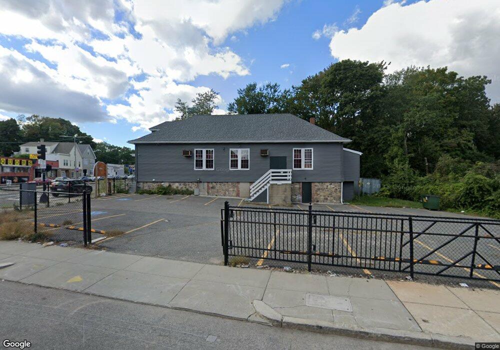
670 Cummins Hwy Mattapan, MA 02126
Southern Mattapan NeighborhoodEstimated Value: $1,018,702
--
Bed
3
Baths
4,223
Sq Ft
$241/Sq Ft
Est. Value
About This Home
This home is located at 670 Cummins Hwy, Mattapan, MA 02126 and is currently estimated at $1,018,702, approximately $241 per square foot. 670 Cummins Hwy is a home located in Suffolk County with nearby schools including KIPP Academy Boston Charter School and Berea Seventh-day Adventist Academy.
Ownership History
Date
Name
Owned For
Owner Type
Purchase Details
Closed on
Jun 28, 2001
Sold by
American Church Tr Co
Bought by
Debreselam St Mikael
Current Estimated Value
Home Financials for this Owner
Home Financials are based on the most recent Mortgage that was taken out on this home.
Original Mortgage
$200,000
Outstanding Balance
$75,288
Interest Rate
7.14%
Mortgage Type
Commercial
Estimated Equity
$943,414
Purchase Details
Closed on
Nov 2, 2000
Sold by
New Cornerstone Bpt Ch
Bought by
American Church Tr Co
Purchase Details
Closed on
Oct 4, 1999
Sold by
New Cornerstone Bapt
Bought by
American Church T Co
Create a Home Valuation Report for This Property
The Home Valuation Report is an in-depth analysis detailing your home's value as well as a comparison with similar homes in the area
Home Values in the Area
Average Home Value in this Area
Purchase History
| Date | Buyer | Sale Price | Title Company |
|---|---|---|---|
| Debreselam St Mikael | $325,000 | -- | |
| American Church Tr Co | $250,000 | -- | |
| American Church T Co | $270,000 | -- | |
| American Church T Co | $270,000 | -- |
Source: Public Records
Mortgage History
| Date | Status | Borrower | Loan Amount |
|---|---|---|---|
| Open | Debreselam St Mikael | $200,000 |
Source: Public Records
Tax History Compared to Growth
Tax History
| Year | Tax Paid | Tax Assessment Tax Assessment Total Assessment is a certain percentage of the fair market value that is determined by local assessors to be the total taxable value of land and additions on the property. | Land | Improvement |
|---|---|---|---|---|
| 2025 | -- | $835,300 | $286,700 | $548,600 |
| 2024 | -- | $878,000 | $286,700 | $591,300 |
| 2023 | $0 | $856,000 | $286,700 | $569,300 |
| 2022 | $0 | $782,800 | $286,700 | $496,100 |
| 2021 | $0 | $798,100 | $274,800 | $523,300 |
| 2020 | $0 | $775,300 | $274,800 | $500,500 |
| 2019 | $0 | $775,500 | $286,700 | $488,800 |
| 2018 | $0 | $718,500 | $274,700 | $443,800 |
| 2017 | $0 | $677,500 | $261,300 | $416,200 |
| 2016 | -- | $629,500 | $237,400 | $392,100 |
| 2015 | -- | $554,000 | $212,600 | $341,400 |
| 2014 | -- | $524,000 | $188,700 | $335,300 |
Source: Public Records
Map
Nearby Homes
- 231 Itasca St
- 839-843 Cummins Hwy
- 34 Ridlon Rd
- 179 Hebron St
- 72 Livermore St
- 265 Hebron St
- 770 Cummins Hwy Unit 1
- 770 Cummins Hwy Unit 22
- 10 Brockton St
- 100 Itasca St
- 95 Woodhaven St
- 0 Tina Ave
- 14-14R Kennebec St
- 20 Monterey Ave
- 90 Hollingsworth St
- 60 and 64 Monterey Ave
- 23 Caton St
- 116 Almont St
- 7 Winborough St
- 48-50 Rockdale St
- 275 Itasca St
- 823 Cummins Hwy
- 585 Cummins Hwy
- 6 Croydon St
- 658 Cummins Hwy
- 265 Itasca St
- 637 Cummins Hwy Unit 641
- 255 Itasca St
- 255 Itasca St Unit 2
- 654 Cummins Hwy
- 19 Ruxton Rd
- 272 Itasca St
- 631 Cummins Hwy
- 635 Cummins Hwy
- 690 Cummins Hwy
- 690 Cummins Hwy
- 690 Cummins Hwy Unit 10
- 690 Cummins Hwy Unit 1
- 64 Ridlon Rd
- 17 Ruxton Rd