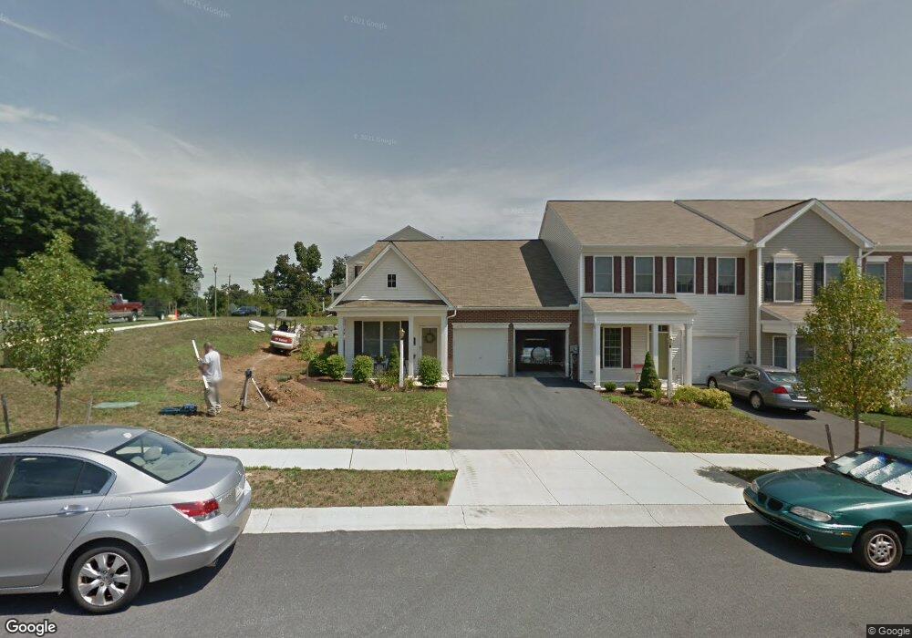
671 Stoverdale Rd Hummelstown, PA 17036
Estimated Value: $334,738 - $369,000
2
Beds
2
Baths
1,680
Sq Ft
$206/Sq Ft
Est. Value
About This Home
This home is located at 671 Stoverdale Rd, Hummelstown, PA 17036 and is currently estimated at $345,435, approximately $205 per square foot. 671 Stoverdale Rd is a home located in Dauphin County with nearby schools including Hershey Elementary School, Hershey Primary Elementary School, and Hershey Middle School.
Ownership History
Date
Name
Owned For
Owner Type
Purchase Details
Closed on
Jun 16, 2009
Sold by
Charter Homes At Hershey
Bought by
Wallace Sally H
Current Estimated Value
Home Financials for this Owner
Home Financials are based on the most recent Mortgage that was taken out on this home.
Original Mortgage
$120,000
Outstanding Balance
$76,388
Interest Rate
4.91%
Mortgage Type
New Conventional
Estimated Equity
$269,047
Purchase Details
Closed on
Sep 26, 2008
Sold by
Gelder And Gelder Limited
Bought by
Charter Homes At Hershey
Home Financials for this Owner
Home Financials are based on the most recent Mortgage that was taken out on this home.
Original Mortgage
$2,500,000
Interest Rate
6.43%
Mortgage Type
Construction
Create a Home Valuation Report for This Property
The Home Valuation Report is an in-depth analysis detailing your home's value as well as a comparison with similar homes in the area
Home Values in the Area
Average Home Value in this Area
Purchase History
| Date | Buyer | Sale Price | Title Company |
|---|---|---|---|
| Wallace Sally H | $239,428 | -- | |
| Charter Homes At Hershey | $56,700 | -- |
Source: Public Records
Mortgage History
| Date | Status | Borrower | Loan Amount |
|---|---|---|---|
| Open | Wallace Sally H | $120,000 | |
| Previous Owner | Charter Homes At Hershey | $2,500,000 |
Source: Public Records
Tax History Compared to Growth
Tax History
| Year | Tax Paid | Tax Assessment Tax Assessment Total Assessment is a certain percentage of the fair market value that is determined by local assessors to be the total taxable value of land and additions on the property. | Land | Improvement |
|---|---|---|---|---|
| 2025 | $4,957 | $158,600 | $34,400 | $124,200 |
| 2024 | $4,659 | $158,600 | $34,400 | $124,200 |
| 2023 | $4,575 | $158,600 | $34,400 | $124,200 |
| 2022 | $4,474 | $158,600 | $34,400 | $124,200 |
| 2021 | $4,474 | $158,600 | $34,400 | $124,200 |
| 2020 | $4,474 | $158,600 | $34,400 | $124,200 |
| 2019 | $4,393 | $158,600 | $34,400 | $124,200 |
| 2018 | $4,277 | $158,600 | $34,400 | $124,200 |
| 2017 | $4,277 | $158,600 | $34,400 | $124,200 |
| 2016 | $0 | $158,600 | $34,400 | $124,200 |
| 2015 | -- | $158,600 | $34,400 | $124,200 |
| 2014 | -- | $158,600 | $34,400 | $124,200 |
Source: Public Records
Map
Nearby Homes
- 1959 Deer Run Dr
- 1919 Limestone Dr
- 2017B Raleigh Rd
- 2039H Raleigh Rd
- 2042 Locust Ln
- 497 Middletown Rd
- 1168 Cord Dr
- 285 Dogwood Dr
- 177 Middletown Rd
- 265 Redwood St
- 994 Clifton Heights Rd
- 30 N Walnut St
- 112 Park Ave
- 228 W Main St
- 791 Gregs Dr
- 235 W 2nd St
- 258 W 2nd St
- 721 S 82nd St Unit L111
- 227 Pleasant View Rd
- 715 Gregs Dr
- 673 Stoverdale Rd
- 605 Stoverdale Rd
- 656 Buck Dr
- 675 Stoverdale Rd
- 0 Buck Dr
- 677 Stoverdale Rd
- 654 Buck Dr
- 689 Buck Dr
- 667 Buck Dr
- 657 Buck Dr
- 651 Buck Dr
- 679 Stoverdale Rd
- 652 Buck Dr
- 652 Buck Dr Unit 162
- 661 Buck Dr
- 676 Stoverdale Rd
- 674 Stoverdale Rd
- 650 Buck Dr
- 681 Stoverdale Rd
- 678 Stoverdale Rd