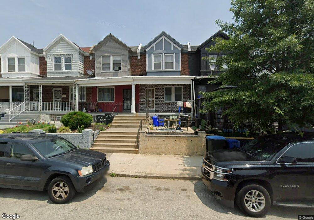
6713 Woolston Ave Philadelphia, PA 19138
West Oak Lane NeighborhoodEstimated Value: $185,452 - $264,000
3
Beds
1
Bath
1,136
Sq Ft
$191/Sq Ft
Est. Value
About This Home
This home is located at 6713 Woolston Ave, Philadelphia, PA 19138 and is currently estimated at $216,613, approximately $190 per square foot. 6713 Woolston Ave is a home located in Philadelphia County with nearby schools including William Rowen School, Gen. Louis Wagner Middle School, and Martin Luther King High School.
Ownership History
Date
Name
Owned For
Owner Type
Purchase Details
Closed on
Mar 15, 2007
Sold by
Leigh James F and Leigh Jeannette
Bought by
Chukwuani Silas
Current Estimated Value
Home Financials for this Owner
Home Financials are based on the most recent Mortgage that was taken out on this home.
Original Mortgage
$106,879
Outstanding Balance
$64,940
Interest Rate
6.33%
Mortgage Type
FHA
Estimated Equity
$151,673
Create a Home Valuation Report for This Property
The Home Valuation Report is an in-depth analysis detailing your home's value as well as a comparison with similar homes in the area
Home Values in the Area
Average Home Value in this Area
Purchase History
| Date | Buyer | Sale Price | Title Company |
|---|---|---|---|
| Chukwuani Silas | $110,000 | None Available |
Source: Public Records
Mortgage History
| Date | Status | Borrower | Loan Amount |
|---|---|---|---|
| Open | Chukwuani Silas | $106,879 |
Source: Public Records
Tax History Compared to Growth
Tax History
| Year | Tax Paid | Tax Assessment Tax Assessment Total Assessment is a certain percentage of the fair market value that is determined by local assessors to be the total taxable value of land and additions on the property. | Land | Improvement |
|---|---|---|---|---|
| 2025 | $1,961 | $167,900 | $33,580 | $134,320 |
| 2024 | $1,961 | $167,900 | $33,580 | $134,320 |
| 2023 | $1,961 | $140,100 | $28,020 | $112,080 |
| 2022 | $890 | $95,100 | $28,020 | $67,080 |
| 2021 | $1,520 | $0 | $0 | $0 |
| 2020 | $1,520 | $0 | $0 | $0 |
| 2019 | $1,587 | $0 | $0 | $0 |
| 2018 | $1,008 | $0 | $0 | $0 |
| 2017 | $1,368 | $0 | $0 | $0 |
| 2016 | $948 | $0 | $0 | $0 |
| 2015 | $846 | $0 | $0 | $0 |
| 2014 | -- | $93,100 | $7,680 | $85,420 |
| 2012 | -- | $12,928 | $2,105 | $10,823 |
Source: Public Records
Map
Nearby Homes
- 2061 Independence St
- 6731 N Woodstock St
- 6733 N Woodstock St
- 2056 Eastburn Ave
- 2070 E Haines St
- 6603 N 21st St
- 6600 N Opal St
- 6558 Limekiln Pike
- 6824 Rodney St
- 2022 66th Ave
- 6534 N Lambert St
- 2120 66th Ave
- 2105 Stenton Ave
- 2115 Stenton Ave
- 2125 Stenton Ave
- 6332 E Wister St
- 6732 Ogontz Ave
- 6531 N Beechwood St
- 2152 Stenton Ave
- 1914 W 65th Ave
- 6715 Woolston Ave
- 6711 Woolston Ave
- 6717 Woolston Ave
- 6709 Woolston Ave
- 6719 Woolston Ave
- 6707 Woolston Ave
- 6721 Woolston Ave
- 6705 Woolston Ave
- 6723 Woolston Ave
- 6703 Woolston Ave
- 6708 N Woodstock St
- 6712 N Woodstock St
- 6710 N Woodstock St
- 6725 Woolston Ave
- 6714 N Woodstock St
- 6706 N Woodstock St
- 6704 N Woodstock St
- 6716 N Woodstock St
- 6701 Woolston Ave
- 6718 N Woodstock St