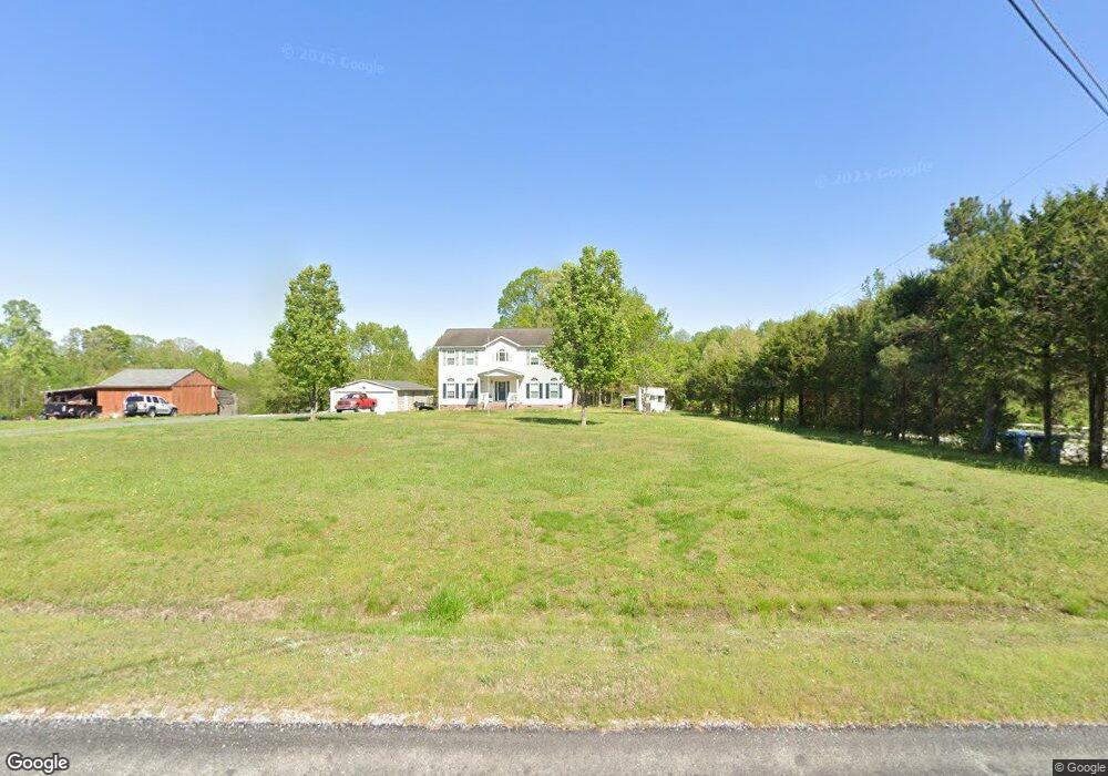
6719 Saferight Rd Greensboro, NC 27406
Burnetts Chapel/Coltrane Mill NeighborhoodEstimated Value: $62,000 - $251,000
--
Bed
--
Bath
--
Sq Ft
3.01
Acres
About This Home
This home is located at 6719 Saferight Rd, Greensboro, NC 27406 and is currently estimated at $139,372. 6719 Saferight Rd is a home with nearby schools including Southern Guilford Middle and Southern Guilford High School.
Ownership History
Date
Name
Owned For
Owner Type
Purchase Details
Closed on
Sep 13, 2024
Sold by
Nuckles Donald
Bought by
Evans Nash Austin
Current Estimated Value
Purchase Details
Closed on
Sep 7, 2024
Sold by
Defate James Alvin
Bought by
Evans Nash Austin
Purchase Details
Closed on
Mar 18, 2004
Sold by
Henderson Richard W and Henderson Betty Jean
Bought by
Defate James A and Defate Tonya F
Home Financials for this Owner
Home Financials are based on the most recent Mortgage that was taken out on this home.
Original Mortgage
$157,200
Interest Rate
5.72%
Mortgage Type
Purchase Money Mortgage
Create a Home Valuation Report for This Property
The Home Valuation Report is an in-depth analysis detailing your home's value as well as a comparison with similar homes in the area
Home Values in the Area
Average Home Value in this Area
Purchase History
| Date | Buyer | Sale Price | Title Company |
|---|---|---|---|
| Evans Nash Austin | $1,000 | None Listed On Document | |
| Evans Nash Austin | $1,000 | None Listed On Document | |
| Evans Nash Austin | $500 | None Listed On Document | |
| Evans Nash Austin | $500 | None Listed On Document | |
| Defate James A | -- | -- | |
| Henderson Richard W | -- | -- |
Source: Public Records
Mortgage History
| Date | Status | Borrower | Loan Amount |
|---|---|---|---|
| Previous Owner | Defate James A | $157,200 |
Source: Public Records
Tax History Compared to Growth
Tax History
| Year | Tax Paid | Tax Assessment Tax Assessment Total Assessment is a certain percentage of the fair market value that is determined by local assessors to be the total taxable value of land and additions on the property. | Land | Improvement |
|---|---|---|---|---|
| 2025 | $397 | $45,800 | $45,800 | -- |
| 2024 | $397 | $45,800 | $45,800 | -- |
| 2023 | $397 | $45,800 | $45,800 | $0 |
| 2022 | $397 | $45,800 | $45,800 | $0 |
| 2021 | $369 | $42,500 | $42,500 | $0 |
| 2020 | $369 | $42,500 | $42,500 | $0 |
| 2019 | $361 | $42,500 | $0 | $0 |
| 2018 | $360 | $42,500 | $0 | $0 |
| 2017 | $360 | $42,500 | $0 | $0 |
| 2016 | $314 | $36,400 | $0 | $0 |
| 2015 | $316 | $36,400 | $0 | $0 |
| 2014 | $320 | $36,400 | $0 | $0 |
Source: Public Records
Map
Nearby Homes
- 5770 Drake Rd
- 434 Nc Highway 62 W
- 6718 Thurber Rd
- 6700 Thurber Rd
- 0 Tom Ball Rd
- 2060 Coltrane Mill Rd
- 5805 Bartlett Dr
- 130 W Steeple Chase Rd
- 6534 Frazier Marsh Rd
- 1139 Kentmere Rd
- 0 Harlow Rd
- 1116 Kentmere Rd
- 5405 Fieldswood Dr
- 6955 Harlow Dr
- 6882 Kelly Coltrane Dr
- 6007 Checker Rd
- 4805 Bisbee
- 6318 Gray Farm Rd
- 5625 Davis Mill Rd
- 5217 Overlea Dr
- 6727 Saferight Rd
- 6715 Saferight Rd
- 6723 Saferight Rd
- 6721 Saferight
- 6729 Saferight Rd
- 6711 Saferight Rd
- 6743 Saferight Rd
- 6733 Saferight Rd
- 6724 Saferight Rd
- 6713 Saferight
- 6728 Saferight Rd
- 6732 Saferight Rd
- 6716 Saferight Rd
- 6737 Saferight Rd
- 6740 Saferight Rd
- 3000 Wyn Dan Ln
- 3010 Wyn Dan Ln
- 6742 Saferight Rd
- 6744 Saferight Rd
- 5799 Drake Rd