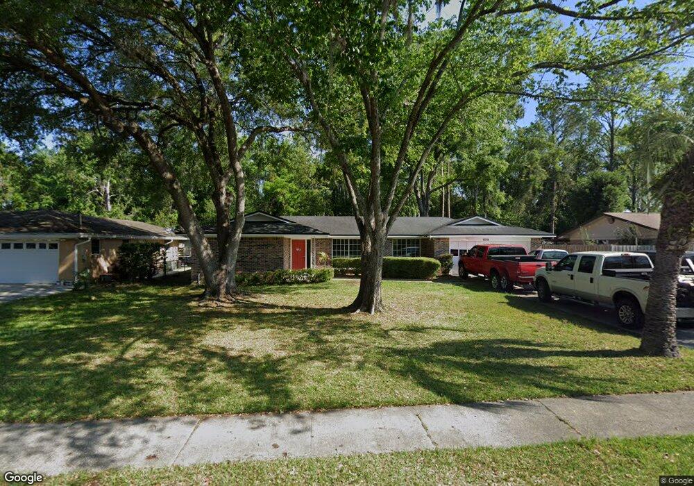
6729 Sioux Ave Jacksonville, FL 32210
Hyde Park NeighborhoodEstimated Value: $244,000 - $282,000
3
Beds
2
Baths
1,641
Sq Ft
$158/Sq Ft
Est. Value
About This Home
This home is located at 6729 Sioux Ave, Jacksonville, FL 32210 and is currently estimated at $259,935, approximately $158 per square foot. 6729 Sioux Ave is a home located in Duval County with nearby schools including Andros Karperos, Hyde Park Elementary School, and Lake Shore Middle School.
Ownership History
Date
Name
Owned For
Owner Type
Purchase Details
Closed on
Jun 6, 1997
Sold by
Hedgepeth Horace H and Hedgepeth Margaret F
Bought by
Shackelford Austin W
Current Estimated Value
Home Financials for this Owner
Home Financials are based on the most recent Mortgage that was taken out on this home.
Original Mortgage
$80,750
Outstanding Balance
$11,585
Interest Rate
8.01%
Estimated Equity
$248,350
Create a Home Valuation Report for This Property
The Home Valuation Report is an in-depth analysis detailing your home's value as well as a comparison with similar homes in the area
Home Values in the Area
Average Home Value in this Area
Purchase History
| Date | Buyer | Sale Price | Title Company |
|---|---|---|---|
| Shackelford Austin W | $85,000 | -- |
Source: Public Records
Mortgage History
| Date | Status | Borrower | Loan Amount |
|---|---|---|---|
| Open | Shackelford Austin W | $80,750 |
Source: Public Records
Tax History Compared to Growth
Tax History
| Year | Tax Paid | Tax Assessment Tax Assessment Total Assessment is a certain percentage of the fair market value that is determined by local assessors to be the total taxable value of land and additions on the property. | Land | Improvement |
|---|---|---|---|---|
| 2025 | $1,689 | $127,379 | -- | -- |
| 2024 | $1,633 | $123,790 | -- | -- |
| 2023 | $1,633 | $120,185 | $0 | $0 |
| 2022 | $1,485 | $116,685 | $0 | $0 |
| 2021 | $1,465 | $113,287 | $0 | $0 |
| 2020 | $1,446 | $111,723 | $0 | $0 |
| 2019 | $1,423 | $109,212 | $0 | $0 |
| 2018 | $1,400 | $107,176 | $0 | $0 |
| 2017 | $1,376 | $104,972 | $0 | $0 |
| 2016 | $1,362 | $102,813 | $0 | $0 |
| 2015 | $1,374 | $102,099 | $0 | $0 |
| 2014 | $1,374 | $101,289 | $0 | $0 |
Source: Public Records
Map
Nearby Homes
- 6717 Bakersfield Dr
- 6711 Bakersfield Dr
- 6938 Hanson Dr N
- 1704 Memory Ln
- 6803 Golfview St
- 1465 Manotak Point Dr Unit 104
- 1728 Londonderry Rd
- 6914 Alachua Ave
- 1832 Navaho Ave
- 1465 Winnebago Ave
- 1438 Ron Rd
- 1627 Westminister Ave
- 1454 Winnebago Ave
- 7132 Hanson Dr N
- 6039 Hyde Park Cir
- 6819 Mcmullin St
- 1341 Ottawa Ave
- 6110 Park St
- 1449 Delmar St
- 6351 Fabian Dr
- 1602 Lane Ave S
- 1602 Lane Ave S Unit 805
- 1602 Lane Ave S Unit 804
- 1602 Lane Ave S Unit 803
- 1602 Lane Ave S Unit 802
- 1602 Lane Ave S Unit 801
- 1602 Lane Ave S Unit 705
- 1602 Lane Ave S Unit 704
- 1602 Lane Ave S Unit 703
- 1602 Lane Ave S Unit 702
- 1602 Lane Ave S Unit 701
- 6739 Bakersfield Dr
- 6731 Bakersfield Dr
- 6749 Bakersfield Dr
- 6827 Bakersfield Dr
- 6721 Bakersfield Dr
- 1660 Lane Ave S
- 6771 Bakersfield Dr
- 6817 Bakersfield Dr
- 1666 Lane Ave S