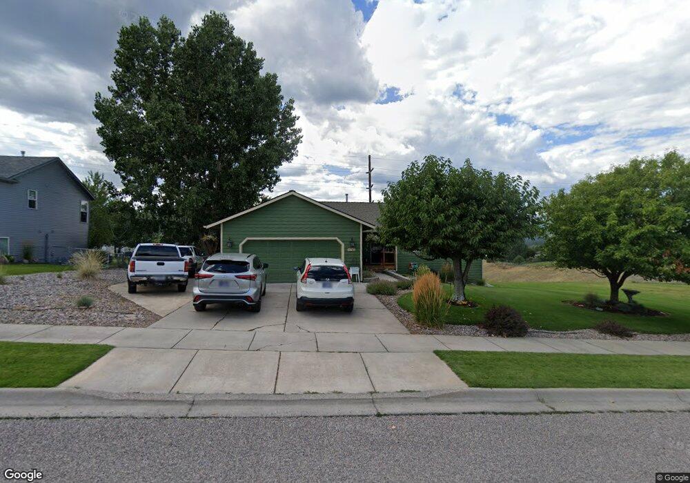
6741 Kelsey Ct Missoula, MT 59803
Miller Creek NeighborhoodEstimated Value: $629,000 - $727,000
3
Beds
2
Baths
1,436
Sq Ft
$467/Sq Ft
Est. Value
About This Home
This home is located at 6741 Kelsey Ct, Missoula, MT 59803 and is currently estimated at $669,899, approximately $466 per square foot. 6741 Kelsey Ct is a home located in Missoula County with nearby schools including Jeannette Rankin Elementary School, Porter Middle School, and Sentinel High School.
Ownership History
Date
Name
Owned For
Owner Type
Purchase Details
Closed on
Feb 13, 2009
Sold by
Umbro Vito W and Umbro Julie A
Bought by
Umbro Vito W and Umbro Julie A
Current Estimated Value
Home Financials for this Owner
Home Financials are based on the most recent Mortgage that was taken out on this home.
Original Mortgage
$147,430
Outstanding Balance
$36,405
Interest Rate
4.92%
Mortgage Type
New Conventional
Estimated Equity
$633,494
Purchase Details
Closed on
Nov 30, 2001
Sold by
Carpita Sebbas S and Carpita Danielle
Bought by
Umbro Vito W and Seymour Julie A
Home Financials for this Owner
Home Financials are based on the most recent Mortgage that was taken out on this home.
Original Mortgage
$140,800
Interest Rate
6.63%
Create a Home Valuation Report for This Property
The Home Valuation Report is an in-depth analysis detailing your home's value as well as a comparison with similar homes in the area
Home Values in the Area
Average Home Value in this Area
Purchase History
| Date | Buyer | Sale Price | Title Company |
|---|---|---|---|
| Umbro Vito W | -- | Insured Titles Llc | |
| Umbro Vito W | -- | -- |
Source: Public Records
Mortgage History
| Date | Status | Borrower | Loan Amount |
|---|---|---|---|
| Open | Umbro Vito W | $147,430 | |
| Closed | Umbro Vito W | $140,800 | |
| Closed | Umbro Vito W | $17,600 |
Source: Public Records
Tax History Compared to Growth
Tax History
| Year | Tax Paid | Tax Assessment Tax Assessment Total Assessment is a certain percentage of the fair market value that is determined by local assessors to be the total taxable value of land and additions on the property. | Land | Improvement |
|---|---|---|---|---|
| 2025 | $6,582 | $595,300 | $109,274 | $486,026 |
| 2024 | $6,265 | $514,800 | $90,796 | $424,004 |
| 2023 | $6,089 | $514,800 | $90,796 | $424,004 |
| 2022 | $4,836 | $353,800 | $0 | $0 |
| 2021 | $4,298 | $353,800 | $0 | $0 |
| 2020 | $4,268 | $335,600 | $0 | $0 |
| 2019 | $4,256 | $335,600 | $0 | $0 |
| 2018 | $4,021 | $307,500 | $0 | $0 |
| 2017 | $3,955 | $307,500 | $0 | $0 |
| 2016 | $3,272 | $266,900 | $0 | $0 |
| 2015 | $3,019 | $266,900 | $0 | $0 |
| 2014 | $2,957 | $146,174 | $0 | $0 |
Source: Public Records
Map
Nearby Homes
- 6770 Roberta Dr
- 4800 Jaiden Ln
- 4543 Christian Dr
- 6520 Danielle Lou Ct
- 4750 Mark Ct
- 5047 Roy Ct
- 4434 Harrison Scott Dr
- 6650 Linda Vista Blvd
- 4388 Harrison Scott Dr
- Linda Vista Blvd Linda Vista Blvd
- 4345 Christian Dr
- 4863 Scott Allen Dr
- 6250 Timothy Ct
- 4060 Jamie Ann Ln
- 5050 Jordan Ct
- 5207 Frazer Ct
- 7155 Brooke Lynn Ct
- Nhn Avery Ln
- 7083 Shaver Dr
- 7123 Shaver Dr
- 6751 Kelsey Ct
- 6734 Kelsey Ct
- 6721 Kelsey Ct
- 6744 Kelsey Ct
- 6726 Kelsey Ct
- 6660 Cam Ct
- 6718 Kelsey Ct
- 6711 Kelsey Ct
- 4680 Scott Allen Dr
- 6771 Kelsey Ct
- 6755 Roberta Dr
- 4672 Scott Allen Dr
- 6680 Cam Ct
- 6655 Cam Ct
- 4688 Scott Allen Dr
- 6701 Kelsey Ct
- 6712 Kelsey Ct
- 6750 Roberta Dr
- 4666 Scott Allen Dr
- 6781 Kelsey Ct