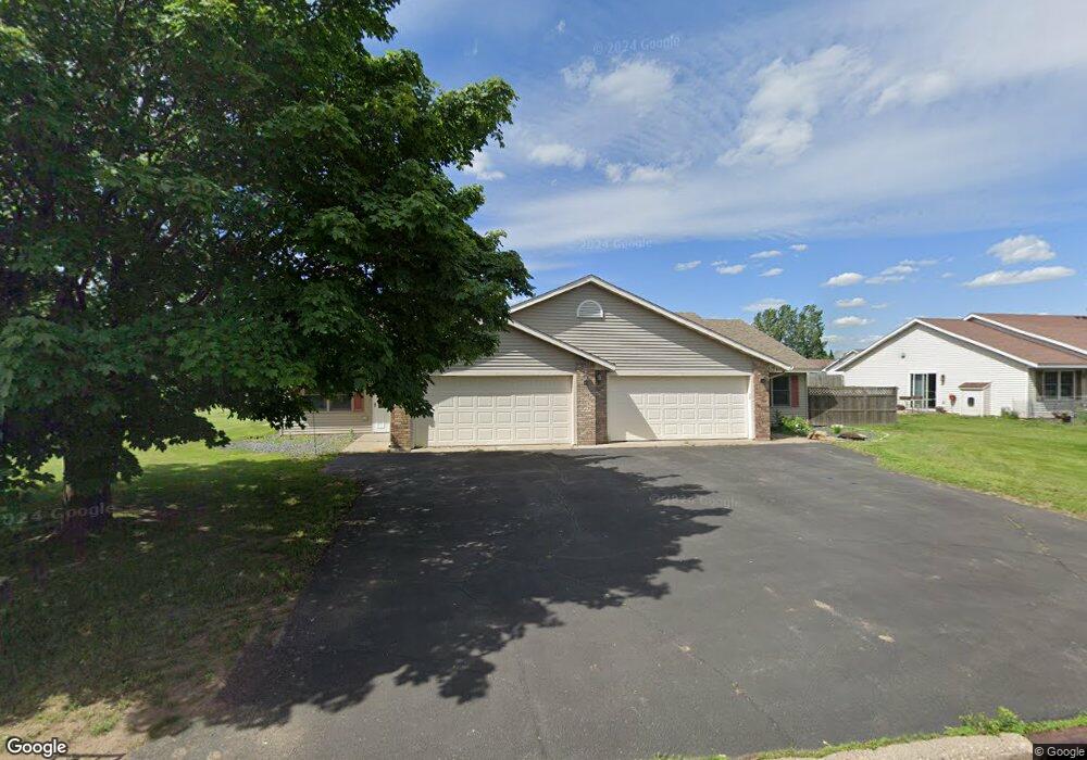
675 Circle Pine Dr New Richmond, WI 54017
Estimated Value: $329,507 - $374,000
4
Beds
4
Baths
--
Sq Ft
0.36
Acres
About This Home
This home is located at 675 Circle Pine Dr, New Richmond, WI 54017 and is currently estimated at $344,127. 675 Circle Pine Dr is a home located in St. Croix County with nearby schools including New Richmond High School and St. Mary School.
Ownership History
Date
Name
Owned For
Owner Type
Purchase Details
Closed on
Sep 2, 2009
Sold by
Powers Aaron and Powers Adrianna
Bought by
Thell Scott C and Thell Anna A
Current Estimated Value
Purchase Details
Closed on
May 18, 2005
Sold by
Shilts Kerry R and Shilts Burdette M
Bought by
Powers Aaron and Powers Adrianna
Home Financials for this Owner
Home Financials are based on the most recent Mortgage that was taken out on this home.
Original Mortgage
$173,600
Interest Rate
5.91%
Mortgage Type
New Conventional
Create a Home Valuation Report for This Property
The Home Valuation Report is an in-depth analysis detailing your home's value as well as a comparison with similar homes in the area
Home Values in the Area
Average Home Value in this Area
Purchase History
| Date | Buyer | Sale Price | Title Company |
|---|---|---|---|
| Thell Scott C | $135,000 | None Available | |
| Powers Aaron | $217,000 | None Available |
Source: Public Records
Mortgage History
| Date | Status | Borrower | Loan Amount |
|---|---|---|---|
| Previous Owner | Powers Aaron | $173,600 |
Source: Public Records
Tax History Compared to Growth
Tax History
| Year | Tax Paid | Tax Assessment Tax Assessment Total Assessment is a certain percentage of the fair market value that is determined by local assessors to be the total taxable value of land and additions on the property. | Land | Improvement |
|---|---|---|---|---|
| 2024 | $38 | $253,100 | $30,400 | $222,700 |
| 2023 | $3,665 | $253,100 | $30,400 | $222,700 |
| 2022 | $3,143 | $225,200 | $30,400 | $194,800 |
| 2021 | $3,209 | $199,800 | $30,400 | $169,400 |
| 2020 | $3,170 | $129,900 | $21,600 | $108,300 |
| 2019 | $3,005 | $129,900 | $21,600 | $108,300 |
| 2018 | $3,002 | $129,900 | $21,600 | $108,300 |
| 2017 | $2,895 | $129,900 | $21,600 | $108,300 |
| 2016 | $2,895 | $129,900 | $21,600 | $108,300 |
| 2015 | $2,932 | $129,900 | $21,600 | $108,300 |
| 2014 | $2,867 | $129,900 | $21,600 | $108,300 |
| 2013 | $2,809 | $129,900 | $21,600 | $108,300 |
Source: Public Records
Map
Nearby Homes
- 619 Chestnut Dr
- 637 Maple Ct
- 1343 Creekwood Dr
- 1141 Pinewood Trail
- 1272 Pheasant Run
- 1016 W Ridge Ct
- 1050 Pheasant Run
- 941 W Edge Place Unit 14
- 1422 Creekwood Dr
- 1430 Creekwood Dr
- 1142 W Edge Place
- 1337 Eagle Ct
- 425 W 8th St Unit 23
- 425 W 8th St Unit 24
- 425 W 8th St Unit 19
- 425 W 8th St Unit 20
- 425 W 8th St Unit 22
- 425 W 8th St Unit 21
- 1549 Creekwood Dr
- TBD County Road A
- 663 Circle Pine Dr
- 670 Sycamore Dr
- 670 A & B Sycamore Dr
- 660 Circle Pine Dr
- 1706 125th St
- 645 Circle Pine Dr
- 680 Circle Pine Dr
- 650 Circle Pine Dr
- 650 Circle Pine Dr Unit B
- 658 Sycamore Dr
- 640 Circle Pine Dr
- 639 Circle Pine Dr
- 646 Sycamore Dr
- 663 Sycamore Dr
- 1712 125th St
- 649 Sycamore Dr
- 627 Circle Pine Dr
- 1702 125th St
- 630 Circle Pine Dr
- 634 1631 97th Street Dr