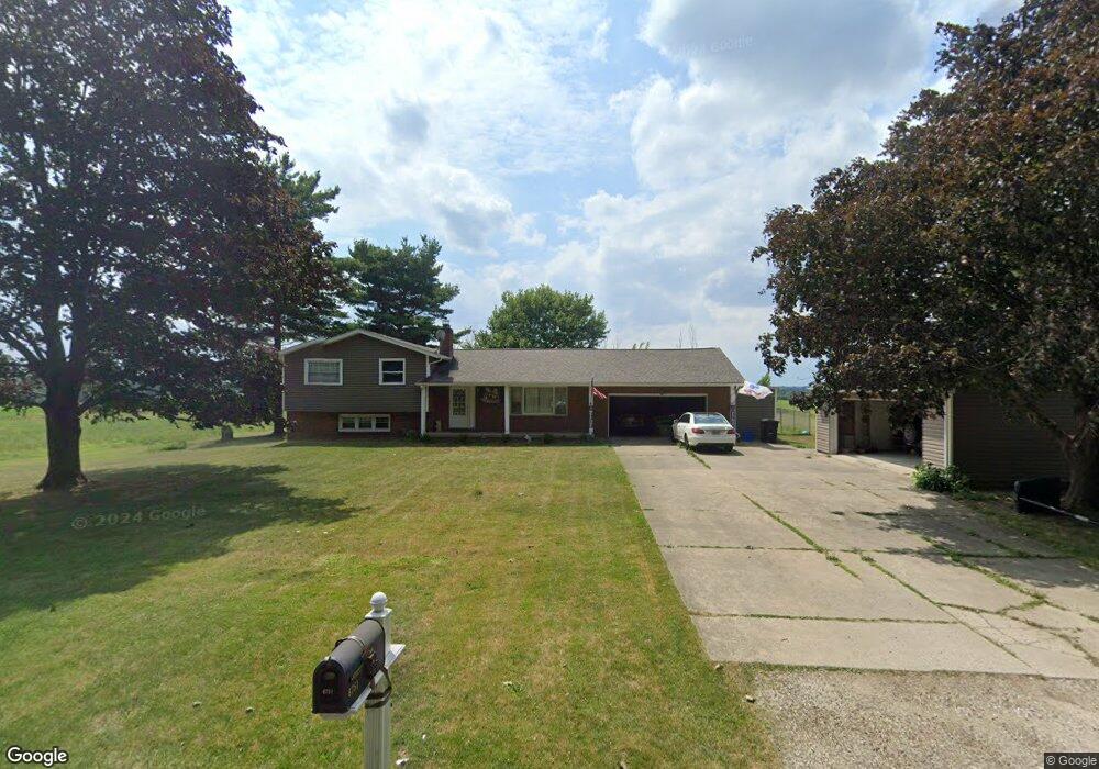
6751 Joliat Ave Louisville, OH 44641
Estimated Value: $299,000 - $388,000
4
Beds
3
Baths
3,184
Sq Ft
$112/Sq Ft
Est. Value
About This Home
This home is located at 6751 Joliat Ave, Louisville, OH 44641 and is currently estimated at $357,748, approximately $112 per square foot. 6751 Joliat Ave is a home located in Stark County with nearby schools including Louisville High School and St. Thomas Aquinas High School & Middle School.
Ownership History
Date
Name
Owned For
Owner Type
Purchase Details
Closed on
Sep 9, 2011
Sold by
Federal Home Loan Mortgage Corporation
Bought by
Furbee William and Furbee Terra
Current Estimated Value
Home Financials for this Owner
Home Financials are based on the most recent Mortgage that was taken out on this home.
Original Mortgage
$114,910
Interest Rate
4.5%
Mortgage Type
FHA
Purchase Details
Closed on
May 12, 2011
Sold by
Hoffman Patrick M and Hoffman Linda Kay
Bought by
Federal Home Loan Mortgage Corporation
Purchase Details
Closed on
Jun 1, 1969
Sold by
Hoffman Patrick M and Hoffman Linda K
Bought by
Hoffman Patrick M and Hoffman Linda Kay
Create a Home Valuation Report for This Property
The Home Valuation Report is an in-depth analysis detailing your home's value as well as a comparison with similar homes in the area
Home Values in the Area
Average Home Value in this Area
Purchase History
| Date | Buyer | Sale Price | Title Company |
|---|---|---|---|
| Furbee William | $117,900 | Attorney | |
| Federal Home Loan Mortgage Corporation | $90,000 | Attorney | |
| Hoffman Patrick M | -- | -- |
Source: Public Records
Mortgage History
| Date | Status | Borrower | Loan Amount |
|---|---|---|---|
| Previous Owner | Furbee William | $114,910 |
Source: Public Records
Tax History Compared to Growth
Tax History
| Year | Tax Paid | Tax Assessment Tax Assessment Total Assessment is a certain percentage of the fair market value that is determined by local assessors to be the total taxable value of land and additions on the property. | Land | Improvement |
|---|---|---|---|---|
| 2025 | -- | $114,280 | $10,890 | $103,390 |
| 2024 | -- | $114,280 | $10,890 | $103,390 |
| 2023 | $4,318 | $88,770 | $9,630 | $79,140 |
| 2022 | $4,327 | $88,770 | $9,630 | $79,140 |
| 2021 | $4,339 | $88,770 | $9,630 | $79,140 |
| 2020 | $3,685 | $79,660 | $8,680 | $70,980 |
| 2019 | $3,700 | $79,670 | $8,680 | $70,990 |
| 2018 | $3,689 | $79,670 | $8,680 | $70,990 |
| 2017 | $3,767 | $77,640 | $8,120 | $69,520 |
| 2016 | $2,805 | $59,060 | $8,120 | $50,940 |
| 2015 | $2,812 | $59,060 | $8,120 | $50,940 |
| 2014 | $650 | $51,490 | $7,070 | $44,420 |
| 2013 | $1,329 | $51,490 | $7,070 | $44,420 |
Source: Public Records
Map
Nearby Homes
- 6052 N Nickelplate St
- 5765 Maplegrove St
- 5495 Meese Rd NE
- 7844 Morningstar Dr
- 2015 E Main St
- 910 Crosswyck Cir
- 1170 Winding Ridge Ave
- 203 Brookfield St
- 316 E Reno Dr
- 5474 Ravenna Ave
- 0 Michigan Blvd
- 6109 Oakhill Ave NE
- 428 Honeycrisp Dr NE
- 3047 Mcintosh Dr NE
- 432 Honeycrisp Dr NE
- 2962 Mcintosh Dr NE
- 2963 Mcintosh Dr NE
- 430 Honeycrisp Dr NE
- 2957 Mcintosh Dr NE
- 524 Glenbar St
- 9530 Easton St
- 6700 Joliat Ave
- 6634 Joliat Ave
- 9539 Easton St
- 9295 Easton St
- 9696 Easton St
- 9421 Easton St
- 9595 Easton St
- 9477 Easton St
- 9637 Easton St
- 9728 Easton St
- 9383 Easton St
- 9699 Easton St
- 9369 Easton St
- 9731 Easton St
- 6501 Joliat Ave
- 9331 Easton St
- 6486 Joliat Ave
- 6461 Joliat Ave
- 9805 Easton St