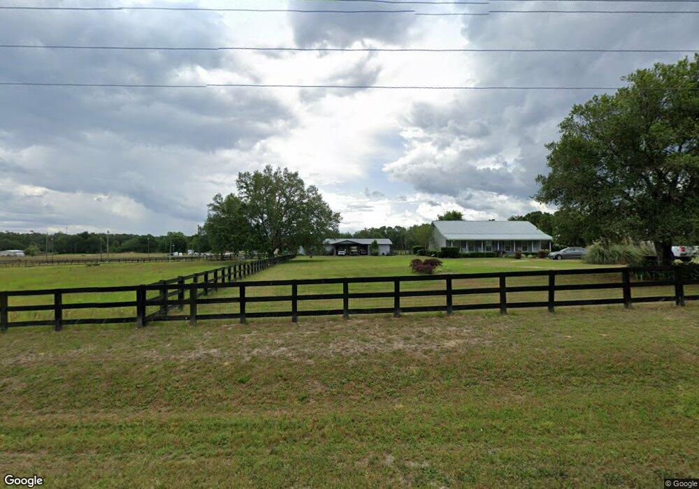
6797 SW Tustenuggee Ave Lake City, FL 32024
Estimated Value: $281,000 - $401,474
3
Beds
2
Baths
1,344
Sq Ft
$264/Sq Ft
Est. Value
About This Home
This home is located at 6797 SW Tustenuggee Ave, Lake City, FL 32024 and is currently estimated at $354,491, approximately $263 per square foot. 6797 SW Tustenuggee Ave is a home located in Columbia County with nearby schools including Columbia City Elementary School and Fort White High School.
Ownership History
Date
Name
Owned For
Owner Type
Purchase Details
Closed on
Jun 21, 2002
Sold by
Morse Katharine L and Selch Katharine
Bought by
Malphurs Kurt Daniel
Current Estimated Value
Home Financials for this Owner
Home Financials are based on the most recent Mortgage that was taken out on this home.
Original Mortgage
$117,600
Outstanding Balance
$49,583
Interest Rate
6.77%
Estimated Equity
$304,908
Purchase Details
Closed on
Oct 31, 2001
Sold by
Mckee Diana
Bought by
Morse Katharine L
Create a Home Valuation Report for This Property
The Home Valuation Report is an in-depth analysis detailing your home's value as well as a comparison with similar homes in the area
Home Values in the Area
Average Home Value in this Area
Purchase History
| Date | Buyer | Sale Price | Title Company |
|---|---|---|---|
| Malphurs Kurt Daniel | $40,000 | -- | |
| Morse Katharine L | -- | -- |
Source: Public Records
Mortgage History
| Date | Status | Borrower | Loan Amount |
|---|---|---|---|
| Open | Malphurs Kurt Daniel | $117,600 |
Source: Public Records
Tax History Compared to Growth
Tax History
| Year | Tax Paid | Tax Assessment Tax Assessment Total Assessment is a certain percentage of the fair market value that is determined by local assessors to be the total taxable value of land and additions on the property. | Land | Improvement |
|---|---|---|---|---|
| 2024 | $1,977 | $158,580 | -- | -- |
| 2023 | $1,977 | $149,767 | $10,058 | $139,709 |
| 2022 | $1,915 | $145,479 | $0 | $0 |
| 2021 | $1,849 | $141,222 | $0 | $0 |
| 2020 | $1,655 | $139,092 | $6,704 | $132,388 |
| 2019 | $1,907 | $135,997 | $0 | $0 |
| 2018 | $1,895 | $133,503 | $0 | $0 |
| 2017 | $2,015 | $140,159 | $6,234 | $133,925 |
| 2016 | $2,047 | $140,250 | $6,188 | $134,062 |
| 2015 | $2,070 | $138,702 | $0 | $0 |
| 2014 | $2,059 | $137,801 | $0 | $0 |
Source: Public Records
Map
Nearby Homes
- 357 SW Wildwood Ct
- 1000 SW Mandiba Dr
- 0 SW Yanglee Glen
- TBD SW Tustenuggee Ave
- 1146 SW Mandiba Dr
- 818 SW Churchill Way
- 261 SW Beyond Ct
- TBD SW County Road 349
- 0 0001 Sw Cr 240
- TBD Owens Rd
- 258 SW Hodges Way
- 397 SW Owens Dr
- 124 SW Beauford Place
- 0 SW Catherine Ln
- 362 SW Little Rd
- 280 Turner Blvd
- 668 Gallilee Loop
- 456 SW Little Rd
- 403 SW Cherrywood Way
- 335 SW Peace Dr
- 311 S West Paul Pearce Ln
- 311 SW Paul Pearce Ln
- 6698 SW Tustenuggee Ave
- 6963 SW Tustenuggee Ave
- 274 SW Burress Glen
- 6567 SW Tustenuggee Ave
- 451 SW Wildwood Ct
- 360 SW Mandiba Dr
- 519 SW Paul Pearce Ln
- 502 SW Paul Pearce Ln
- 432 SW Mandiba Dr
- 152 SW Mandiba Dr
- 153 SW Wildwood Ct
- 0 SW Mandiba Unit MFRGC512614
- TBD Mandiba Dr
- 231 SW Mandiba Dr
- 179 SW Mandiba Dr
- 550 SW Mandiba Dr
- 570 SW Mandiba Dr
- 591 SW Mandiba Dr