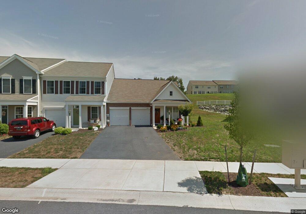
681 Stoverdale Rd Hummelstown, PA 17036
Estimated Value: $339,000 - $375,000
2
Beds
2
Baths
1,725
Sq Ft
$207/Sq Ft
Est. Value
About This Home
This home is located at 681 Stoverdale Rd, Hummelstown, PA 17036 and is currently estimated at $357,144, approximately $207 per square foot. 681 Stoverdale Rd is a home located in Dauphin County with nearby schools including Hershey Elementary School, Hershey Primary Elementary School, and Hershey Middle School.
Ownership History
Date
Name
Owned For
Owner Type
Purchase Details
Closed on
Oct 25, 2010
Sold by
Barta Tr Gary L
Bought by
Freedman Jill M
Current Estimated Value
Home Financials for this Owner
Home Financials are based on the most recent Mortgage that was taken out on this home.
Original Mortgage
$159
Outstanding Balance
$106
Interest Rate
4.39%
Mortgage Type
New Conventional
Estimated Equity
$357,038
Purchase Details
Closed on
Mar 19, 2009
Sold by
Charter Homes At Hershey
Bought by
Barta Gary L
Home Financials for this Owner
Home Financials are based on the most recent Mortgage that was taken out on this home.
Original Mortgage
$150,000
Interest Rate
5.14%
Mortgage Type
New Conventional
Create a Home Valuation Report for This Property
The Home Valuation Report is an in-depth analysis detailing your home's value as well as a comparison with similar homes in the area
Home Values in the Area
Average Home Value in this Area
Purchase History
| Date | Buyer | Sale Price | Title Company |
|---|---|---|---|
| Freedman Jill M | $210,000 | -- | |
| Barta Gary L | $266,462 | -- |
Source: Public Records
Mortgage History
| Date | Status | Borrower | Loan Amount |
|---|---|---|---|
| Open | Freedman Jill M | $159 | |
| Previous Owner | Barta Gary L | $150,000 |
Source: Public Records
Tax History Compared to Growth
Tax History
| Year | Tax Paid | Tax Assessment Tax Assessment Total Assessment is a certain percentage of the fair market value that is determined by local assessors to be the total taxable value of land and additions on the property. | Land | Improvement |
|---|---|---|---|---|
| 2025 | $4,632 | $148,200 | $32,200 | $116,000 |
| 2024 | $4,275 | $148,200 | $32,200 | $116,000 |
| 2023 | $4,275 | $148,200 | $32,200 | $116,000 |
| 2022 | $4,181 | $148,200 | $32,200 | $116,000 |
| 2021 | $0 | $148,200 | $32,200 | $116,000 |
| 2020 | $0 | $148,200 | $32,200 | $116,000 |
| 2019 | $0 | $148,200 | $32,200 | $116,000 |
| 2018 | $0 | $148,200 | $32,200 | $116,000 |
| 2017 | $0 | $148,200 | $32,200 | $116,000 |
| 2016 | $0 | $148,200 | $32,200 | $116,000 |
| 2015 | -- | $148,200 | $32,200 | $116,000 |
| 2014 | -- | $148,200 | $32,200 | $116,000 |
Source: Public Records
Map
Nearby Homes
- 1959 Deer Run Dr
- 1919 Limestone Dr
- 2039H Raleigh Rd
- 2017B Raleigh Rd
- 2042 Locust Ln
- 497 Middletown Rd
- 1168 Cord Dr
- 285 Dogwood Dr
- 177 Middletown Rd
- 265 Redwood St
- 994 Clifton Heights Rd
- 112 Park Ave
- 30 N Walnut St
- 228 W Main St
- 235 W 2nd St
- 791 Gregs Dr
- 258 W 2nd St
- 589 Lovell Ct
- 610 Carrington Ct
- 721 S 82nd St Unit L111
- 679 Stoverdale Rd
- 687 Stoverdale Rd
- 677 Stoverdale Rd
- 675 Stoverdale Rd
- 689 Stoverdale Rd
- 673 Stoverdale Rd
- 691 Stoverdale Rd
- 693 Stoverdale Rd
- 605 Stoverdale Rd
- 686 Stoverdale Rd
- 671 Stoverdale Rd
- 695 Stoverdale Rd
- 678 Stoverdale Rd
- 688 Stoverdale Rd
- 656 Buck Dr
- 654 Buck Dr
- 690 Stoverdale Rd
- 652 Buck Dr
- 652 Buck Dr Unit 162
- 676 Stoverdale Rd