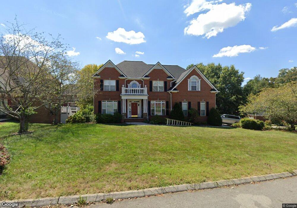
682 Canter Ln Cookeville, TN 38501
Estimated Value: $596,000 - $698,995
6
Beds
5
Baths
3,347
Sq Ft
$191/Sq Ft
Est. Value
About This Home
This home is located at 682 Canter Ln, Cookeville, TN 38501 and is currently estimated at $640,499, approximately $191 per square foot. 682 Canter Ln is a home located in Putnam County with nearby schools including Capshaw Elementary School, Cookeville High School, and Avery Trace Middle School.
Ownership History
Date
Name
Owned For
Owner Type
Purchase Details
Closed on
Feb 22, 2023
Sold by
Clemons Steve and Clemons Bess
Bought by
Steven And Bess Clemons 2023 Joint Revocable
Current Estimated Value
Purchase Details
Closed on
Oct 26, 2004
Sold by
Cruz Leonardo R
Bought by
Steve Clemons and Steve Bess
Home Financials for this Owner
Home Financials are based on the most recent Mortgage that was taken out on this home.
Original Mortgage
$333,600
Interest Rate
5.62%
Purchase Details
Closed on
Jun 8, 2000
Sold by
Tim Mcreynolds
Bought by
Rodriguez and Rodriguez Leonardo R
Purchase Details
Closed on
Jan 29, 1998
Bought by
Mcreynolds Tim and Mcreynolds Beth
Create a Home Valuation Report for This Property
The Home Valuation Report is an in-depth analysis detailing your home's value as well as a comparison with similar homes in the area
Home Values in the Area
Average Home Value in this Area
Purchase History
| Date | Buyer | Sale Price | Title Company |
|---|---|---|---|
| Steven And Bess Clemons 2023 Joint Revocable | -- | -- | |
| Steve Clemons | $360,000 | -- | |
| Rodriguez | $350,000 | -- | |
| Mcreynolds Tim | $74,700 | -- |
Source: Public Records
Mortgage History
| Date | Status | Borrower | Loan Amount |
|---|---|---|---|
| Previous Owner | Mcreynolds Tim | $333,600 |
Source: Public Records
Tax History Compared to Growth
Tax History
| Year | Tax Paid | Tax Assessment Tax Assessment Total Assessment is a certain percentage of the fair market value that is determined by local assessors to be the total taxable value of land and additions on the property. | Land | Improvement |
|---|---|---|---|---|
| 2024 | $4,440 | $124,025 | $11,500 | $112,525 |
| 2023 | $4,440 | $124,025 | $11,500 | $112,525 |
| 2022 | $4,083 | $124,025 | $11,500 | $112,525 |
| 2021 | $4,083 | $124,025 | $11,500 | $112,525 |
| 2020 | $3,952 | $124,025 | $11,500 | $112,525 |
| 2019 | $3,952 | $100,925 | $11,500 | $89,425 |
| 2018 | $3,603 | $100,925 | $11,500 | $89,425 |
| 2017 | $3,603 | $100,925 | $11,500 | $89,425 |
| 2016 | $3,603 | $100,925 | $11,500 | $89,425 |
| 2015 | $3,603 | $100,925 | $11,500 | $89,425 |
| 2014 | $3,681 | $99,356 | $0 | $0 |
Source: Public Records
Map
Nearby Homes
- 383 Hermitage Ave
- 709 Russell Strausse Rd
- 980 Walton Trail
- 1064 Sugarhill Place
- 935 Woodwinds Dr
- 788 Old Walton Rd
- 323 S Maple Ave
- 482 E Hampton Ct
- 505 S Maple Ave
- 969 Stonebridge Cir
- 992 Stonebridge Cir
- 733 E Spring St
- 119 Downton North Dr
- 22 S Elm Ave
- 1155 Perimeter Park Dr
- 1298 Eastwood Dr
- 101 Allison Way
- 92 S Maple Ave
- 1202 Eastwood Dr
- 1225 Neal St