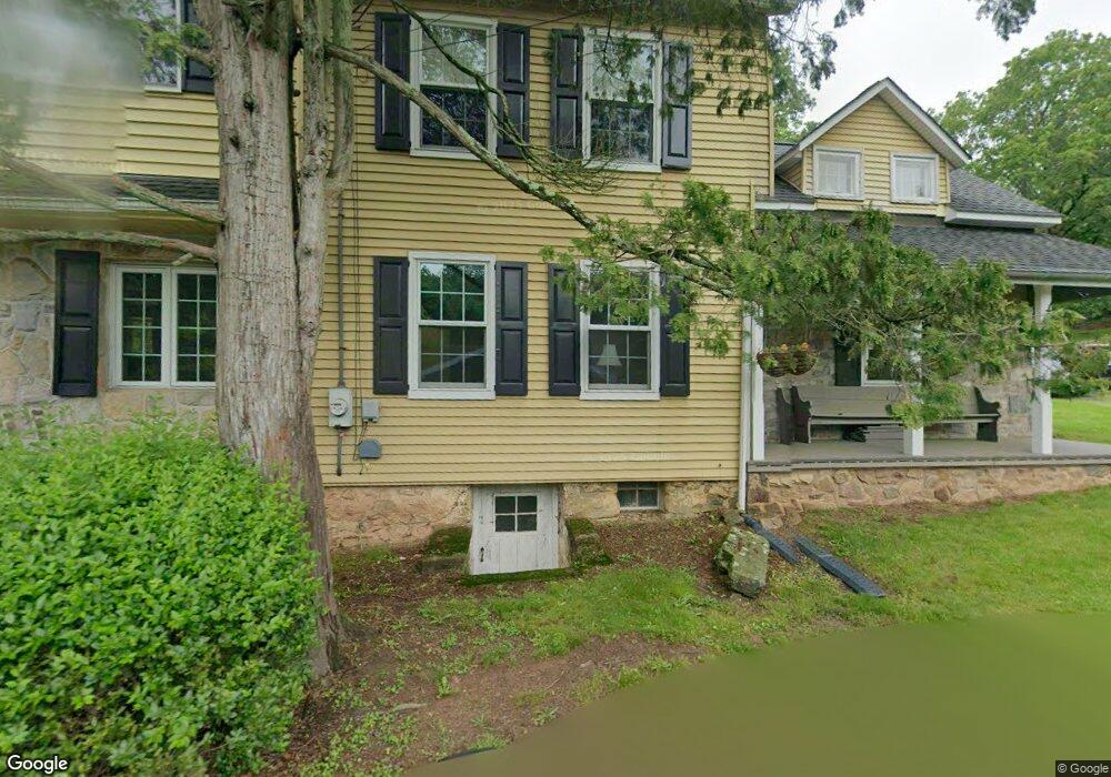
6845 Ridge Rd Zionsville, PA 18092
Upper Milford Township NeighborhoodEstimated Value: $501,000 - $692,000
4
Beds
2
Baths
3,156
Sq Ft
$180/Sq Ft
Est. Value
About This Home
This home is located at 6845 Ridge Rd, Zionsville, PA 18092 and is currently estimated at $568,075, approximately $179 per square foot. 6845 Ridge Rd is a home located in Lehigh County with nearby schools including Shoemaker Elementary School, Eyer Middle School, and Emmaus High School.
Ownership History
Date
Name
Owned For
Owner Type
Purchase Details
Closed on
Aug 25, 1995
Sold by
Peifly David A and Peifly Deborah C
Bought by
Stauffer Gary M and Stauffer Deborah B
Current Estimated Value
Purchase Details
Closed on
Mar 30, 1994
Sold by
Peifly David A and Peifly Deborah C
Bought by
Peifly David A and Peifly Deborah C
Purchase Details
Closed on
Jun 23, 1987
Bought by
Peifly David A and Peifly Deborah C
Purchase Details
Closed on
Dec 23, 1986
Sold by
Peifly David A and Peifly Deborah C
Bought by
Peifly David A and Peifly Deborah C
Create a Home Valuation Report for This Property
The Home Valuation Report is an in-depth analysis detailing your home's value as well as a comparison with similar homes in the area
Home Values in the Area
Average Home Value in this Area
Purchase History
| Date | Buyer | Sale Price | Title Company |
|---|---|---|---|
| Stauffer Gary M | $152,000 | -- | |
| Peifly David A | -- | -- | |
| Peifly David A | -- | -- | |
| Peifly David A | $3,000 | -- |
Source: Public Records
Tax History Compared to Growth
Tax History
| Year | Tax Paid | Tax Assessment Tax Assessment Total Assessment is a certain percentage of the fair market value that is determined by local assessors to be the total taxable value of land and additions on the property. | Land | Improvement |
|---|---|---|---|---|
| 2025 | $6,068 | $237,700 | $79,600 | $158,100 |
| 2024 | $5,800 | $237,700 | $79,600 | $158,100 |
| 2023 | $5,683 | $237,700 | $79,600 | $158,100 |
| 2022 | $5,546 | $237,700 | $158,100 | $79,600 |
| 2021 | $5,427 | $237,700 | $79,600 | $158,100 |
| 2020 | $5,375 | $237,700 | $79,600 | $158,100 |
| 2019 | $5,341 | $237,700 | $79,600 | $158,100 |
| 2018 | $5,205 | $237,700 | $79,600 | $158,100 |
| 2017 | $5,112 | $237,700 | $79,600 | $158,100 |
| 2016 | -- | $237,700 | $79,600 | $158,100 |
| 2015 | -- | $237,700 | $79,600 | $158,100 |
| 2014 | -- | $237,700 | $79,600 | $158,100 |
Source: Public Records
Map
Nearby Homes
- 117 Concord Dr
- 7921 Corning Rd
- 328 Ashford Ln
- 62 Ashford Ln
- 317 Ashford Ln
- 0 Chestnut St
- 6335 Sweetbriar Ln
- 5722 Kings Hwy S
- 770 Gravel Pike
- 5061 Wendi Dr W
- 1962 Tollgate Rd
- 4759 Sheep Rock Rd
- 4835 Shimerville Rd
- 4675 E Mill Hill Rd
- Lot 1 Mountain Rd
- 6709 Mountain Rd
- 0 Mountain Lot 1
- 830 E Main St
- 4434 Taviston Ct E
- 725 E Main St